The city is in the process of a large wayfinding and signage project that is expected to be completed by Spring 2022. Hopefully, supply chain issues or cost overruns don't significantly delay it or scale it down (not saying I know of any issues for this project, but with current general market conditions, its always a concern).
Below is a link to the citys Bike and Pedestrian News Bulletin (From May 2021) that discusses the project (not a ton of information, but there is a small rendering showing what the signage will look like). It looks like an impressive project that will greatly enhance the trail system!
https://content.govdelivery.com/acco...letins/2d9ce95


 Reply With Quote
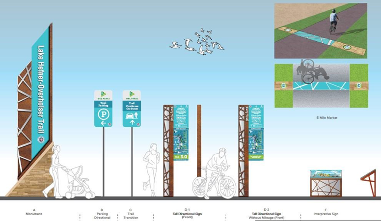


Bookmarks