

Apparently for those who decline to understand the situation, it wasOriginally Posted by SoonerDave


 Participating Member

Apparently for those who decline to understand the situation, it was
Lost most if not all respect for him a while back.
Yeah that's what I've heard as well. Just a few pieces missing to avoid a major outbreak. Honestly the flooding issue could end up being much more damaging and affect way more people, especially if the area gets more rain this week. I saw where Keystone Dam will release 160,000 cfs tonight which will begin to flood low-lying areas in Jenks and Bixby. A 180,000 cfs release would begin to flood entire neighborhoods in Sand Springs, Tulsa, Jenks, Bixby and points downstream like Muskogee. The Tulsa mayor has declared a flood emergency in preparation.
Participating Member
And even after all that rain, we had dust in the air this afternoon.
Participating Member

Believe it or not though he was the only meteorologist that wasn't predicting doom and gloom yesterday. I am not the biggest fan of his "presentation" but when it comes to hype, he usually does it right these days. Of course that hasn't always been the case, especially back when he was on KOCO.
Participating Member
NWS Norman
@NWSNorman
We continue to monitor the potential for severe weather Wednesday afternoon. There does appear to be a risk of severe thunderstorms across central sections of Oklahoma into western north Texas. #okwx #texomawx
Image
8:49 PM · May 21, 2019 · TweetDeck
44
Retweets
94
Likes
More release is sure needed so that flooded Cimarron River can better accept runoff from Stillwater, Guthrie and other towns. As a result for now Stillwater Creek is out of its banks in Stillwater. OSU report of water going 3 ft. over the spillway at Blackwell Lake added to the situation. Spillway water goes directly into Stillwater Creek.
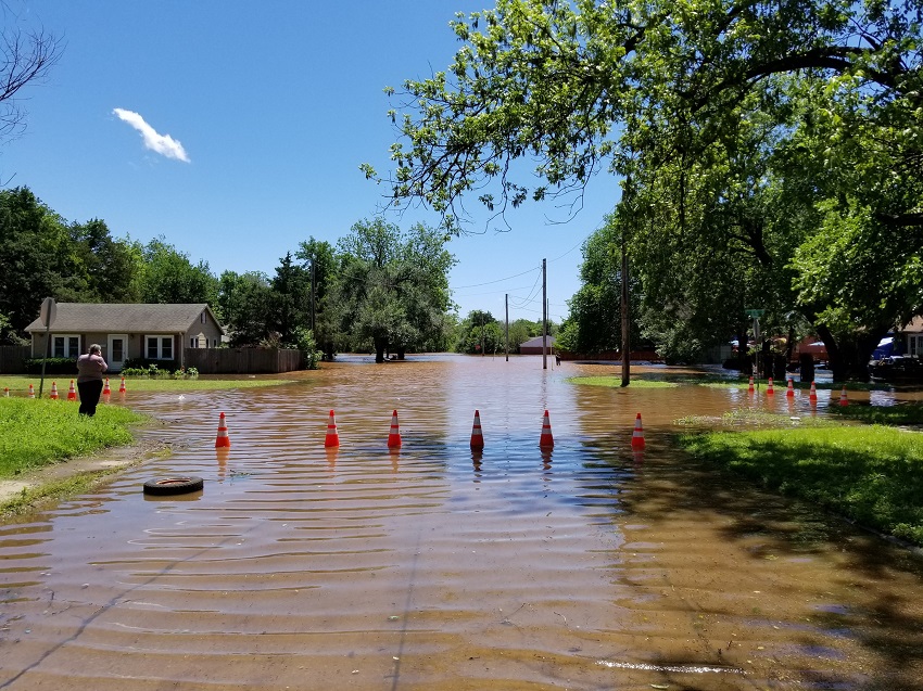
Flood in Stillwater on Tuesday:
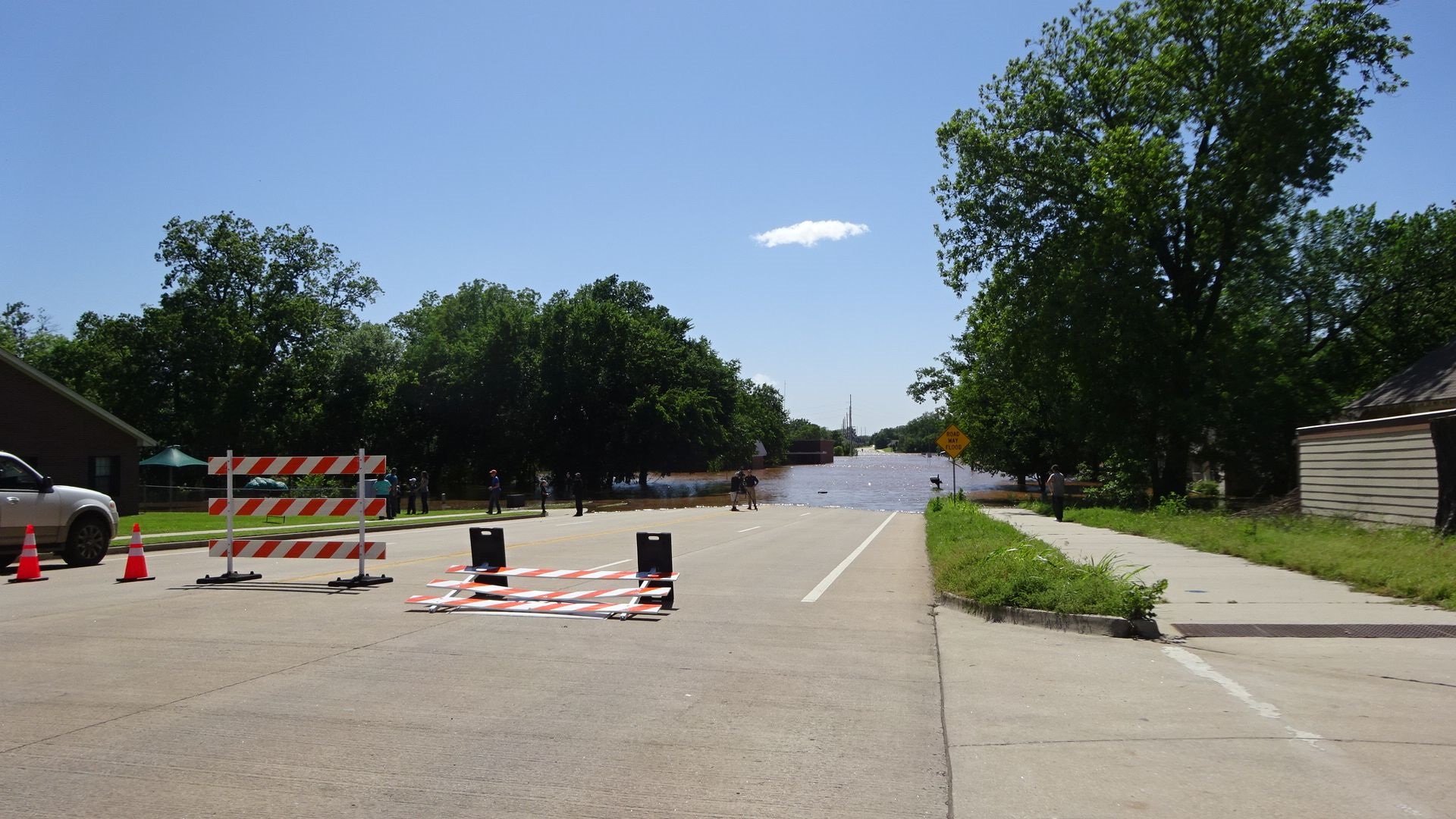
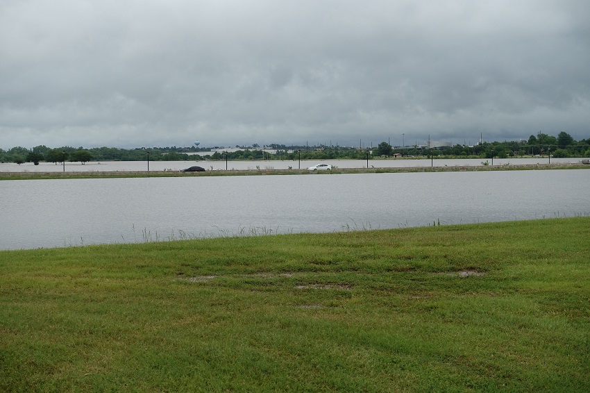
W. 12th St. underwater and closed:
The flooding as seen from the other side of W. 12th. Water went a block to the left and got into some houses. Much of the area shown along 12th was made into park land after previous floods. At least several other scenes like this on streets near Stillwater Creek. Not since 2007, the year it rained over 60", has there been flooding like this:
11th and Knoblock
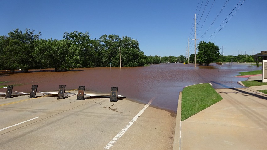
Water shown almost up to Lakeview Ave. bridge across Boomer Lake. Earlier the water was up to the outer lanes, which were closed.
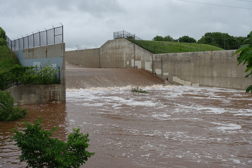
Water over the spillway at Boomer Lake. Boomer Creek had no trouble handling the water.
NWS I can respect. AT, still not so much. To each their own.
*sigh*
Looking toward the next GFS run coming up just after 7am....looking like models are going to project increasing chances of storms in the central and north central parts of the state going into the afternoon. If the storms do go up, there's a good shot they'll evolve into supercells.
SPC guidance from 1am local had risk area from OKC to Tulsa to SE KS, but indications are that region may expand south and west some with later models. CAPE levels are moderately unstable, but strong jet may provide sufficient lift for storms.
Participating Member
They went with slight for 8 am outlook with enhanced for Tulsa area. It was mentioned in outlook discussion that a special sounding will be released to sample air. Lack of forcing and cap is why their maintaining slight risk.
Man any met in this area has to have a strong stomach.
Euro appears to show a line of storms planting along I-35 later this afternoon and evening from OKC to the Red River. Don't see that at all in GFS. Obviously some differing biases in whether that cap will hold.
Participating Member
An aerial flood watch was just issued for Canadian, Cleveland, Garfield, Grady, Grant, Kay, Kingfisher, Lincoln, Logan, McClain, Noble, Oklahoma, Payne, Pottawatomie counties until Thursday at 7:00 a.m.
Participating Member
Boundary is lifting north across the state right now, should bring in warmer temperatures and higher dewpoints across C OK by lunchtime. This will also aid in eroding some lingering low-level clouds. This boundary and just east of it will be the focal point for storm development heading into late afternoon with storms possibly developing along and near the I-35 corridor.
Best shot looks to be across N and NE OK for supercells, but development further south and west cannot be ruled out. Look for storms to start bubbling up around 2pm.

Keystone Dam is now releasing 215,000 cfs with more possible. At this amount entire neighborhoods will be flooded downstream in the Tulsa area. Webbers Falls further downstream is under a mandatory evacuation.
Participating Member
The story today will be even worse flooding for NE Oklahoma from any worse storms that form.
A lot of roads closed.
https://ok.maps.arcgis.com/apps/View...9ccfd58d92c3da
What needs to really happen is for no more rain in the Kaw and Keystone lake basins. Even at 215,000 cfs both are still taking in more water than they are letting out. Keystone is taking in 250,000 cfs right now.
The catastrophic 1986 flood in Tulsa peaked at Keystone releasing 307,000 cfs.
Participating Member
SPC has upgraded to Moderate Risk for far NE OK, including Tulsa area. This will include a 15% probability of significant tornado threat.
Moderate Risk has been expanded further SW towards OKC, but confidence is still low in this area for storm development. Tornado parameters are still greater than 5% for OKC metro.
River Spirit Casino/Hotel in Tulsa has closed due to potential flooding. They built just above the 100 year flood plain but this event may surpass that.
Participating Member
highway 62 closing between tahlequah and muskogee
Participating Member
Funny how the 'this was an overblown non-event' ilk have gone dark in the light of evidence.
Tornado Watch may be issued for broad corridor of OK from SW to NE along and ahead of frontal boundary in consideration of new development forming near Wichita Falls and heading northeast toward Lawton.
Participating Member
NWS Norman
@NWSNorman
·
26m
2:00 PM - we have expanded the slight risk and tornado probabilities to include parts of SW OK and western N TX. Not everyone will see a storm, but those that do should be ready for large hail and potentially a tornado. Watch for updates.
——
NWS Norman
@NWSNorman
·
14m
2:15 PM - technical discussion about the evolving severe weather potential over SW Oklahoma. A tornado watch may be issued soon. Stay alert
https://mobile.twitter.com/NWSNorman
Participating Member
PDS watch is out for all of C OK. Another one is likely coming for far NE OK later today.
80% probabilities for both multiple tornadoes and a significant tornado or two.
Storms are firing right on cue down near the Red River along I-44.
Looks like the Euro model got this one better than GFS.
Participating Member
NWS Tornado
@NWStornado
A tornado watch has been issued for parts of Oklahoma and Texas until 10 PM CDT
https://mobile.twitter.com/NWStornad...81290035126273
There are currently 1 users browsing this thread. (0 members and 1 guests)
 Posting Permissions

 Reply With Quote
Bookmarks