
Originally Posted by
Anonymous.

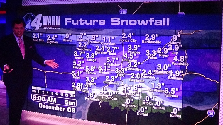
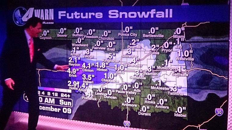
Classic southern plains winter storm still being picked up on by models. Temperatures and track will determine locations of impacts, but impacts do look to be significant wherever they take place.
We will get into NAM window in next couple days so we will have a better idea. But for now this is what we have model-wise.
GFS:
Start of storm: Freezing rain and sleet just NW of I-44 corridor. Snow in NW OK.
End of storm: Snow all of I-44 corridor and points N.
Canadian & GEM:
Start of storm: Freezing rain over I-44 corridor for prolonged period, potential major icestorm scenario. Snow in NW OK.
End of storm: Snow all of I-44 corridor and points N.
Will keep updating as we get into additional forecast model windows and obviously the less time gap before the event - the more accurate things will be painted.


 Reply With Quote


Bookmarks