Widgets Magazine
Page 1 of 2 12 LastLast
Results 1 to 25 of 37

Thread: Maps 4 ideas

Hybrid View

Previous Post Previous Post   Next Post Next Post
  1. #1

    Default Maps 4 ideas

    Never to early to start throwing out some ideas. Mayor Holt has mentioned he wants a mental health piece included in Maps 4 so that will be in it, beyond that I haven't heard much.

    Some ideas-

    Public art- $50-$100 million. Hire local artists and commission them to create public works of art. Imagine driving down NW expressway and the medians are full of various works of art. This huge investment would go along way towards beautification of the city, and would be a boom to the local art community. The only guidelines would be it needs to fit the ethos, pathos or logos of OKC/OK. (it would generate significant media buzz as well, "this city is spending $100 million in public art all made by local artists." Could have positive effects on companies trying to grow here as the perception of OKC continues to change.

    City canopy. $25 million. Trees anywhere and everywhere we can plant them.

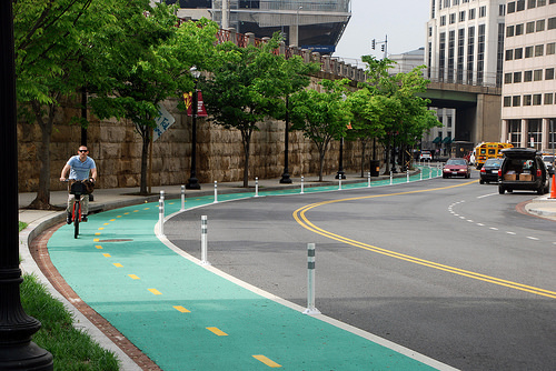
    More sidewalks and bike trails $50 million. This should be on every maps from now on.

    Street car extension to the plaza district and OU HSC.

    A lagoon by the boathouse district, maybe even on the south side of the river if they build a bridge to walk over. https://www.crystal-lagoons.com/concept-technology/
    These look awesome. It would be fun to have a beach in OKC. Right in the boathouse district seems perfect as well. $5 adults $3 for kids.

    Build a beach at Lake Hefner.

    Fix the boulevard to make it the urban road we thought we were gonna get before ODOT hammed it up.

    What else?

  2. #2

    Default Re: Maps 4 ideas

    Flying cars

    ...or do we HAVE to have a MAPS4? Wasn't MAPS supposed to be temporary?

    We've done some REALLY good things with it, but does it have to continue forever?

  3. #3

    Default Re: Maps 4 ideas

    I'd like to see some cool pedestrian / bike bridges over the OK River.

    All for many more sidewalks (still completely bizarre that OKC has so few, even with the last round of improvements and more coming as part of the Better Streets program) and anything to do with public transportation and recreation.

    We need to give people ways to get out and walk and ride their bike. We're still way, way behind the curve here.

    Would like to see more streets reduced in width (perhaps Classen) with dedicated bike lanes connecting different parts of the city to the core.

  4. #4
    HangryHippo Guest

    Default Re: Maps 4 ideas

    I'd love to see trees, bike lanes, and public transit expansion addressed. This city desperately need more trees!

  5. #5

    Default Re: Maps 4 ideas

    Transit (more streetcar/bus service/bike infra), Trees, River activation, Arts (this one is a stretch but it would be great to set up a dedicated fund to subsidize music and art events so that they happen nightly)

  6. #6

    Default Re: Maps 4 ideas

    When I come to OKC, it's always jarring to me to see lack of trees, lack of public landscaping along medians, thoroughfares, and certainly in front of businesses etc. With the red dirt that always pokes through it just gives the town a "dirty" feeling. So if I had unlimited resources as a private citizen, that's the hill I would die on. Those things make a huge difference in perception and quality of life.

    Having said that, I'm not sure that should be the focus of something like MAPS. That's not keeping with the "transformational" aspects of the last 20 years. I'm tempted to say public transit because it's so badly needed, and sidewalks/trails etc. And there are many individual neighborhoods that could use the MAPS treatment. But I kind of feel those efforts either have momentum already and other funding sources, or are too "niche" in the case of individual neighborhoods. MAPS should be about taking the next leap as a city. Something to capture the imagination. Prepare for OKC in 2050, what does that look like? And for the future of OKC that has to be economic development in some capacity. Broaden the scope of industry in town, some way, some how. Diversity of high-paying jobs. Not Costco or Amazon warehouse incentives, for God's sake. That's a different argument but OKC needs something bolder. I don't know what that looks like. Business incubation, research, money for technology training/education, I don't know.

    20 years ago, we rightly learned that we have to set up OKC as the kind of place where entrepreneurs and the creative class want to live. I think those efforts are now becoming self-sustaining. What's the next step? What are other places doing, from a public policy perspective, that are attracting the best and brightest?

  7. #7

    Default Re: Maps 4 ideas

    Quote Originally Posted by stlokc View Post
    When I come to OKC, it's always jarring to me to see lack of trees, lack of public landscaping along medians, thoroughfares, and certainly in front of businesses etc. With the red dirt that always pokes through it just gives the town a "dirty" feeling. So if I had unlimited resources as a private citizen, that's the hill I would die on. Those things make a huge difference in perception and quality of life.

    Having said that, I'm not sure that should be the focus of something like MAPS. That's not keeping with the "transformational" aspects of the last 20 years. I'm tempted to say public transit because it's so badly needed, and sidewalks/trails etc. And there are many individual neighborhoods that could use the MAPS treatment. But I kind of feel those efforts either have momentum already and other funding sources, or are too "niche" in the case of individual neighborhoods. MAPS should be about taking the next leap as a city. Something to capture the imagination. Prepare for OKC in 2050, what does that look like? And for the future of OKC that has to be economic development in some capacity. Broaden the scope of industry in town, some way, some how. Diversity of high-paying jobs. Not Costco or Amazon warehouse incentives, for God's sake. That's a different argument but OKC needs something bolder. I don't know what that looks like. Business incubation, research, money for technology training/education, I don't know.

    20 years ago, we rightly learned that we have to set up OKC as the kind of place where entrepreneurs and the creative class want to live. I think those efforts are now becoming self-sustaining. What's the next step? What are other places doing, from a public policy perspective, that are attracting the best and brightest?
    I think you kinda contradicted yourself here.

    You said trees are a huge part of quality of life.

    But we shouldn’t do it because it’s not transformational enough?

    Building a lagoon is pretty big. And maps isn’t setup for subsidizing high paying jobs. There’s like 30 different programs for that. Maps is for infrastructure projects that transform the city so we at least have a shot at high paying non O&G jobs.

    All of what you said are good ideas, (albeit extremely difficult) but it’s not what Metro Area Projects Plan is for

  8. #8

    Default Re: Maps 4 ideas

    Trees for certain; in the medians as well as along the river. Probably just for starters. Continue the sidewalk building. I personally would like an extension on the tax for road repaving and make it last a number of years. Come up with more amenities for the river as well as Lakes Hefner and Overholser. Overholser could be a true gem in the city, but I think it would require a master plan between Yukon, OKC, and Bethany

  9. #9

    Default Re: Maps 4 ideas

    Quote Originally Posted by ChrisHayes View Post
    Trees for certain; in the medians as well as along the river. Probably just for starters. Continue the sidewalk building. I personally would like an extension on the tax for road repaving and make it last a number of years. Come up with more amenities for the river as well as Lakes Hefner and Overholser. Overholser could be a true gem in the city, but I think it would require a master plan between Yukon, OKC, and Bethany
    Overholser, Hefner, and even Draper to a lesser extent could all be major assets to the city but even with the new activities at Hefner and overholser still seem under utilized. They have so much potential.

  10. #10

    Default Re: Maps 4 ideas

    New amphitheater on the river would be number one on my wish list.

  11. #11

    Default Re: Maps 4 ideas

    Public transportation from the Airport to Downtown. For my own selfish reasons, I'd like it to go to Edmond as well, but if you want business and tourists downtown people need to be able to fly in and get there easily.

  12. #12
    Join Date
    Jun 2011
    Posts
    6,697
    Blog Entries
    1

    Default Re: Maps 4 ideas

    Quote Originally Posted by austinriley View Post
    Public transportation from the Airport to Downtown. For my own selfish reasons, I'd like it to go to Edmond as well, but if you want business and tourists downtown people need to be able to fly in and get there easily.
    I agree about airport transportation, but it should go to Santa Fe and then when Santa Fe/Commuter Rail to Norman/Edmond get done your wish will be fulfilled.

  13. #13
    Join Date
    Feb 2005
    Posts
    10,179
    Blog Entries
    1

    Default Re: Maps 4 ideas

    Google Maps: https://www.google.com/maps/place/N+...!4d-97.5143592

    Streetcar extension & related: $150 million dedicated to the streetcar expansion & support infrastructure and more bike lanes. About 8 miles to expand the streetcar route to Film Row, up Classen Blvd., to Paseo (23rd N.W.); HSC: ...angle/spur from N.W. 5th Broadway onto Harrison (under I-235) east to N.E. 8th into the OUHSC

    EST: $104 million new rail line.
    $25 million, an extra streetcar
    $21 million, Decorative stops, cycletrack protected bike lanes (Downtown, Classen Blvd., Paseo, Harrison Ave., to OUHSC


    Cycletrack protected bike lanes


    Harrison Avenue to Research Park to OUHSC @N.E. 8th Street.

  14. Default Re: Maps 4 ideas

    I love a lot of the ideas thrown out there. After seeing the water park and rapids park, I might suggest a wave pool and lazy river like Typhoon Lagoon at Disneyworld. Also, as a huge fan of the canal system, an extension to the west side of the tracks into the park would be very cool.

  15. #15

    Default Re: Maps 4 ideas

    MAPS for Transportation: Trees, streetscapes, bike lanes and trails, sidewalks, better bus stops/service, streetcar expansion. Sounds good to me.

  16. Default Re: Maps 4 ideas

    Quote Originally Posted by dankrutka View Post
    MAPS for Transportation: Trees, streetscapes, bike lanes and trails, sidewalks, better bus stops/service, streetcar expansion. Sounds good to me.
    while I totally agree with everything mentioned so far, I think STL makes a good point in that we need for MAPS XX to always be transformational in nature, but we have MAPS light (as in the current MAPS for Streets, MAPS for Kids, MAPS for the Thunder, etc) that are just a year or two with a specific focus that isn't capital transformational but IS transformational for OKC!!

    So with that in mind, I propose a 3-year ~$375M MAPS for Beautification and Transportation which would include the following projects (many already mentioned):

    *** Beautification $125M ***
    * Tree Canopy $25M: Establish a Tree Bank to put trees at every major entrance, interchange, and along every major street. Fill-in trees along neighborhood streets where necessary. One thing nobody mentions but would make a HUGE, transformational impact in OKC would be to add trees INSIDE parking lots (not just to the perimeter). We could dedicate a few dollars for this for certain large, ugly but privately owned parking lots where a new city ordinance is passed requiring trees inside lots but the city would use this to go 50/50 with owners: win-win! And again, this is a tree bank where additional dollars can be added (so it's not JUST Maps) but this MAPS would get it started in a HUGE way.

    * City Art $25M: Establish a Public Art bank which adds art, sculpture, fountains, monuments at major entrances/interchanges and at various prominent spots in the city. One of the other threads mentioned a need to honor a local civil rights activist many don't know (Roscoe I forget his last name, so sorry....). This would be the kind of thinking, a monument to him in Bricktown to teach all and honor his legacy/impact that helped make OKC great. As this is also a bank, it could receive funding from elsewhere but MAPS would kick start it.

    * Bridge beautification $20M. Establish a fund to beautify bridges in this city, particularly along the Oklahoma River. Most of the bridges in this city were built with function in mind. However, this has been to the detriment of the city since they have added to the dusty, ugly scene we have. This would be a step in the right direction to add facades to bridges that honor the city's past or present legacies, perhaps create a non-functional 'suspension' type facade, make a few Oklahoma type bridge facades (maybe the state can pitch in), perhaps redo Sissortail bridge to add in the nonfunctioning but artistic cables that were cut.

    * Sidewalks $20M. As was mentioned, every new MAPS should have a sidewalk component until OKC has sidewalks completely filled in every street in the greater city core (basically I-44 to I-35 to near S 44th) and along every major street (both sides) and most neighborhood streets that connect to schools, public venues/amenities, entertainment districts, and are along transit. Individual neighborhoods outside of the city core would be a case-by-case basis. [just wanted to insert that this idea is a master plan for sidewalks, the $20M would just construct what would be coordinated with the other projects listed here in this mini-maps, there'd be other maps to add up/finish the sidewalk master plan. Ditto that for crosswalks and other 'master plans' ive noted].

    ** Crosswalks $10M+. A subproject to sidewals, but we need better crosswalks in this city at every major interchange where sidewalks (and transit) would connect, every intersection in the downtown core and in the greater core where sidewalks/transit exist, and key mid-block locations in entertainment and historical districts (think Auto Alley!!!!, Film Row, Uptown, Plaza, Asian District, Bricktown, Paseo, 39th, Stockyard's City, Eastside, and Capital Hill) and OCU. Midblock crosswalks will have solar powered activated lighting and perhaps raised. Walkable districts = walkable city!

    * Bike Lanes: Not really sure of the cost here, but dedicate key grade separated bike lanes (like Laramie's pics) along at least one major street every direction from downtown within the greater city core. In the downtown core, dedicate a few major streets not served by streetcar to be the bike lane streets.

    * Lighting $25M. Lighting added to every street in the greater city core, and along every major street/avenue in the city grid. Partner with the state to ensure ALL freeways in the city (and metro) are well lit. Ensure every single bus stop and route is well lit. Bright Lights = Big City!

    *** Transit ***
    * Transit Stops $??. Ensure every bus and streetcar stop in the greater city core has a functioning platform and shelter at minimum that is well lit and has tree foliage and perhaps some public art significant for that stop/neighborhood (notice a theme yet?). Every stop in the core is ADA and connected to sidewalks that connect inside the neighborhoods. This IS transformational for OKC!

    * Local Transit additions: Not sure the amount, but dedicate funding to capital purchase of buses so that the city can have most routes running M-F 5am-11pm, Sat 8am-11pm, Sun 9am-10pm. Encourage EMBARK to extend OWL routes once per hour Th-Sat 11pm-3am.

    * Airport Transit: Capital purchase of a few luggage capable large buses to run Express from downtown to WRWA daily 9am-8pm (maybe earlier M-F and more frequently for run-hour purposes) and a few to go from other 'future transit center' points in the city (like NW Xpressway somewhere and maybe Crossroads) to WRWA but less frequently.

    * Commuter Transit: Partner with OCOG and the RTD for commuter bus purchases. Encourage RTD to establish bus routes connecting to the suburbs, including some that will be eventually replaced with Commuter Rail.

    * Commuter Rail: Partner with RTD on commuter rail purchase, rail infrastructure upgrades, and stations within OKC city limits at 'N Broadway Ext PnR', '63rd street stop', already funded 'Santa Fe Transit Center', and 'Crossroads PnR'. Encourage the suburbs to build/retrofit their stations in Edmond, Moore, and Norman; long term eventually Guthrie and Purcell.

    * Streetcar Extensions $125M:

    ** Classen $40M: Extend from Midtown to the Asian District along Classen with track on both sides of the street. Enable turns-offs at 23rd Street and possibly going S on Classen from Midtown (and perhaps 16th). This would be roughly 4 miles of track + stations (that can also be used for bus). Maybe partner with OCU if they wanted a turnaround that connected to the campus from the Asian District.

    ** OHC $35M: Extend down Sheridan to Lincoln up into the OHC with terminus at OU Medical Center campus. Have turn-offs at 4th, 10th, and one that could keep going up Lincoln at somewhere near the OU terminus for future expansion. Partner with OU to share costs. Basically 5 miles of track but OU/state of OK sharing some of the cost.

    ** Capital Hill ~ $50M: Go down Robinson from the OKC BLVD intersection, double tracked to just past Capital Hill HS. Not sure on the cost of this one since it will involve a few bridges but it is roughly 2.5 miles each way. There could be funds from the Scissortail Park MAPs (and maybe the CC) to build their stations which could reduce this budget.

    I'd coordinate the Tree planting and Art at major entrances and freeway interchanges to get the biggest impact while keeping spending low. I'd force these maps components to coordinate budget and schedule wherever there are overlaps in locations (and there will be numerous). The idea is, if we're building a streetcar station then lets also plant the trees, install the sidewalks/crosswalks, lighting, and transit routing at the same time to reduce total cost. ...
    Last edited by HOT ROD; 06-16-2018 at 03:53 PM. Reason: revised the sidewalk initiative to a master plan
    Oklahoma City, the RENAISSANCE CITY!

  17. #17
    Join Date
    Jun 2011
    Posts
    6,697
    Blog Entries
    1

    Default Re: Maps 4 ideas

    Quote Originally Posted by HOT ROD View Post
    * Sidewalks $20M. As was mentioned, every new MAPS should have a sidewalk component until OKC has sidewalks completely filled in every street in the greater city core (basically I-44 to I-35 to near S 44th) and along every major street (both sides) and most neighborhood streets that connect to schools, public venues/amenities, entertainment districts, and are along transit. Individual neighborhoods outside of the city core would be a case-by-case basis.
    I like this of course, but IMO you'd need to spend $100M+ to have a deep, meaningful impact on our lack of sidewalks in this city. And even that probably wouldn't do what you're seeking. MAPS 3 started at something like 18M, got cut to 9M, eventually put back to ~18M*, and you can still drive in plenty of dense places around the core and think, where are the bloody sidewalks. This also doesn't account for the places that technically have sidewalks, but where they may as well not be there (e.g. recent discussions about Walker and places with alternating sidewalks and non-sidewalks due to removal). You could probably literally have a full up "MAPS for Sidewalks" 5 year tax collection only for sidewalks, put a hella bunch of sidewalks in (as well as make repairs), and still have non-trivial gaps in important places. I don't at all mean to be discouraging of the incremental efforts, we definitely need them. I'm just saying that the problem is so monumentally bad (city-wide, I know you focused on the core, but there are places core-adjacent that are sorely lacking as well -- not talking about the near-burbs even) that it could take us a generation to fix it done incrementally. If someone has the figures handy (I'm sure it's out there) regarding total number of sidewalk miles in OKC, and the cost per mile I'm sure we can come up with numbers closer to what's needed vs my obvious hyperbole here (apologies, making a point).

    *I doubt these numbers are precise, point is meant to be illustrative

  18. #18

    Default Re: Maps 4 ideas

    Because the Chamber is always heavily involved in these initiatives, it's almost a lead-pipe cinch they will push for the new fairgrounds arena and probably even to expand the convention center.

  19. #19

    Default Re: Maps 4 ideas

    Transit and sidewalks would be actually useful things. But a giant new arena/stadium is probably going to make its way onto the list.

  20. #20

    Default Re: Maps 4 ideas

    Complete everything promised for MAPS3 first.

  21. #21

    Default Re: Maps 4 ideas

    Public Transportation (streetcar expansion to Capitol Hill, NW 23rd, Plaza, and OU Health Center; Sunday service; better bus service); road diets/sidewalks; trees

  22. #22
    Join Date
    Feb 2005
    Posts
    10,179
    Blog Entries
    1

    Default Re: Maps 4 ideas

    Quote Originally Posted by okccowan View Post
    Public Transportation (streetcar expansion to Capitol Hill, NW 23rd, Plaza, and OU Health Center; Sunday service; better bus service); road diets/sidewalks; trees
    Good point about streetcar expansion to Capitol Hill and the south side... We also have a unique Stockyard City that deserves preservation and development.

  23. #23

    Default Re: Maps 4 ideas

    I think the Chamber will also make a big push for some version of the Innovation Link (cap over I-235).

  24. #24

    Default Re: Maps 4 ideas

    Quote Originally Posted by Pete View Post
    I think the Chamber will also make a big push for some version of the Innovation Link (cap over I-235).
    Wouldn't be opposed to that. That would be really cool.

    I want my lagoon though.

  25. #25

    Default Re: Maps 4 ideas

    Quote Originally Posted by Pete View Post
    I think the Chamber will also make a big push for some version of the Innovation Link (cap over I-235).
    This is such a baffling idea. I'm not even sure what they're trying to connect much less at such a massive cost.

Thread Information

Users Browsing this Thread

There are currently 1 users browsing this thread. (0 members and 1 guests)

Similar Threads

  1. MAPs for Norman Ideas
    By venture in forum Norman
    Replies: 40
    Last Post: 09-28-2014, 02:07 PM
  2. New MAPS Website- MAPS Facts.org
    By Urban Pioneer in forum General Civic Issues
    Replies: 122
    Last Post: 11-30-2009, 12:52 PM
  3. did the original maps have more information disclosed than maps 3?
    By soonerfan_in_okc in forum General Civic Issues
    Replies: 6
    Last Post: 11-27-2009, 02:45 AM
  4. Oklahoman Coverage: Maps & Maps 3
    By Doug Loudenback in forum General Civic Issues
    Replies: 18
    Last Post: 11-14-2009, 08:21 PM
  5. Light Rail Up For Ideas For MAPS 3
    By sethsrott in forum General Civic Issues
    Replies: 3
    Last Post: 03-25-2008, 07:03 PM

Bookmarks

Posting Permissions

  • You may not post new threads
  • You may not post replies
  • You may not post attachments
  • You may not edit your posts
  •  
Single Sign On provided by vBSSO