

Today was such a beautiful May day! Beautiful weather!

 Participating Member

Today was such a beautiful May day! Beautiful weather!
Gold Member

Yes! Took the Miata accross town for dinner. Don't do that much in February.Originally Posted by tfvc.org

Participating Member
Rain chances go up overnight. The moisture is very needed.
Highest rain amounts to the SE parts of the state, but could see a heavier band setup somewhere from W/C OK.
Backside snow looks possible for panhandle areas, and then maybe extreme E/NE OK as the system really cranks up.
 Participating Member
Here is the link to Gary England's El Nino Tornado outlook.
https://www.youtube.com/watch?v=vnOa...gJr5ExnaBecdVb
Participating Member
Here is Damon Lanes take on the upcoming sprint Tornado Season.
http://www.koco.com/weather/spring-t...tlook/38136874
Participating Member
What a great rain for the southeastern half of the state. Just a little more than a handful of degrees cooler and this would be quite the snowfall.
After this system finishes up, the next timeframe of action looks to be right around March 1.
Sponsored by Sprint?
Participating Member
Looks like early Tuesday morning, showers and thunderstorms will develop right on top of central OK and move eastward.
Participating Member
Are we done with the cold and the snow? I would like to shave my beard now.
Participating Member
Shave it........
Participating Member
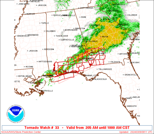
SPC upgrading most of C and E OK to a SLIGHT risk for severe weather late this evening into early morning hours.
Participating Member
I was going to quote and say "brought to you by Sprint?", lol.
Participating Member
THE NWS STORM PREDICTION CENTER HAS ISSUED A
* SEVERE THUNDERSTORM WATCH FOR PORTIONS OF
SOUTHWEST THROUGH NORTHEAST OKLAHOMA
WESTERN NORTH TEXAS
* EFFECTIVE THIS MONDAY NIGHT AND TUESDAY MORNING FROM 735 PM
UNTIL 400 AM CST.
* PRIMARY THREATS INCLUDE...
SCATTERED LARGE HAIL LIKELY WITH ISOLATED VERY LARGE HAIL EVENTS
TO 2 INCHES IN DIAMETER POSSIBLE
SCATTERED DAMAGING WIND GUSTS TO 70 MPH POSSIBLE
SUMMARY...SCATTERED THUNDERSTORMS EXPECTED TO INCREASE IN NUMBER AND
STRENGTH ROUGHLY FROM WEST TO EAST ACROSS WATCH AREA THROUGH EARLY
TUESDAY. SOME OF THE STORMS WILL YIELD LARGE HAIL AND LOCALLY
DAMAGING WIND.
THE SEVERE THUNDERSTORM WATCH AREA IS APPROXIMATELY ALONG AND 100
STATUTE MILES EAST AND WEST OF A LINE FROM 40 MILES SOUTH OF FORT
SILL OKLAHOMA TO 5 MILES NORTH OF BARTLESVILLE OKLAHOMA. FOR A
COMPLETE DEPICTION OF THE WATCH SEE THE ASSOCIATED WATCH OUTLINE
UPDATE (WOUS64 KWNS WOU3).
PRECAUTIONARY/PREPAREDNESS ACTIONS...
REMEMBER...A SEVERE THUNDERSTORM WATCH MEANS CONDITIONS ARE
FAVORABLE FOR SEVERE THUNDERSTORMS IN AND CLOSE TO THE WATCH
AREA. PERSONS IN THESE AREAS SHOULD BE ON THE LOOKOUT FOR
THREATENING WEATHER CONDITIONS AND LISTEN FOR LATER STATEMENTS
AND POSSIBLE WARNINGS. SEVERE THUNDERSTORMS CAN AND OCCASIONALLY
DO PRODUCE TORNADOES.
Participating Member
The national weather service in norman has issued a
* severe thunderstorm warning for...
Northwestern kiowa county in southwestern oklahoma...
Southwestern wa****a county in western oklahoma...
Southeastern beckham county in western oklahoma...
Northeastern greer county in southwestern oklahoma...
* until 830 pm cst
* at 748 pm cst...a severe thunderstorm was located near retrop...
Moving east at 40 mph.
Hazard...60 mph wind gusts and quarter size hail.
Source...radar indicated.
Impact...hail damage to vehicles is expected. Expect wind damage
to roofs...siding...and trees.
* locations impacted include...
Hobart...cordell...burns flat...sentinel...dill city...lone wolf...rocky...
Willow...retrop and brinkman.
Precautionary/preparedness actions...
For your protection move to an interior room on the lowest floor of a
building.
Owner / Administrator

OMG!!
Tons of hail and crazy lightening and torrential rain downtown.
Good grief, it's only February.
Participating Member
Good drink of moisture with these. Some of the storms south of Chickasha are small supercells and will have decent hail.
HRRR showing another line of storms developing later over north central OK, may back build into OKC - or may just miss it.
As it turned out, the second line developed just to the north and northeast of Stillwater and moved east. It didn't back build to Stillwater, much less OKC.
And so this is the end of the February 2016 weather discussion.
Participating Member
Extreme fire danger the next couple days.
Slight chance of a quick moving shower or storm overnight tonight, best chance in SE OK.
Looking ahead, beginning Sunday into next week - look like we enter a wet pattern as a large storm system takes its sweet time to move on. Hopefully we get some good soaking moisture to help dampen these fire days.
Participating Member
Anon didn't get the memo.
Participating Member
Damn lol!
There are currently 1 users browsing this thread. (0 members and 1 guests)
 Posting Permissions

 Reply With Quote
Bookmarks