Widgets Magazine
Page 1 of 3 123 LastLast
Results 1 to 25 of 53

Thread: General Weather Discussion - Jan 2016

  1. Default General Weather Discussion - Jan 2016

    Live Chat @ Weather Spotlight | NWS Norman (OUN) | Storm Prediction Center | Mesonet | West TX Mesonet | NWS OUN Fire Weather | Road Conditions


    Current Conditions
    [hr][/hr]
    Air Temperature Dewpoint Winds Rainfall Last 24 Hours
    [hr][/hr]
    Advisory Table 
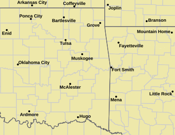
NWS Norman Warning Area NWS Tulsa Warning Area
    • Tornado Warning
    • Tornado Watch
    • Severe T-Storm Warning
    • Severe T-Storm Watch
    • Blizzard Warning
    • Blizzard Watch
    • Winter Storm Warning
    • Winter Storm Watch
    • Ice Storm Warning
    • Red Flag Warning
    • Winter Weather Advisory
    • Wind Chill Advisory
    • Wind Chill Warning
    • Freezing Rain Advisory
    Other Color Meanings:
    Web-Based Watch/Warning/Advisory Map Colors - NOAA's National Weather Service
    [hr][/hr]
    Radar & Satellite for Oklahoma
    [hr][/hr]
    [hr][/hr]
    Severe Weather Outlooks & Products
    [hr][/hr]
    Day 1 (Today) Outlook Day 2 (Tomorrow) Outlook Day 3 Outlook Outlook for Days 4 through 8
    [hr][/hr]
    National Advisory Map SPC Mesoscale Discussions (MCD or MD) 
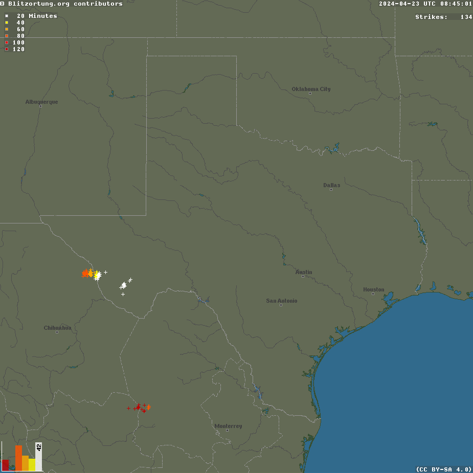
Regional Live Lightning Image


    SPC Watches


    Additional information is always available via:
    http://www.weatherspotlight.com/
    Including the side-by-side model comparisons per run time. Lightning image is © Blitzortung.org. Mesonet maps are all © of the Oklahoma Mesonet / OU Board of Regents.

  2. #2

    Default Re: General Weather Discussion - Jan 2016

    Okay time for a new month.

    Right now it looks like rain chances go up Tuesday night. Weak, moisture starved system comes through.

    Then this weekend it gets bone-chillingly cold.

    Looks like after the cold air moves in, we will have small 'clipper' type systems come through with snow chances. Nothing looks significant at this time until around January 15th.

  3. #3

    Default Re: General Weather Discussion - Jan 2016

    Little ice pellets now falling downtown.

  4. #4

    Default Re: General Weather Discussion - Jan 2016

    Snow and sleet moving into OKC metro right now, should be minimal impacts.


    One of the "clipper type" systems I mentioned above, is beginning to look more significant over this coming weekend. Will have to watch it as temperatures will be plummeting at that time.

  5. #5

    Default Re: General Weather Discussion - Jan 2016

    Hunch tells me this will be the month Winter finally hits.
    And it could be interesting precipitation speaking. I expect heavier amounts towards the end of the month. But, we shall see.

    Btw, thanks for the all the updates and analyses Anon.

  6. #6

    Default Re: General Weather Discussion - Jan 2016

    This weekend there will be a weak low that swings in behind this current storm that is bringing us the overriding moisture (fog) and warmer temperatures.

    Models are saying this little low will have little to no moisture until it reaches the MS river area. However, it still attempts to produce some precipitation. Right now the forecast is for this clipper low to track on the OK/KS border, giving that area the best chance for rain to snow mix. There could be a pocket/band of decent snow that develops on the deformation side of this low as it tracks east, which would likely setup to the south and west of wherever the main low tracks. This will be something interesting to watch for over the weekend to see if it unfolds. Impacts will likely be insignificant other than maybe brief moderate to heavy snow over a very localized area.


    Looking ahead, temps still to drop heading into the next week until a couple days before the next system - which is still on track for around the 15th.

  7. #7

    Default Re: General Weather Discussion - Jan 2016

    Quote Originally Posted by TU 'cane View Post
    Hunch tells me this will be the month Winter finally hits.
    And it could be interesting precipitation speaking. I expect heavier amounts towards the end of the month. But, we shall see.

    Btw, thanks for the all the updates and analyses Anon.
    My common sense tells me this will be the month Winter finally hits, since it's the coldest month of Winter.

  8. #8

    Default Re: General Weather Discussion - Jan 2016

    Quote Originally Posted by Bunty View Post
    My common sense tells me this will be the month Winter finally hits, since it's the coldest month of Winter.
    HA! I knew there'd be a snarky response to that, which is fair.
    However, I will say this: there were lots of people moaning and groaning about how "unseasonably warm" the ENTIRE month of December was.

    All I was meaning is that I think it'll get bone chillingly cold this month, and people will finally have their Winter.

  9. #9

    Default Re: General Weather Discussion - Jan 2016

    Okay super hard forecast tonight.

    Clipper low is still coming across the state this evening. Someone will get a heavy band of snow out of it, then it will dissipate, only to reform over eastern OK into AR/MO.

    The tricky part is guessing where it will setup, this is virtually impossible - and for how long the band stays alive is another mystery.

    NAM puts the band somewhere in NW OK (Think Elk City to Ponca City)
    GFS puts the band somewhere WC-COK (Think just west of OKC to near Stillwater)

    Basically, watch the radar tonight and we will see where it sets up, but don't be caught offguard if you see some decent snowfall rates. It will likely be heavy in a very localized area. Could see 3-6" in a narrow swath somewhere.

  10. #10

    Default Re: General Weather Discussion - Jan 2016

    Quote Originally Posted by Anonymous. View Post
    Okay super hard forecast tonight.

    Clipper low is still coming across the state this evening. Someone will get a heavy band of snow out of it, then it will dissipate, only to reform over eastern OK into AR/MO.

    The tricky part is guessing where it will setup, this is virtually impossible - and for how long the band stays alive is another mystery.

    NAM puts the band somewhere in NW OK (Think Elk City to Ponca City)
    GFS puts the band somewhere WC-COK (Think just west of OKC to near Stillwater)

    Basically, watch the radar tonight and we will see where it sets up, but don't be caught offguard if you see some decent snowfall rates. It will likely be heavy in a very localized area. Could see 3-6" in a narrow swath somewhere.
    It appears to be heading toward OKC but Weather Channel predicts only 1 inch at this time. But their forecast seems to change every 30 minutes or so.

  11. #11

    Default Re: General Weather Discussion - Jan 2016

    Tornado Payne on channel 9 has upped his predicted snow accumulation to 1-2 inches for central OK (10 PM Friday newscast).

  12. #12

    Default Re: General Weather Discussion - Jan 2016

    Really snowing at my place this morning:


  13. #13

    Default Re: General Weather Discussion - Jan 2016

    Quote Originally Posted by BB37 View Post
    Tornado Payne on channel 9 has upped his predicted snow accumulation to 1-2 inches for central OK (10 PM Friday newscast).

  14. #14

    Default Re: General Weather Discussion - Jan 2016

    Really nice snowfall yesterday. Big, wet flakes, fluffy powdered sugar appearance on the ground, but didn't turn to ice or screw up driving generally. Doesn't happen too often.

  15. Default Re: General Weather Discussion - Jan 2016

    Quote Originally Posted by SoonerDave View Post
    Really nice snowfall yesterday. Big, wet flakes, fluffy powdered sugar appearance on the ground, but didn't turn to ice or screw up driving generally. Doesn't happen too often.
    It could do that a couple times a week and I'd be just fine.

  16. #16

    Default Re: General Weather Discussion - Jan 2016

    Yeah, it was great. Pretty for a little bit. The kids had a lot of fun. Really nice.

  17. #17

    Default Re: General Weather Discussion - Jan 2016

    Any hints as to what type of precip we can expect with the system coming in next weekend the 16th-17th ?

  18. #18

    Default Re: General Weather Discussion - Jan 2016

    Quote Originally Posted by Bobby821 View Post
    Any hints as to what type of precip we can expect with the system coming in next weekend the 16th-17th ?
    Hopefully something that will deflate your Snowpocalypse balloon!

  19. #19

    Default Re: General Weather Discussion - Jan 2016

    Quote Originally Posted by OKCisOK4me View Post
    Hopefully something that will deflate your Snowpocalypse balloon!
    Hardy har har Good one!! NOT!!

  20. #20

    Default Re: General Weather Discussion - Jan 2016

    Quote Originally Posted by Bobby821 View Post
    Hardy har har Good one!! NOT!!
    Are you sure you're 42?

    So far a chance of light snow Sunday night into Monday.

  21. #21

    Default Re: General Weather Discussion - Jan 2016

    System on the 15th at this time looks like it won't affect the main part of OK, as the low doesn't catch moisture with a weird track until east of the state (will have to monitor this). Another piece of energy comes through behind it on Monday, which at this time looks to be rain to winter precipitation transition.

    Another storm is showing up quickly behind that one, around the 21st.


    I will note that it is unlikely that the next week or two will play out that way, as models often overestimate moisture return after a storm has passed. So when forecasting storms (especially winter) it is important to note that we won't have the best data until the storm before it has passed.

  22. #22

    Default Re: General Weather Discussion - Jan 2016

    A lot of action on the horizon as a wet pattern seems to be detailing itself for the next week or so.

    After this miniature warmup this week, temperatures drop on Friday.

    Another "clipper" type storm comes through Saturday night into Sunday, although this one has a lot more moisture to work with. Once again track will be everything and there will likely be narrow swath of accumulating snow, while others are left out. At this time, it appears southern OK is the best shot at this.

    Maybe another chance at light snow Monday/Tuesday.

    Larger storm consistently showing up for the next weekend around the 22nd and 23rd.


    Like my post above, we must take these systems one-at-a-time as the models sometimes get confused when there is a train of storms like this.

  23. #23

    Default Re: General Weather Discussion - Jan 2016

    System this weekend is starting to look more bread and milk worthy.

    Will keep this updated as we get closer to the event.

  24. Default Re: General Weather Discussion - Jan 2016

    Of course I get Monday off and it snows all day....

  25. #25

    Default Re: General Weather Discussion - Jan 2016

    David Payne's only concern is Storm #4, on the other side of the world, right now. That was per last night's newscast since no one is airing at this time.

Thread Information

Users Browsing this Thread

There are currently 1 users browsing this thread. (0 members and 1 guests)

Similar Threads

  1. General Weather Discussion - May 2015
    By venture in forum Weather & Geosciences
    Replies: 623
    Last Post: 06-03-2015, 09:22 PM
  2. General Weather Discussion - December 2014
    By venture in forum Weather & Geosciences
    Replies: 114
    Last Post: 12-29-2014, 11:41 AM
  3. General Weather Discussion - September 2014
    By venture in forum Weather & Geosciences
    Replies: 101
    Last Post: 10-02-2014, 10:07 AM
  4. General Weather Discussion - May 2014
    By venture in forum Weather & Geosciences
    Replies: 429
    Last Post: 05-30-2014, 08:39 AM
  5. Winter Weather Discussion - Jan/Feb 2011
    By venture in forum Weather & Geosciences
    Replies: 620
    Last Post: 02-23-2011, 01:31 AM

Bookmarks

Posting Permissions

  • You may not post new threads
  • You may not post replies
  • You may not post attachments
  • You may not edit your posts
  •  
Single Sign On provided by vBSSO