Widgets Magazine
Page 10 of 20 FirstFirst ... 56789101112131415 ... LastLast
Results 226 to 250 of 479

Thread: Maps 4 Neighborhoods

  1. #226

    Default Re: Maps 4 Neighborhoods

    Quote Originally Posted by hoyasooner View Post
    Hoya's MAPS plan

    The purpose of MAPS, as I see it, is to 1) improve the quality of life for citizens, 2) improve the economic health of the city, and 3) to move OKC forward to make it the city we want it to be in the future. Ideally every MAPS project should do all 3 of these. At a minimum, it should accomplish 2 of the 3. But at every step, we should keep in mind the third goal -- we should be constantly moving forward towards remaking the city into a better place to live. Every thing we do should make OKC of 30 years from now a much better place than OKC today.

    With that in mind, here's my proposal for the next big MAPS. This doesn't necessarily have to be MAPS 4. We could allow the tax could lapse, we could use a MAPS 4 for some incremental improvements (expand streetcar to Chesapeake, tear down crappy apartments on 10th, build some sidewalks, etc). But this is my plan for the big one, the one that transforms OKC in a major way.

    It is a combination of the traditional MAPS system, an agreement with neighboring cities, a set of municipal bonds, and a set of TIF programs. It would probably be the most aggressive capital spending project the metro area has ever undertaken. It is primarily transportation oriented, with funding and requirements for TOD.

    The Plan:

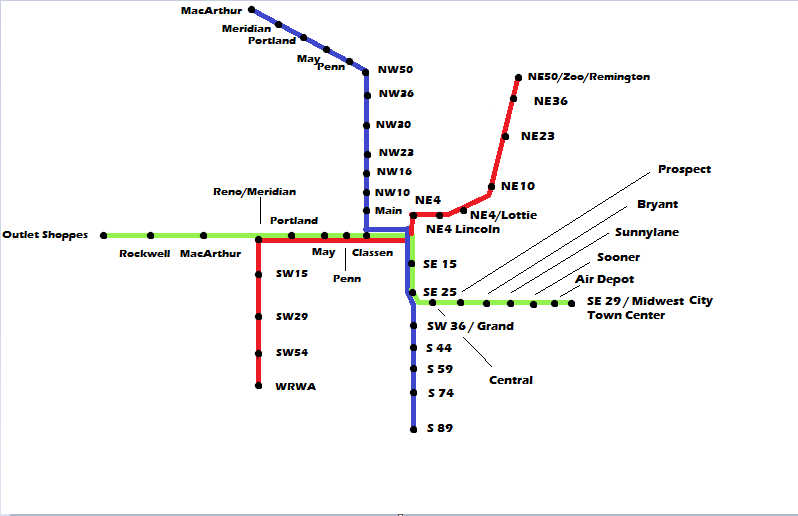
    A Regional Transit Authority has already been formed (in real life, not just in Hoyaworld), bringing OKC, Moore, Norman, Del City, MWC, and Edmond together to cooperate on this. Each of the cities would hold a MAPS-style election to get their share of money for the regional mass transit system. This is the plan that the city already seems to be moving forward on. We've seen the drawings with the colored lines going around the metro area, showing rail systems and rapid streetcar, etc. My plan adds on to this one.

    Where mine goes farther is a series of bonds and an aggressive TIF program to ensure that these areas get the maximum benefit possible from the mass transit investment. Let's reinvest in our cities, and do it right. The bond money and the TIF money would fund building quality transit-oriented development at each rail stop. We don't want park and ride systems there. You shouldn't arrive at the Midwest City rail stop and see a massive parking lot there. Some structured parking would exist, but primarily we want a walkable area with shopping, housing, entertainment, offices, etc. These do not have to be incredibly large to begin with. Each city will set aside a certain area at each stop that will be dedicated for TOD.

    So, each new stop will have the area within a certain distance (say, a 5 minute walk) rezoned so that it follows form-based codes. This will make sure that future development in the area creates the most benefit for the community. When private development takes off (and it will), there should be guidelines in place so developers know exactly what to build, and how to do it. Most suburban developers in this area really have no idea what we're looking for here. It will be a brand new experience for them and they need to have guidance and support.

    Bond money will be used to install sidewalks, bike paths, and other types of infrastructure to connect existing neighborhoods to the train station, to help prepare the cities for the development that will follow. There are a lot of people who already live in these cities, and we should make it as easy as possible for them to get to the station without using a car. So any neighborhood within a mile of the station should have improvements to it that maximize the abilities of the people in it to get to the station. This might mean putting in pedestrian bridges over a creek that runs through the neighborhood. It might mean putting in street signs directing you to the station, with walk times and bike times listed. It might mean putting in better crosswalks on busy streets, or putting in a lot more sidewalks.

    Bond money and TIF money will also be used to create, perhaps in partnership with a private developer, the first TOD along each stop. This does not have to be massive, but it has to be done right. I'd like to see at least 5 or 6 high-quality buildings (no EIFS) at each stop, each building 3 or 4 stories tall, in a small area around the stops, with shopping and offices, but primarily housing. This has the advantage of showing people exactly what they've paid for, exactly the type of development they can expect to see. In the coming years, all new construction within the 5 minute-walk area will follow the pattern. Each city can have its own architectural style and its own feel.

    The point of all this is to push the city towards quality development as fast as we can. Slow progression puts the city at an economic disadvantage. For some areas, like Del City and Midwest City, this will be a big boost for them, raising the perception of the cities and bringing new, quality development. If living in the Del City TOD area means you can live in a cool townhouse that is a 2 minute walk from a lot of amenities, and you are right next to the streetcar that brings you to downtown, it elimnates some of the stigma that has come to be associated with that city (and as a Del City boy, I want that). It makes the city, at least the new TOD part, much more desirable. For Moore, Norman, and Edmond, it ensures that at least a portion of their growth will be in a small area, improving the tax base and reducing future tax burdens that come with sprawling growth.
    This is massive and would be difficult to pass for that reason. But let's say that the idea could be entertained: The West side of the city is pretty well ignored in all this given that none of the rail lines run West of Classen.

    Do you have any ideas for connectivity to the West?


    Also, I think this is a plan worth pursuing maybe in 5 to 10 years. I really think that we need to see Wheeler in action, and if Wheeler is done right, I think it can be the poster-child for this type of initiative.

  2. #227

    Default Re: Maps 4 Neighborhoods

    I think there should be a connection to Will Rogers Airport, but right now that isn't in the RTA plan.

  3. #228

    Default Re: Maps 4 Neighborhoods

    Quote Originally Posted by hoyasooner View Post
    I think there should be a connection to Will Rogers Airport, but right now that isn't in the RTA plan.
    I just don't see how we could essentially completely ignore the West half of the city and get this to pass.

    We'd need at least 2 nodes, probably connected via BRT between I-40 and Memorial West of I-44. I could maybe see nodes being built near all 3 PC High Schools: 50th & Meridian, Rockwell & Hefner-or-122nd, 23rd and Council.

    I think 50th and Meridian has a particularly decent opportunity because of Dolese Park being right there. It would certainly be a prime candidate for retrofitting. The connectivity there is also not quite as shoddy as it is when you start getting more to the West.

  4. #229

    Default Re: Maps 4 Neighborhoods

    I'd be fine with that, but I know it's not in the current real-world plan. Are there rail lines already existing to support those areas?

  5. #230

    Default Re: Maps 4 Neighborhoods

    Quote Originally Posted by hoyasooner View Post
    I'd be fine with that, but I know it's not in the current real-world plan. Are there rail lines already existing to support those areas?
    They don't go very far north (between Reno and 10th) and there are tracks that run out by the Airport (Pacific Union tracks, I believe). I think it would need to be less about the exact form of connectivity, but that connectivity exists. I think you would have to do BRT in order to avoid an obscene expense to start laying tracks north from the Union tracks up Merdian and Rockwell.

    Once OKC gets the street car up to 63rd/Western we can rework Embark routes 005, 007, 008, 010 that serve the NW to provide transfer service (via streetcar) to downtown by creating major connectivity points along Classen (probably 23rd and NW Expressway), we can then funnel everything North of 39th to a sort of hub located at Expressway, and everything south of 39th either directly downtown via 10th or to a 23rd and Classen hub.

    I guess the point is, the biggest problem is that OKC has a major lack of places. OKC needs to identify 10 to 20 intersections outside of downtown where we are going to funnel our public resources, whether direct or incentivized. What you're talking about though is probably a 15-20 year $2.5B - $5B package that heavily incentivizes private dollars to certain areas.

    I can't really speak to the other 3 quadrants of the city, because I'm just not familiar enough with them, but as I see it, here are your most important, non-NW Expressway intersections on the NW side outside of the Grand Boulevard Loop:

    Britton and May (Lake Connectivity)
    122nd and May
    23rd and Meridian
    50th and Meridian
    39th and MacArthur
    Hefner and Rockwell
    Reno and Council

    I'm sure you could put in some more but choosing 2 or 3 out of just that list would be pretty hard, and it goes to show how difficult this process will be over the next 25 to 50 years to rethink OKC. And that's just one quadrant, although probably the most active.

    We could certainly look at getting some of that land out of our hands and handing it over to The Village, Bethany, and Warr Acres, but those 3 communities have to be allies in redeveloping the city.

  6. #231

    Default Re: Maps 4 Neighborhoods

    Quote Originally Posted by Teo9969 View Post
    This is a private sector problem.
    Indeed. If private shopping center developers saw the economic potential of retrofitting suburbia there could be a neighborhood center within one mile of every neighborhood in the city.

  7. #232

    Default Re: Maps 4 Neighborhoods

    Quote Originally Posted by krisb View Post
    Indeed. If private shopping center developers saw the economic potential of retrofitting suburbia there could be a neighborhood center within one mile of every neighborhood in the city.
    As Montreal said…it's not that simple.

    There simply aren't enough bodies nor enough connectivity to ever make it something that works all across the city.

    Better than a bunch of shopping centers would probably be neighborhoods full of mini-farms. You sit on a 1/4 acre land…do something with it.

    That's probably the best way to beef up the micro-economies of these communities, and potentially land values as well.

  8. Default Re: Maps 4 Neighborhoods

    I think one of the big errors made in Denver, which has a very nice rail system still under construction in some places, is that they chose to build the system entirely on their own. The result has been nice rail stations with totally inconvenient parking. Had The RTD engaged the suburbs and developers, tens of millions could have been saved. Developers could build huge urban projects around the stations while being required to pay for stations and parking. This is also how it has been done overseas. Developers pay for development rights in return for lease payments for the land. The lease payments pay system operating costs and keep fares very low. OKC doesnt have the density but a moderated version of this should be possible.

  9. #234
    Join Date
    Feb 2005
    Posts
    10,136
    Blog Entries
    1

    Default Re: Maps 4 Neighborhoods

    MAPS 4 Neighborhoods:

    should include something for all eight wards in Oklahoma City. More than 40 - 50% of what we generate from a MAPS 4 initiative should focus on the neighborhood agenda with each ward deciding what it wants to do with its equally distributed allocation. The other 50 - 60% should target a city-wide focus like a future transit base for light & commuter rail; along with upgrades of existing MAPS' improvement projects'--if needed. Example: Expanded Bricktown canal & street car routes--to name a few. We need to continue with the MAPS theme of no less that 7 projects.

    OKC should strive for improvement. There are areas within out city that need attention. Attention that could be contagious for individual homeowners to take note of their neighbors; begin to embark on something of their own.

    You don't need to let the MAPS brand expire; that would signal that our city has peaked. OKC has something special with MAPS that many other cities have had to sit back, take notes and only dream.

    Caution: Major infrastructure will need to be addressed with the bulk of assistance & grants through the Federal Government. MAPS was never intended to be a cure-all & fix-all for concerns about OKC; hopefully, it will keep Oklahoma City competitive with the some of the innovative trends throughout the country.

  10. #235

    Default Re: Maps 4 Neighborhoods

    MAPS 4 absolutely needs to be focused on transit infrastructure.

    We need to make serious, substantial investments in rail transit, bus shelters, sidewalks, bike routes, and other public transit fixed infrastructure.

    I appreciate that an RTA is in the development process, but we need to do more than that. We need to get light rail going. Commuter rail is a nice start, but we need to identify some key corridors and get light rail started.

    You can get to the west side with a light rail line straight down Reno. It can terminus at the Outlet Shoppes.

    You can get to the airport with a line that connects to the Reno line, straight down Meridian. You can get to the NW side via Classen and NW Expressway. We can access the inner NE side via the Adventure Line, we have the ROW and an existing rail line. We can access the south side via Shields. We can get to the east side via SE29th and hit MWC in the process.

    We need to say, "this is our rail transit plan" and start working on it. I have chosen key corridors, most with wide ROW and large medians that can facilitate putting tracks down the middle of. (Reno, Shields, NW Expwy, Classen). All have major business or leisure destinations along or at the end of them, save for the blue line on the southside, which I suspect would be primarily park and ride driven while serving the SE Latino community.


  11. Default Re: Maps 4 Neighborhoods

    I like the map above. If you're going to do rail, hover, i think it should be regional. Include Norman, Edmond and MWCDC-Tinker/ Boeing.

  12. #237

    Default Re: Maps 4 Neighborhoods

    Quote Originally Posted by mugofbeer View Post
    I like the map above. If you're going to do rail, hover, i think it should be regional. Include Norman, Edmond and MWCDC-Tinker/ Boeing.
    Norman and Edmond are both planned to be served by Commuter Rail, which is a much better mode of transit for such stage lengths.

  13. #238

    Default Re: Maps 4 Neighborhoods

    Why do people keep trying to put mass transit down NW Expressway? Who would use this service and where would they possibly be going from or to?

  14. #239

    Default Re: Maps 4 Neighborhoods

    Why would people not use it? To be able to get anywhere in the city from the West and Northwest parts of the city would be more than valuable. Currently, the area has tons of room to grow to be much more urban but the framework for urban centers every mile is already there and the population(which outside of the main core) is easily some of the highest in the city. Do I think it should be first? Heck no but it would be foolish to completely deny that side of town some mass transit. And as to your question of going to or from, how bout going to work downtown, catching a train to Norman (obviously down the road) Penn sqaure during the extra busy christmas season, the possibilities are endless. I know i'd use it to be able to have a drink on 10th street and not have to worry about driving home. Since it literally cuts through the middle of the northside it allows most people who would use it to be no more than 3-4 miles from it. Couple that with some neighborhood based bus service and I think you have a formula for success.

  15. #240

    Default Re: Maps 4 Neighborhoods

    Quote Originally Posted by Just the facts View Post
    Why do people keep trying to put mass transit down NW Expressway? Who would use this service and where would they possibly be going from or to?
    NW Expressway is the largest area of employment and recreation outside of the downtown core. It easily has the most attractions, shopping, restaurants, businesses, and employers outside of downtown. Saying it does not deserve a connection to transit just because it does not conform to urban design is a mistake.

    If that were the case, the only place that should deserve transit is Deep Deuce and the CBD. They are the only two areas that are pretty close to 100% conformity to urban design and walkability -- and both still fail in some regards.

    I live 11 miles from downtown Portland, on the blue line. It is certainly not an urban area, yet the MAX is packed day in and day out. To say transit will fail because it is a suburban designed area is incorrect. Living proof of its success is right outside my front door. I am a frequent user of it, and I'm not the only person served 11 miles out from downtown.

    NW Expressway is one of the busiest thoroughfares in OKC, and there is plenty of reason it deserves transit.

  16. #241

    Default Re: Maps 4 Neighborhoods

    I started to craft multiple responses to that, but then I figured, why bother - NW Exp isn't getting meaningful mass transit in my lifetime anyhow.

  17. #242

    Default Re: Maps 4 Neighborhoods

    Quote Originally Posted by Just the facts View Post
    I started to craft multiple responses to that, but then I figured, why bother - NW Exp isn't getting meaningful mass transit in my lifetime anyhow.
    of course because you know better than anyone else here right?

  18. #243

    Default Re: Maps 4 Neighborhoods

    Quote Originally Posted by Just the facts View Post
    I started to craft multiple responses to that, but then I figured, why bother - NW Exp isn't getting meaningful mass transit in my lifetime anyhow.
    With that type of attitude it won't.

    I am not a huge fan of sprawl, but it is what it is. Real human beings live in it, and the benefits of mass fixed-rail transit extend well beyond the core.

  19. #244

    Default Re: Maps 4 Neighborhoods

    Quote Originally Posted by catch22 View Post
    With that type of attitude it won't.

    I am not a huge fan of sprawl, but it is what it is. Real human beings live in it, and the benefits of mass fixed-rail transit extend well beyond the core.
    Correct me if I am wrong, but my guess is Portland has two things currently in place that OKC doesn't that makes mass transit to the suburbs feasible. First, traffic there is probably bad enough to make commuting by car a headache. Most people won't use mass transit as long as its easier to commute by car and in 2015 in OKC, I would imagine relatively few people would take the train instead of their car to get from NW Expressway and 63rd to downtown. Secondly, Portland probably has a compact and urban downtown with all the amenities one would need once you get there, all within walking distance or a streetcar ride.

    OKC is probably about 20-25 years out from being there. With that said, now is the time to start laying foundations and getting things into place so such a system can be built when the time is right. I think first, streetcar service should be extended up Classen to the Chesapeake campus and a commuter rail line added to/from Will Rogers World Airport.

    Lines to Tinker, Edmond, Norman, and NW Expressway can be added as the demand is there.

  20. #245

    Default Re: Maps 4 Neighborhoods

    Quote Originally Posted by bchris02 View Post
    Correct me if I am wrong, but my guess is Portland has two things currently in place that OKC doesn't that makes mass transit to the suburbs feasible. First, traffic there is probably bad enough to make commuting by car a headache. Most people won't use mass transit as long as its easier to commute by car and in 2015 in OKC, I would imagine relatively few people would take the train instead of their car to get from NW Expressway and 63rd to downtown. Secondly, Portland probably has a compact and urban downtown with all the amenities one would need once you get there, all within walking distance or a streetcar ride.

    OKC is probably about 20-25 years out from being there. With that said, now is the time to start laying foundations and getting things into place so such a system can be built when the time is right. I think first, streetcar service should be extended up Classen to the Chesapeake campus and a commuter rail line added to/from Will Rogers World Airport.

    Lines to Tinker, Edmond, Norman, and NW Expressway can be added as the demand is there.
    Portland's system was 20+ years in the making. I am benefiting from the result of 20 plus years of work. My point is, in order to be where Portland is today, it will take 20-25 years if we started tomorrow morning.

    OKC 2040 = Portland 2015. Think about that. If we wait 25 years to get started, we will be 50 years behind Portland.

  21. #246

    Default Re: Maps 4 Neighborhoods

    I'm confused. We talk about wanting to serve and build up more of the overall city with transit. What other corridors are more important than NW Expwy? Classen to NW Expwy has always sounded like a slam-dunk to me.

    NW Expwy could be decent and support high-frequency LRT with a little retrofitting.

  22. Default Re: Maps 4 Neighborhoods

    A commute down NW Expressway is already pretty harrowing in 2015. I'll bet a lot of people out there would opt for rail if given a chance. The trick is finding a way to more densely cluster some population around the stops. Right now most neighborhoods nearby are set back from NWE a mile or more. Sprawl retrofit of the commercial centers lining the street and TOD make lots of sense there.

  23. #248

    Default Re: Maps 4 Neighborhoods

    Quote Originally Posted by catch22 View Post
    MAPS 4 absolutely needs to be focused on transit infrastructure.

    We need to make serious, substantial investments in rail transit, bus shelters, sidewalks, bike routes, and other public transit fixed infrastructure.

    I appreciate that an RTA is in the development process, but we need to do more than that. We need to get light rail going. Commuter rail is a nice start, but we need to identify some key corridors and get light rail started.

    You can get to the west side with a light rail line straight down Reno. It can terminus at the Outlet Shoppes.

    You can get to the airport with a line that connects to the Reno line, straight down Meridian. You can get to the NW side via Classen and NW Expressway. We can access the inner NE side via the Adventure Line, we have the ROW and an existing rail line. We can access the south side via Shields. We can get to the east side via SE29th and hit MWC in the process.

    We need to say, "this is our rail transit plan" and start working on it. I have chosen key corridors, most with wide ROW and large medians that can facilitate putting tracks down the middle of. (Reno, Shields, NW Expwy, Classen). All have major business or leisure destinations along or at the end of them, save for the blue line on the southside, which I suspect would be primarily park and ride driven while serving the SE Latino community.

    The current Embark routes on the NW side would interface pretty well with that with a little modification. They run north/south from about NW16th to about NW 63rd at Classen, May, and Portland, crossing or really close to NW Highway. Part of Meridian is covered. If those were adjusted at the north end and extended at the south end to meet with rail stops at both the north and south ends, Reno/NW Highway, that whole side of the city would have great coverage.

    I would extend all of it on out to Council and run connecting bus routes north and south on Rockwell and Council, especially when we get Bethany on board.

    http://embarkok.com/assets/files/map...ap_4282014.pdf

  24. #249

    Default Re: Maps 4 Neighborhoods

    Quote Originally Posted by Spartan View Post
    NW Expwy could be decent and support high-frequency LRT with a little retrofitting.
    I'm all for this. The problem is that it is still "controlled" by ODOT. Even the BRT concepts released lately have their fingerprints on them.

  25. #250

    Default Re: Maps 4 Neighborhoods

    Quote Originally Posted by Urbanized View Post
    A commute down NW Expressway is already pretty harrowing in 2015. I'll bet a lot of people out there would opt for rail if given a chance. The trick is finding a way to more densely cluster some population around the stops. Right now most neighborhoods nearby are set back from NWE a mile or more. Sprawl retrofit of the commercial centers lining the street and TOD make lots of sense there.
    Every time I go over there, I think about how it's too bad that the area is as sprawled out as it is. I'd love to see that area be retrofitted into a more urban layout.

Thread Information

Users Browsing this Thread

There are currently 1 users browsing this thread. (0 members and 1 guests)

Similar Threads

  1. New MAPS Website- MAPS Facts.org
    By Urban Pioneer in forum General Civic Issues
    Replies: 122
    Last Post: 11-30-2009, 12:52 PM
  2. did the original maps have more information disclosed than maps 3?
    By soonerfan_in_okc in forum General Civic Issues
    Replies: 6
    Last Post: 11-27-2009, 02:45 AM
  3. Oklahoman Coverage: Maps & Maps 3
    By Doug Loudenback in forum General Civic Issues
    Replies: 18
    Last Post: 11-14-2009, 08:21 PM
  4. Urban Neighborhoods
    By The Old Downtown Guy in forum Announcements & Help Desk
    Replies: 26
    Last Post: 02-09-2009, 09:56 AM
  5. Neighborhoods
    By shadow42 in forum Suburban & Other OK Communities
    Replies: 45
    Last Post: 06-13-2008, 02:46 PM

Bookmarks

Posting Permissions

  • You may not post new threads
  • You may not post replies
  • You may not post attachments
  • You may not edit your posts
  •  
Single Sign On provided by vBSSO