

Let's hope this trend continues.Originally Posted by Anonymous.


 Participating Member

Let's hope this trend continues.
Participating Member
technical discussion follows on this link
https://www.facebook.com/NWSNorman/p...31143010239960
Participating Member

Pretty thick layer of clouds still over NW OKC. Hopefully they can hang on.
David
So recap of what we have right now.
SPC outlook updated about 20 minutes ago has the Moderate Risk in basically the same area still. It still runs north to just over I-40 and all the way east to I-35. 10% Tornado area is slightly offset south now with the northern edge including Jackson, Kiowa, Wa****a, Caddo, Grady, McClain, Garvin, and Pontotoc Counties. However, storms don't care about human placed boundaries so just keep that in mind.
Current radar has an active severe storm already west of Lubbock with other storms developing west of that and also back towards Abilene. Watch is likely for this area up to the Southwest tip of Oklahoma soon.
Surface analysis has 70+ dewpoints all over East Texas that will be getting pulled northward today. Of course the big question is how far north will the outflow boundary from yesterday come. The showers in North Texas area pretty much right on that boundary. Looking at visible satellite with some daylight now...clearing exists for some of South Central OK back into North Texas. Just to the west of that, low cloud deck/fog still exists. This should burn off pretty easily. As everything lifts north and the sun burns through, instability should start to increase pretty quickly today. The activity on the boundary has been highlighted as something that cool keep it from getting too far north, but right now it doesn't appear as though it'll cause many issues.
12Z & 13Z (still partial) HRRR have a good handle on morning precip for a change. It'll bring the storms in by late afternoon and pull the boundary over around the same time. SigTOR values are significant even with this mess of convection.
4KM NAM has a line of supercells west of OKC by 6PM, but splits them around the city by 7PM. As usual, don't take exact placement of any of these simulated reflectivity products to the bank.
Pretty much all of the major cells are shown to be rotating as well...
Main thing...like every typical higher end event, it takes just one thing to be off to shut it down...but if things happen just right it can be pretty bad. Just be prepared and we'll see how it plays out.
David
First Tornado Watch of the day is now active over West and parts of North Texas.
Participating Member
Cloud deck is really starting to thin out, but is still very thick over SW OK. Looks like C OK will be destabilizing soon.
Here's a good map for how much radiation is actually penetrating the cloud deck. This helps us determine how thick the clouds are.

V, I was able to get to your chat, earlier, but it's been locking up in the last few minutes (never ending leading). Rebooted but didn't help. Presumably that will resolve, later, but I was letting you know. As always, we appreciate you.
Participating Member
I can't get in either, Venture.
Guys, Venture had to do some updates to his site that involved some network changes w/Cox, so you might need to refresh a few times to get the update to come through.
David
Here is an alternate to get into the chat directly...
WeatherSpotlight
Started getting some security attacks on the site last night so the new IP address hasn't gone or totally yet.
David
MESOSCALE DISCUSSION 0543
NWS STORM PREDICTION CENTER NORMAN OK
1222 PM CDT FRI MAY 08 2015
AREAS AFFECTED...WESTERN PART OF NORTH TX/SOUTHWEST OK
CONCERNING...SEVERE POTENTIAL...TORNADO WATCH LIKELY
VALID 081722Z - 081845Z
PROBABILITY OF WATCH ISSUANCE...95 PERCENT
SUMMARY...SEVERE POTENTIAL IS EXPECTED TO STEADILY INCREASE
EAST-NORTHEASTWARD THIS AFTERNOON ACROSS ADDITIONAL PORTIONS OF
NORTH TX INTO WESTERN/SOUTHERN OK...INCLUDING A MULTI-MODAL-RELATED
TORNADO/LARGE HAIL/DAMAGING WIND RISK. A TORNADO WATCH WILL LIKELY
BE NEEDED EARLY THIS AFTERNOON.
DISCUSSION...A COMPLEX STORM MODE INCLUDING SOME LOOSELY CLUSTERED
SUPERCELLS IS EVOLVING AT MIDDAY ACROSS THE SOUTHEAST TX PANHANDLE
AND WESTERN PART OF NORTH TX. AIR MASS DESTABILIZATION CONTINUES TO
STEADILY OCCUR NEAR/JUST NORTH OF A PRIOR OUTFLOW BOUNDARY ACROSS
WESTERN NORTH TX...WHILE THICKER CLOUD COVER HAS TENDED TO LINGER
INTO OK AS OF EARLY AFTERNOON. THINKING IS THAT CLUSTERED SUPERCELLS
WILL TEND TO PERSIST EAST-NORTHEASTWARD POTENTIALLY AS AN
UPSCALE-GROWING COMPLEX INTO ADDITIONAL PORTIONS OF NORTH TX AND
ADJACENT WESTERN/SOUTHERN OK CENTERED ALONG THE RED RIVER VICINITY.
LARGE HAIL WILL LIKELY REMAIN THE PRIMARY RISK IN THE SHORT-TERM
/EARLY AFTERNOON/...BUT DAMAGING WINDS/SOME TORNADO RISK SHOULD
BECOME MORE OF A CONCERN AS ADDITIONAL BOUNDARY LAYER HEATING
OCCURS.
David
Guest
For those who don't like the local policy about sounding sirens in Okla. City.
http://www.okc.gov/news/2015_05/Torn...an_in_OKC.html
“Think about a busy parent hearing sirens at their office in north Oklahoma City where the weather seems fine, but their teenager is home alone on the south side and might be in danger,” said Emergency Manager Frank Barnes. “Our policy is to sound sirens everywhere in the City, no matter where the tornado threat is, so people know to seek more information about the weather and decide what protective measures they need to take.”
David
MESOSCALE DISCUSSION 0545
NWS STORM PREDICTION CENTER NORMAN OK
0212 PM CDT FRI MAY 08 2015
AREAS AFFECTED...SOUTHWEST/SOUTH-CENTRAL OK AND WESTERN NORTH TX
CONCERNING...TORNADO WATCH 143...
VALID 081912Z - 082045Z
THE SEVERE WEATHER THREAT FOR TORNADO WATCH 143 CONTINUES.
SUMMARY...MAINLY A LARGE HAIL/DAMAGING WIND THREAT WILL CONTINUE TO
SPREAD EAST-NORTHEASTWARD ACROSS SOUTHWEST/SOUTH-CENTRAL OK THROUGH
MID-AFTERNOON...WHILE STORMS ARE LIKELY TO ALSO INCREASE LATER THIS
AFTERNOON ACROSS ADDITIONAL PORTIONS OF WESTERN NORTH TX/IMMEDIATE
RED RIVER VICINITY OF OK WITH ALL SEVERE HAZARDS POSSIBLE. TORNADO
WATCH 143 CONTINUES UNTIL 02Z. AN ADDITIONAL WATCH COULD BE NEEDED
LATER THIS AFTERNOON FOR MORE OF EAST-CENTRAL/SOUTHEAST OK.
DISCUSSION...MULTIPLE SEVERE CLUSTERS/HIGH PRECIP SUPERCELLS WITH
HISTORY OF LARGE HAIL /INCLUDING RECENT TENNIS BALL SIZE HAIL
REPORTS/ WILL CONTINUE TO SPREAD EAST-NORTHEASTWARD ACROSS SOUTHWEST
INTO SOUTH-CENTRAL OK...LIKELY FAVORING A SOUTHWEST-NORTHEAST
ORIENTED FRONTAL BOUNDARY THAT EXTENDS TOWARD THE OKC METRO AREA.
LARGE HAIL WILL REMAIN A DISTINCT POSSIBILITY...AND LOCALLY DAMAGING
WINDS AND POSSIBLY SOME TORNADO RISK SHOULD BECOME AN INCREASING
CONCERN AS CLOUDS CONTINUE TO THIN/DESTABILIZATION CONTINUES TO
OCCUR. A SPECIAL 18Z OBSERVED SOUNDING FROM NORMAN SAMPLED MORE THAN
1500 J/KG MLCAPE WITH MODESTLY STRONG/AMPLE TURNING OF
LOWER/MID-TROPOSPHERIC WINDS.
FARTHER SOUTH/SOUTHWEST...ADDITIONAL SEVERE DEVELOPMENT INCLUDING
SUPERCELLS SHOULD DEVELOP INTO/ACROSS WESTERN PARTS OF NORTH TX IN
VICINITY OF OUTFLOW IN ADDITION TO NEAR-RED RIVER PORTIONS OF OK BY
LATE AFTERNOON.
Participating Member
I'm in total agreement with this policy, but you know, people just want to bitch.
That flies directly in the face of the notion that the sirens are for "outdoor individuals" only. And I've heard that line more than once.
Participating Member
I agree with the policy and think it should stay the same.
Participating Member
Do we have firm fix on the warm fronts location?
I’M thinking it’s just south of Norman?
David
Bulletin - eas activation requested
tornado warning
national weather service norman ok
355 pm cdt fri may 8 2015
the national weather service in norman has issued a
* tornado warning for...
South central jackson county in southwestern oklahoma...
West central tillman county in southwestern oklahoma...
Southeastern hardeman county in northern texas...
Northwestern wilbarger county in northern texas...
* until 445 pm cdt
* at 355 pm cdt...a severe thunderstorm capable of producing a
tornado was located near medicine mound...moving east at 40 mph.
Hazard...tornado and golf ball size hail.
Source...radar indicated rotation.
David
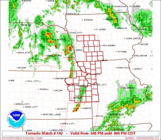
Tornado Watch for rest of metro being issued.
David
The national weather service has extended tornado watch 143 to
include the following areas until 9 pm cdt this evening
in oklahoma this watch includes 8 counties
in central oklahoma
canadian cleveland lincoln
logan oklahoma pottawatomie
in east central oklahoma
pontotoc seminole
this includes the cities of...ada...chandler...el reno...
Guthrie...moore...mustang...norman...oklahoma city...seminole...
Shawnee and yukon.
Participating Member
Storms blowing up as they come into the metro!
Participating Member
So is it pretty much wind/hail/flooding for the metro at this point? Any real tornado risk here?
VIP Member
You realize all of the above things can be just as destructive as a tornado, right? And that flooding is going to cause people a lot more headaches because most won't have flood insurance and regular insurance won't pay for their homes, whereas regular homeowners insurance does help with tornado recovery? I do not understand you.
Still corrupting young minds
There are currently 1 users browsing this thread. (0 members and 1 guests)
 Posting Permissions

 Reply With Quote


Bookmarks