Widgets Magazine
Page 2 of 25 FirstFirst 1234567 ... LastLast
Results 26 to 50 of 624

Thread: General Weather Discussion - May 2015

  1. Default Re: General Weather Discussion - May 2015

    Slight Risk for today has been extended all the way to I-35 and is now entirely hatched for Oklahoma. Main threat will be very large hail over 2 inches. Damaging wind and tornadoes will also be possible.

    Chat room day for Wednesday, so will hold off any big model updates until the morning so I can get the new Euro run involved.
    ...CENTRAL/SOUTHERN PLAINS...
    WARM-CONVEYOR SCATTERED SHOWERS/TSTMS WILL BE ONGOING AT 12Z TODAY
    FROM PARTS OF NORTHEAST TX AND EASTERN OK NWD INTO THE MID MO
    VALLEY. RESIDUAL CLOUD COVER IS EXPECTED ACROSS MUCH OF THE
    WARM/MOIST SECTOR INTO THIS AFTERNOON. MEANWHILE...SLY LOW-LEVEL
    WINDS WILL MAINTAIN POLEWARD MOISTURE RETURN/THETA-E ADVECTION EAST
    OF THE DRY LINE...WITH PW VALUES EXCEEDING 1.25 INCHES. THIS
    COMBINED WITH SURFACE HEATING WEST OF THE EARLY DAY CLOUDINESS WILL
    CONTRIBUTE TO A DESTABILIZING AIR MASS WITH MLCAPE OF 1500-2500 J/KG
    FROM SOUTH-CENTRAL KS SWD THROUGH WRN OK AND WRN/CENTRAL TX...WHILE
    VALUES OF 1000-1500 J/KG NWD THROUGH CENTRAL KS AND SRN/ERN NEB.
    EFFECTIVE BULK SHEAR OF 35-40 KT IS EXPECTED ALONG THE FULL EXTENT
    OF THE DRY LINE WITH THIS SHEAR VECTOR ORIENTED PERPENDICULAR TO
    THIS BOUNDARY WHICH SUPPORTS SUPERCELLS WITH STORMS THAT DEVELOP
    LATE THIS AFTERNOON INTO THE EVENING.

    MODELS CONTINUE TO INDICATE MUCH OF THE LEAD SHORTWAVE
    TROUGH-RELATED LARGE-SCALE FORCING FOR ASCENT WILL OVERSPREAD THE
    CENTRAL PLAINS/MIDDLE MO VALLEY...WHILE NEUTRAL HEIGHT TENDENCIES OR
    WEAK RISES...WITH SOME MIDLEVEL WARMING WILL OCCUR ACROSS THE
    SOUTHERN PLAINS PORTION OF THE DRYLINE. GIVEN THIS FACTOR AND
    GUIDANCE FROM THE HIGH-RES MODELS AND CAMS SUGGEST STORM COVERAGE
    NEAR AND EAST OF THE DRY LINE WILL TEND TO BE ISOLATED...WHICH
    CONTINUES TO SUPPORT A SLIGHT RISK FOR SEVERE STORMS...AND NO
    INCLUSION OF AN ENHANCED RISK AREA AS THIS TIME. SEVERE HAIL AND
    DAMAGING WINDS MAY BE THE MOST COMMON RISKS...WITH A PLUME OF
    STEEPER MIDLEVEL LAPSE RATES SPREADING ACROSS TX/OK/KS PORTIONS OF
    THE SLIGHT RISK AREA THIS EVENING SUGGESTING VERY LARGE HAIL WILL BE
    POSSIBLE. VERTICALLY VEERING WIND PROFILES WILL SUPPORT A TORNADO
    THREAT. FORECAST SOUNDINGS INDICATED SOME BACKING OF LOW-LEVEL
    WINDS ACROSS WRN-NORTH TX THROUGH WRN OK INTO SOUTH CENTRAL KS THIS
    EVENING AS THE DRY LINE RETREATS WITH A TORNADO IN THOSE AREAS AS
    WELL WITH ANY STORMS THAT DEVELOP.

  2. #27

    Default Re: General Weather Discussion - May 2015

    Slight Risk Friday extended to cover most of Oklahoma. Saturday is now has a large 30 percent risk area ( The highest the 4-8 product day allows them to do this far out).

  3. #28

    Default Re: General Weather Discussion - May 2015

    If this cloud deck burns off, lookout this afternoon!

  4. #29

    Default Re: General Weather Discussion - May 2015

    From SPC on there latest outlook from this morning.

    SUFFICIENT LOW-LEVEL MOISTURE...EFFECTIVE BULK SHEAR OF 35-40
    KT...AND STRENGTHENING LOW-LEVEL SHEAR BY THIS EVENING WILL SUPPORT
    A RISK FOR SUPERCELLS WITH TORNADOES AND VERY LARGE HAIL. THE
    DAMAGING WIND RISK SHOULD BE SMALLER GIVEN THE EXPECTATION FOR
    MAINLY ISOLATED/DISCRETE CELLS. THE PARAMETER SPACE IS FORECAST TO
    BECOME FAVORABLE FOR SIGNIFICANT TORNADOES FROM WRN OK INTO CENTRAL
    KS THIS EVENING...
    BUT WILL NOT RAISE TORNADO PROBABILITIES BECAUSE
    CONFIDENCE IN SUPERCELL INITIATION ACROSS THIS SAME CORRIDOR REMAINS
    A BIT TOO LOW.

  5. Default Re: General Weather Discussion - May 2015

    I will be out with a couple of co-workers in western OK this afternoon. Will post any pics that are worthwhile.

  6. Default Re: General Weather Discussion - May 2015

    Grr...supposed to have my band and orchestra picnic on Friday evening :/
    Still corrupting young minds

  7. Default Re: General Weather Discussion - May 2015

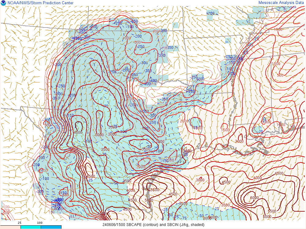
    So far for this morning not a lot really going on. A few isolated showers with one denser patch developing over Southern Caddo. No high level cirrus/cloud debris today to worry about like we normally do, so that is one positive sign towards storm development. The cloud cover over Western OK is eroding some, but very slowly so far. So outside of that let's look at the rest of the setup...

    - Moisture: Mid to upper 60s as far as dewpoints right now, with a pretty solid fetch of moisture from the south. So we are good there.
    - Instability: SPC Mesoanalysis has most of the area marginally to moderately unstable area with short term models getting us very unstable by afternoon.
    - Boundaries: Dryline will sharpen some and get barely into West Central and Northwest OK late this afternoon before retreating. Any left over boundaries from last night's storms will also help provide trigger areas.

    Right now my feeling is that this will not be a very widespread event. Storm coverage is really limited in the current model runs, but signs are there that we'll get a few to go. The limit of extensive coverage will allow them to remain isolated and not fight for energy from other storms. So the focus now will be watching on how the cloud deck burns off. I would pay attention to both the dryline in NW OK but also and area that might get sparked off over SW OK/NW TX around late afternoon. If I were going out, I would take the easy launch point of Clinton and see how things evolve. Even though it is only a slight risk, I had some of my best chase days with slight risks - so stay aware!

    Chat room is up and going for today: Weather Spotlight - Live Chat Room for Weather Event Coverage

  8. Default Re: General Weather Discussion - May 2015

    We got some serious rain in Norman. Rained hard all night and kept me up with the thunder. My puppy however didn't even notice...

  9. Default Re: General Weather Discussion - May 2015

    Quote Originally Posted by FighttheGoodFight View Post
    We got some serious rain in Norman. Rained hard all night and kept me up with the thunder. My puppy however didn't even notice...
    Norman won the 24 hour rain total...3.94", with 2.76" since midnight alone. Definitely a lot of water.

  10. #35

    Default Re: General Weather Discussion - May 2015

    Beginning to see slivers of sun through the clouds in the north metro.

  11. Default Re: General Weather Discussion - May 2015

    Rick Smith @ounwcm

    Getting more concerned about potential for dangerous storms this afternoon/evening. Lots of ingredients will be in place. Not a guarantee!

    Rick Smith @ounwcm

    Pay very close attention to the #okwx and #texomawx. Watch for updated outlooks and don't leave work without checking the weather.

  12. Default Re: General Weather Discussion - May 2015

    Outlook upgraded to Enhanced.

  13. Default Re: General Weather Discussion - May 2015

    ...northwest ok...
    The area with the lowest confidence in robust convective initiation
    along the dryline is over northwest ok. However...virtually all
    models agree on a strong cape/shear environment by late afternoon
    with little cap. Any storm that forms in this region would have a
    high conditional risk of significant severe weather. However...
    Will maintain only 5 percent tornado and 15 percent hail
    probabilities at this time.

    ...southwest ok into tx...
    Visible satellite imagery shows strong heating occurring over parts
    of western north tx...where dewpoints are in the mid 60s. This area
    may be far enough southwest to recover from the subsidence
    associated with the shortwave over ks...with another area of higher
    confidence in convective initiation. Supercells capable of very
    large hail and isolated tornadoes are expected to occur in this
    region during the mid afternoon through evening hours.

  14. Default Re: General Weather Discussion - May 2015

    Couple early storms trying to go up. Small hail main risk right now.


  15. Default Re: General Weather Discussion - May 2015

    Storm has gone severe already.

    THE NATIONAL WEATHER SERVICE IN NORMAN HAS ISSUED A


    * SEVERE THUNDERSTORM WARNING FOR...
    SOUTHERN CADDO COUNTY IN SOUTHWESTERN OKLAHOMA...


    * UNTIL 130 PM CDT


    * AT 1246 PM CDT...A SEVERE THUNDERSTORM WAS LOCATED 5 MILES WEST OF
    BOONE...MOVING NORTHEAST AT 30 MPH.


    HAZARD...60 MPH WIND GUSTS AND HALF DOLLAR SIZE HAIL.


    SOURCE...RADAR INDICATED.

  16. #41

    Default Re: General Weather Discussion - May 2015

    Nice clearing taking place, but these little storms popping up this early could keep revamping the cloud deck we have been burning off all day.

  17. Default Re: General Weather Discussion - May 2015


    AREAS AFFECTED...PORTIONS OF WEST TEXAS...NORTHWEST TEXAS AND
    SOUTHWEST OKLAHOMA

    CONCERNING...SEVERE POTENTIAL...WATCH LIKELY

    VALID 061803Z - 062000Z

    PROBABILITY OF WATCH ISSUANCE...95 PERCENT

    SUMMARY...THUNDERSTORMS EXPECTED TO DEVELOP RAPIDLY BETWEEN 18 AND
    19Z. SEVERE HAIL AND WIND GUSTS ARE THE PRIMARY THREATS
    INITIALLY...BUT TURNING LOW-LEVEL HODOGRAPHS SUGGEST A TORNADO
    THREAT FOR ANY SUSTAINED UPDRAFTS.

    DISCUSSION...STRONG HEATING HAS CONTRIBUTED TO RAPID DESTABILIZATION
    AHEAD OF A DIFFUSE DRYLINE WITH AN EASTERN EDGE STRETCHING FROM EAST
    OF LBB TO NEAR SHAMROCK. ALTHOUGH THE MCD AREA IS UNDER NEUTRAL TO
    SLIGHT MID-LEVEL HEIGHT RISES IN THE WAKE OF THE EXITING
    WAVE...LITTLE TO NO CONVECTIVE INHIBITION IS PRESENT OVER THE AREA.
    MIXED-LAYER CAPE VALUES HAVE RISEN ABOVE 2000 J/KG WITH LOW-LEVEL
    LAPSE RATES ABOVE 8 C/KM. WITH EFFECTIVE SHEAR OF 30-40
    KT...SUPERCELL STRUCTURES WILL BE THE FAVORED MODE FOR PERSISTENT
    UPDRAFTS...BUT LONGEVITY OF THE SUPERCELLS COULD BE NEGATIVELY
    IMPACTED BY STORM INTERACTIONS AS NUMEROUS STORMS ARE EXPECTED TO
    DEVELOP UNDER LITTLE INHIBITION AND POSSIBLY ENHANCED BY LIFT FROM A
    WEAK POTENTIAL VORTICITY ANOMALY PROGRESSING THROUGH THE BROAD
    CYCLONIC FLOW IN UPPER-LEVELS. REGARDLESS OF STORM MODE...SEVERE
    HAIL IS LIKELY WITH THE STRONGER STORMS...WITH SEVERE WIND GUSTS
    POSSIBLE GIVEN THE STEEP LOW-LEVEL LAPSE RATES. ALTHOUGH LOW-LEVEL
    WIND SPEEDS REMAIN SOMEWHAT MODEST...LOW-LEVEL HODOGRAPHS SHOW
    CURVATURE...WITH EFFECTIVE HELICITY VALUES OF 100-150 M2/S2 FOR
    STORMS THAT DEVIATE TO THE RIGHT OF THE MEAN FLOW AND SHEAR.

  18. Default Re: General Weather Discussion - May 2015


    AREAS AFFECTED...MUCH OF CNTRL KS...S CNTRL NEB

    CONCERNING...SEVERE POTENTIAL...WATCH LIKELY

    VALID 061809Z - 062045Z

    PROBABILITY OF WATCH ISSUANCE...95 PERCENT

    SUMMARY...STORMS WILL DEVELOP ACROSS NWRN INTO CNTRL KS WITH
    TORNADOES...LARGE HAIL AND DAMAGING WIND POSSIBLE.

    DISCUSSION...VISIBLE SATELLITE SHOWS CU INCREASING IN DEPTH ACROSS
    MUCH OF CNTRL KS INTO SWRN NEB DUE TO HEATING AND A RAPID NWD
    ADVECTION OF LOW-LEVEL MOISTURE WITH DEWPOINTS RISING INTO THE 60S
    F. MEANWHILE...AN UPPER TROUGH AXIS EXTENDS FROM NERN CO INTO WRN
    KS...WITH ENHANCED VORTICITY ON THE N SIDE OF THE MIDLEVEL JET.

    NEARBY VWPS SHOW SUBSTANTIAL LOW-LEVEL TURNING OF THE WINDS WITH
    HEIGHT...FAVORABLE FOR SUPERCELLS. THE LACK OF A CAPPING INVERSION
    COMBINED WITH THE RELATIVELY HIGH-RH BOUNDARY LAYER AND AMPLE
    LOW-LEVEL SRH SUGGEST TORNADOES MAY OCCUR. LARGE HAIL IS ALSO LIKELY
    BUT MID TO UPPER LEVEL FLOW IS WEAK...SUGGESTING HP SUPERCELLS WITH
    LARGE PROPAGATIONAL COMPONENT. SOME HIGH RESOLUTION MODELS SUGGEST A
    LINEAR MODE AND DAMAGING WIND THREAT AS WELL...MAINLY OVER NRN KS
    INTO SRN NEB.

  19. Default Re: General Weather Discussion - May 2015

    Quote Originally Posted by Anonymous. View Post
    Nice clearing taking place, but these little storms popping up this early could keep revamping the cloud deck we have been burning off all day.
    The short term models seemed to anticipate this, and the feeling I'm getting from SPC/NWS is that it won't matter.

    No CIN out there and instability already very high.


  20. Default Re: General Weather Discussion - May 2015


  21. Default Re: General Weather Discussion - May 2015

    Tornadoes
    Probability of 2 or more tornadoes
    Mod (50%)
    Probability of 1 or more strong (F2-F5) tornadoes
    Mod (30%)
    Wind
    Probability of 10 or more severe wind events
    High (70%)
    Probability of 1 or more wind events > 65 knots
    Low (10%)
    Hail
    Probability of 10 or more severe hail events
    High (90%)
    Probability of 1 or more hailstones > 2 inches
    Mod (40%)
    Combined Severe Hail/Wind
    Probability of 6 or more combined severe hail/wind events
    High (>95%)


  22. #47

    Default Re: General Weather Discussion - May 2015

    Most "impressive" watch for OK this season, I think.

    Once these little cells shove off, and the big boys come out to play on the dryline, we could be in business.

  23. #48

    Default Re: General Weather Discussion - May 2015

    Just a general question. With the probabilities so high (can't remember a tornado watch having 50% probabilities in some time), would this qualify as a PDS?

  24. Default Re: General Weather Discussion - May 2015

    Quote Originally Posted by adaniel View Post
    Just a general question. With the probabilities so high (can't remember a tornado watch having 50% probabilities in some time), would this qualify as a PDS?
    Nope. Need 50% EF2-EF5 typically...even that can be borderline.

  25. #50

    Default Re: General Weather Discussion - May 2015

    Where is the dryline positioned at right now? Oklahoma Texas border?

Thread Information

Users Browsing this Thread

There are currently 1 users browsing this thread. (0 members and 1 guests)

Similar Threads

  1. General Weather Discussion - April 2015
    By venture in forum Weather & Geosciences
    Replies: 364
    Last Post: 04-29-2015, 10:39 PM
  2. General Weather Discussion - March 2015
    By venture in forum Weather & Geosciences
    Replies: 521
    Last Post: 04-06-2015, 10:04 PM
  3. General Weather Discussion - January/February 2015
    By venture in forum Weather & Geosciences
    Replies: 525
    Last Post: 03-01-2015, 02:38 PM
  4. General Weather Discussion - May 2014
    By venture in forum Weather & Geosciences
    Replies: 429
    Last Post: 05-30-2014, 08:39 AM
  5. General Weather Discussion - January 2014
    By venture in forum Weather & Geosciences
    Replies: 203
    Last Post: 02-02-2014, 08:54 AM

Bookmarks

Posting Permissions

  • You may not post new threads
  • You may not post replies
  • You may not post attachments
  • You may not edit your posts
  •  
Single Sign On provided by vBSSO