Widgets Magazine
Page 1 of 18 123456 ... LastLast
Results 1 to 25 of 427

Thread: General Weather Discussion - February 2014

  1. Default General Weather Discussion - February 2014


    Current Conditions

    Norman Warning Area Map 
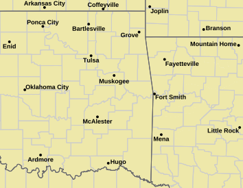
Tulsa County Warning Area Map
    Blizzard Watch | Blizzard Warning | Winter Storm Watch | Winter Storm Warning | Ice Storm Warning | Red Flag Warning | Winter Weather Advisory | Wind Chill Advisory | Wind Chill Warning | Freezing Rain Advisory | Tornado Warning | Tornado Watch | Severe T-Storm Warning | Severe T-Storm Watch
    Other Color Meanings: Web-Based Watch/Warning/Advisory Map Colors - NOAA's National Weather Service
    Oklahoma Mesonet Current Conditions
    Red - Air Temp, Green - Dewpoint, Barbs - Wind Speed/Direction, Gray - Gusts, Blue - Precip since Midnight
    Radar & Satellite for Oklahoma


    Snowfall Forecast Models
    GEM Snowfall 12Z/0Z NAM Snowfall WRF Snowfall 12Z / 0Z GFS Snowfall

    Freezing Rain Forecast Models

    GEM Freezing Rain 12Z/0Z NAM Freezing Rain 12Z / 0Z GFS Freezing Rain

    Additional information is always available via:
    http://www.weatherspotlight.com/ Including the side-by-side model comparisons per run time.


  2. Default Re: General Weather Discussion - February 2014

    ECMWF Overview...

    Sunday: No major changes in the Euro forecast. Main area of accumulating precip appears to be south of I-40. Looks like a dusting/less than an inch north of I-40, about 1-2" south to a Lawton-Ada line, then maybe 2-4" just south of there in spots.

    Tuesday: Looks like NW OK and NC OK will get the heaviest snow. As Anon has said, Central may get dry slotted some or at least amounts kept well in check. Probably still looking at 1-3" for the Metro, lighter south. Area of 4-6" up between Woodward to Enid.

    Thursday: Light snow over much of SW, C, and NE OK. About an inch.

    Friday: Light/Mdt Snow. Another 1-3" for the metro.

  3. #3

    Default Re: General Weather Discussion - February 2014

    That looks doable. The car washes will rake in the dough the week after next

  4. Default Re: General Weather Discussion - February 2014

    Winter Storm Watch for Southern OK tonight through tomorrow.

    URGENT - WINTER WEATHER MESSAGE
    NATIONAL WEATHER SERVICE NORMAN OK
    418 AM CST SAT FEB 1 2014


    OKZ032-036>048-050>052-TXZ083>090-011815-
    /O.NEW.KOUN.WS.A.0001.140202T0000Z-140203T0000Z/
    HUGHES-JACKSON-TILLMAN-COMANCHE-STEPHENS-GARVIN-MURRAY-PONTOTOC-
    COAL-COTTON-JEFFERSON-CARTER-JOHNSTON-ATOKA-LOVE-MARSHALL-BRYAN-
    HARDEMAN-FOARD-WILBARGER-WICHITA-KNOX-BAYLOR-ARCHER-CLAY-
    INCLUDING THE CITIES OF...HOLDENVILLE...ALTUS...FREDERICK...
    LAWTON...DUNCAN...PAULS VALLEY...SULPHUR...ADA...COALGATE...
    WALTERS...WAURIKA...ARDMORE...TISHOMINGO...ATOKA.. .MARIETTA...
    MADILL...DURANT...QUANAH...CHILLICOTHE...CROWELL.. .VERNON...
    WICHITA FALLS...MUNDAY...KNOX CITY...SEYMOUR...ARCHER CITY...
    HOLLIDAY...LAKESIDE CITY...HENRIETTA
    418 AM CST SAT FEB 1 2014


    ...WINTER STORM WATCH IN EFFECT FROM THIS EVENING THROUGH SUNDAY
    AFTERNOON...


    THE NATIONAL WEATHER SERVICE IN NORMAN HAS ISSUED A WINTER STORM
    WATCH...WHICH IS IN EFFECT FROM THIS EVENING THROUGH SUNDAY
    AFTERNOON FOR PARTS OF SOUTHERN OKLAHOMA AND WESTERN NORTH TEXAS.


    * TIMING: TONIGHT INTO SUNDAY...WITH THE HEAVIEST PRECIPITATION
    BETWEEN 3 AM AND 3 PM.


    * MAIN IMPACT: A MIX OF SNOW...SLEET...FREEZING RAIN...AND RAIN
    WILL DEVELOP TONIGHT...THEN SWITCH OVER TO SNOW WEST TO EAST.
    PRECIPITATION WILL END WEST TO EAST ON SUNDAY. TOTAL SNOW AND
    SLEET ACCUMULATIONS OF 2 TO 5 INCHES WITH LOCALLY HEAVIER
    AMOUNTS ARE LIKELY. TOTAL ICE ACCUMULATIONS UP TO 0.25 INCH ARE
    ALSO LIKELY MAINLY SOUTHEAST OF A WICHITA FALLS TO ADA LINE.


    * OTHER IMPACTS: SNOW...SLEET...AND ICE ACCUMULATIONS WILL MAKE
    TRAVEL SLICK AND HAZARDOUS TONIGHT INTO SUNDAY. MOTORISTS
    SHOULD USE EXTRA CAUTION.

  5. #5

    Default Re: General Weather Discussion - February 2014

    Latest GFS runs bringing Sunday's system further north. Or at least developing a decent snow band somewhere over SW to C OK. Including the OKC area.

    Latest NAM also has north trend.


    I will say that Tuesday is looking interesting on GFS. Trying to close off the low more and possibly let more snow in the picture for main body of OK instead of massive dry slot. Will watch the trends.

  6. Default Re: General Weather Discussion - February 2014

    Winter Storm Warnings are up now for the southern counties...

    URGENT - WINTER WEATHER MESSAGE
    NATIONAL WEATHER SERVICE NORMAN OK
    126 PM CST SAT FEB 1 2014


    OKZ032-036>048-050>052-TXZ083>090-020330-
    /O.UPG.KOUN.WS.A.0001.140202T0000Z-140203T0000Z/
    /O.NEW.KOUN.WS.W.0001.140202T0300Z-140203T0000Z/
    HUGHES-JACKSON-TILLMAN-COMANCHE-STEPHENS-GARVIN-MURRAY-PONTOTOC-
    COAL-COTTON-JEFFERSON-CARTER-JOHNSTON-ATOKA-LOVE-MARSHALL-BRYAN-
    HARDEMAN-FOARD-WILBARGER-WICHITA-KNOX-BAYLOR-ARCHER-CLAY-
    INCLUDING THE CITIES OF...HOLDENVILLE...ALTUS...FREDERICK...
    LAWTON...DUNCAN...PAULS VALLEY...SULPHUR...ADA...COALGATE...
    WALTERS...WAURIKA...ARDMORE...TISHOMINGO...ATOKA.. .MARIETTA...
    MADILL...DURANT...QUANAH...CHILLICOTHE...CROWELL.. .VERNON...
    WICHITA FALLS...MUNDAY...KNOX CITY...SEYMOUR...ARCHER CITY...
    HOLLIDAY...LAKESIDE CITY...HENRIETTA
    126 PM CST SAT FEB 1 2014


    ...WINTER STORM WARNING IN EFFECT FROM 9 PM THIS EVENING TO 6 PM
    CST SUNDAY...


    THE WINTER STORM WATCH IS NO LONGER IN EFFECT.


    * TIMING: TONIGHT AND SUNDAY...WITH THE HEAVIEST PRECIPITATION
    BETWEEN 3 AM AND 3 PM.


    * MAIN IMPACT: A MIX OF SNOW...SLEET...FREEZING RAIN...AND RAIN
    WILL DEVELOP TONIGHT...THEN SWITCH OVER TO SNOW WEST TO EAST.
    PRECIPITATION WILL END WEST TO EAST ON SUNDAY. TOTAL SNOW AND
    SLEET ACCUMULATIONS OF 2 TO 5 INCHES WITH LOCALLY HEAVIER
    AMOUNTS ARE LIKELY. TOTAL ICE ACCUMULATIONS UP TO 0.25 INCH ARE
    ALSO LIKELY MAINLY SOUTHEAST OF A WICHITA FALLS TO ADA LINE. ICE
    ACCUMULATIONS AROUND DURANT AND ATOKA MAY EXCEED 0.25 INCH
    SUNDAY AND NECESSITATE A FURTHER WARNING.


    * OTHER IMPACTS: SNOW...SLEET...AND ICE ACCUMULATIONS WILL MAKE
    TRAVEL SLICK AND HAZARDOUS TONIGHT INTO SUNDAY. MOTORISTS
    SHOULD USE EXTRA CAUTION.


    PRECAUTIONARY/PREPAREDNESS ACTIONS...


    KEEP UP WITH THE LATEST WEATHER INFORMATION...ESPECIALLY IF YOU
    PLAN TO TRAVEL.

  7. Default Re: General Weather Discussion - February 2014

    18Z NAM and HRRR now both pushing heavy snowfall rates into Central OK tomorrow. Would not be surprised to see OUN put out some advisory text shortly for those counties.


  8. Default Re: General Weather Discussion - February 2014

    So the 12PM-3PM segment is the one that has me a little concern now...

    All snow, or should be...with a basic 10:1 ratio...


  9. Default Re: General Weather Discussion - February 2014

    The image is also a pretty good indication of how narrow the snow band will probably be tomorrow. Also how much the effects on the Metro will vary widely from end to end. From that image along, that is an inch or two from Yukon to Edmond and nearly 8 inches in Norman.

  10. #10

    Default Re: General Weather Discussion - February 2014

    Quote Originally Posted by s00nr1 View Post
    18Z NAM and HRRR now both pushing heavy snowfall rates into Central OK tomorrow. Would not be surprised to see OUN put out some advisory text shortly for those counties.
    what is the color legend saying ? 1/10 of an inch? confused

  11. Default Re: General Weather Discussion - February 2014

    Quote Originally Posted by blangtang View Post
    what is the color legend saying ? 1/10 of an inch? confused
    My bad. The legend is liquid precip...so take the number and multiple it by 10 to get a basic snowfall amount.

  12. #12

    Default Re: General Weather Discussion - February 2014

    Let's hope the 6-8 stays just south of Norman. Cool with 2-4 as long as it's the white stuff

  13. Default Re: General Weather Discussion - February 2014

    Well there's certainly a decent jet stream up there. Just went from DFW to Atlanta in 1 hour.

  14. #14

    Default Re: General Weather Discussion - February 2014

    Classic. Models say one thing for 4 days straight, 16 hours away from event and they all change.

  15. Default Re: General Weather Discussion - February 2014

    18Z GFS not completely in line with NAM. 1-2" for Metro area by 6AM, 6AM to 9AM another 1-3" South Metro, <1" North Metro, then lighter snow with maybe another 1" for the south Metro through 3PM.

    So recap of the various model runs for the Metro max snowfall predictions as of right now, with the understand higher is going to be Norman area and south.
    06Z GFS: 1-4" (highest on this run was actually W Metro)
    12Z GFS: 2-3"
    18Z GFS: 3-6"
    12Z NAM: 1-2"
    18Z NAM: 5-8", up to 10" further SW.
    12Z GEM: 2-4"
    12Z WRF: ~1"
    00Z ECMWF: 1-2"
    12Z ECMWF: 2-4"

    The afternoon runs are in bold.

  16. Default Re: General Weather Discussion - February 2014

    Oh...and Braums is running out of milk on the east side here in Norman. So the run is on.

  17. Default Re: General Weather Discussion - February 2014

    Winter Wx Advisory up for counties north of the Warning area...

    URGENT - WINTER WEATHER MESSAGE
    NATIONAL WEATHER SERVICE NORMAN OK
    507 PM CST SAT FEB 1 2014


    OKZ021>031-033>035-020715-
    /O.NEW.KOUN.WW.Y.0004.140202T0300Z-140203T0000Z/
    BECKHAM-WA****A-CADDO-CANADIAN-OKLAHOMA-LINCOLN-GRADY-MCCLAIN-
    CLEVELAND-POTTAWATOMIE-SEMINOLE-HARMON-GREER-KIOWA-
    INCLUDING THE CITIES OF...ELK CITY...SAYRE...CORDELL...ANADARKO...
    YUKON...EL RENO...MUSTANG...OKLAHOMA CITY...CHANDLER...
    CHICKASHA...PURCELL...NORMAN...MOORE...SHAWNEE...S EMINOLE...
    HOLLIS...MANGUM...HOBART
    507 PM CST SAT FEB 1 2014


    ...WINTER WEATHER ADVISORY IN EFFECT FROM 9 PM THIS EVENING TO
    6 PM CST SUNDAY...


    THE NATIONAL WEATHER SERVICE IN NORMAN HAS ISSUED A WINTER
    WEATHER ADVISORY FOR SNOW AND SLEET...WHICH IS IN EFFECT FROM
    9 PM THIS EVENING TO 6 PM CST SUNDAY.


    * TIMING: SNOW AND SLEET ARE EXPECTED TO START OVER FAR WEST
    CENTRAL OKLAHOMA TOWARD MIDNIGHT...THEN SPREAD INTO CENTRAL
    OKLAHOMA AROUND SUNRISE SUNDAY. THE HEAVIEST PRECIPITATION IS
    EXPECTED TO FALL BETWEEN 3 AM AND 3 PM.


    * MAIN IMPACT: SNOW AND SLEET ACCUMULATIONS OF 1 TO 3 INCHES WILL
    BE POSSIBLE ACROSS WEST-CENTRAL INTO CENTRAL OKLAHOMA...MAINLY
    NEAR AND SOUTH OF INTERSTATE-40.


    PRECAUTIONARY/PREPAREDNESS ACTIONS...


    BE CAREFUL IF YOU HAVE TO TRAVEL. EVEN SMALL AMOUNTS OF SNOW AND
    SLEET CAN MAKE ROADS AND SIDEWALKS SLICK AND DANGEROUS.

  18. #18

    Default Re: General Weather Discussion - February 2014

    WWA now up for the metro for 1-3".

    Latest HRRR is pretty intense, with a very narrow band exceeding 12" in SW OK already by 5AM. Hm.

  19. #19

    Default Re: General Weather Discussion - February 2014

    Working this evening, what time should we expect any falling precipitation to begin?

  20. #20
    Join Date
    Jun 2008
    Posts
    2,690

    Default Re: General Weather Discussion - February 2014

    Quote Originally Posted by venture View Post
    Oh...and Braums is running out of milk on the east side here in Norman. So the run is on.
    Got the bread covered but need milk. Now.

  21. Default Re: General Weather Discussion - February 2014

    Quote Originally Posted by Hollywood View Post
    Working this evening, what time should we expect any falling precipitation to begin?
    For the metro...probably closer to 1-3AM.

  22. #22

    Default Re: General Weather Discussion - February 2014

    Quote Originally Posted by venture View Post
    For the metro...probably closer to 1-3AM.
    Just as I get off duty. Works for me.

  23. #23

    Default Re: General Weather Discussion - February 2014

    Okay the bottomline about what is going to happen tonight.

    Someone is going to get hit with 1-2"+ per hour snowfall rates underneath a band that we call a deformation band or zone. This occurs when a storm system rides up along a boundary and on the cold side (the northwest side) of the comma head is going to usually have an intense, narrow shield of precipitation. In this case, it will be especially narrow due to the size of the system and the nature of it shoving off to the ENE and getting ripped through the jet stream once it passes across N TX.

    So before the low actually drifts into the jetstream aloft and gets ripped to shreds and flies NE across the country, it will have time to anchor down and pull in moist air from the deep south and then this air will rise over this cold air in place here resulting in the above mentioned deformation zone.

    This is difficult to forecast because the area of intense snow gradient will be relatively narrow. Radar trends late tonight will foreshadow everything.

    The latest NAM runs are making me think this band may try to set up along 44 and just south. However, the northern trend is cooking right now.

  24. Default Re: General Weather Discussion - February 2014

    Bread and Milk!


  25. Default Re: General Weather Discussion - February 2014


    Of course.... I leave OKC to attend a weather conference (AMS) in Atlanta and am going to miss this.

Thread Information

Users Browsing this Thread

There are currently 1 users browsing this thread. (0 members and 1 guests)

Similar Threads

  1. 2014 Tropical Weather Discussion
    By venture in forum Weather & Geosciences
    Replies: 46
    Last Post: 11-03-2014, 10:42 PM
  2. General Weather Discussion - January 2014
    By venture in forum Weather & Geosciences
    Replies: 203
    Last Post: 02-02-2014, 08:54 AM
  3. Oklahoma Weather Discussion - February/March 2013
    By venture in forum Weather & Geosciences
    Replies: 1248
    Last Post: 04-02-2013, 01:29 PM
  4. Oklahoma Weather Discussion - January/February 2012
    By venture in forum Weather & Geosciences
    Replies: 262
    Last Post: 02-29-2012, 07:04 AM
  5. Fishing General Discussion
    By jstanthrnme in forum Current Events & Open Topic
    Replies: 2
    Last Post: 10-24-2011, 12:37 AM

Bookmarks

Posting Permissions

  • You may not post new threads
  • You may not post replies
  • You may not post attachments
  • You may not edit your posts
  •  
Single Sign On provided by vBSSO