

This has happened a couple times before...can do without anymore of these. Chasers on the Spotter Network...


 David
David

This has happened a couple times before...can do without anymore of these. Chasers on the Spotter Network...
Participating Member
wow
Participating Member

To add to what venture said; it is fairly common in mathematics, physics, and especially computer science for the first item in a series to be indexed by zeroOriginally Posted by warreng88

Participating Member
That seriously just made me shed tears. Man I can't believe this has happened... Still in shock. Tim was such a great guy - I cannot emphasize that enough.

Participating Member
Storm Chase Media
5 hours ago
With an extremely heavy heart, I would like everyone know that some of the best chasers and researchers in the field, Tim Samaras, his son Paul Samaras, and Carl Young have passed away due to Friday night's tornadic event west of the Oklahoma City metro area.
I ask that you please keep the Samaras and Young families in your prayers as they go through this very difficult time...thanks.
David
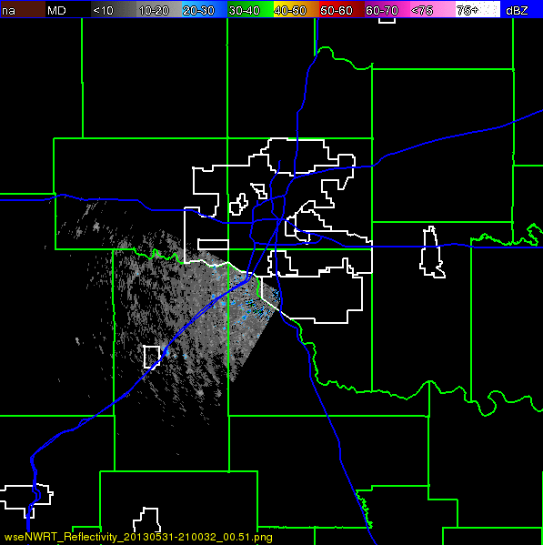
Southern part filled in...

I don't care much about requiring storm chasers to be licensed. But if it must be done might as well go all out to protect them by requiring them to use well armored vehicles that can anchor down in EF5 tornadoes, assuming that would be possible to do.
David
Better look from the Spotter Network page...

The poster formerly known as cleanskull
The way those pics spell out letters is interesting. One of the vehicles I saw yesterday was one of those big double long pickup trucks and I swear it looked like the whole thing had been rhino coated.
Participating Member
OK not entirely weather related but somewhat... cleaning up after my carport got flooded out during the storms and tossed a bunch of stuff away and put my trash bin on the curb... somebody came by and took all the useless crap I just loaded in it. Wasn't out there 30 minutes.
Participating Member
Somehow, the video on the link I keep trying to post has some weird script or something, as the video keeps changing.
Hey, Venture, any thoughts about the upcoming week? Hating to hear some severe talk already, but wondered about your thoughts
David
Slight Risk today roughly western 2 rows of counties...
...CNTRL THROUGH SRN HIGH PLAINS AREAS...
LOW-MID 50S DEWPOINTS WILL ADVECT THROUGH THE SRN AND CNTRL HIGH
PLAINS BENEATH STEEP MID-LEVEL LAPSE RATES ALONG SLY LLJ EAST OF LEE
TROUGH. THIS PROCESS IN CONJUNCTION WITH DIABATIC WARMING WILL
RESULT IN AN AXIS OF 1500-2000 J/KG MLCAPE FROM WRN TX NWD THROUGH
CNTRL NEB...WITH THE GREATER INSTABILITY LIKELY OVER WRN TX. STRONG
DIABATIC WARMING WILL CONTRIBUTE TO DEEPLY MIXED BOUNDARY LAYERS
ALONG AND WEST OF THE TROUGH AXIS. STORMS WILL LIKELY DEVELOP BY
LATE AFTERNOON WITHIN ZONE OF CONVERGENCE AND WEAKENING CONVECTIVE
INHIBITION ALONG THIS BOUNDARY. BELT OF STRONGER WLYS WILL RESIDE
NORTH OF THE WARM SECTOR. HOWEVER...SELY WINDS VEERING TO WLY 30-35
KT AT 500 MB WILL RESULT IN 40+ KT EFFECTIVE SHEAR FROM NRN PART OF
WRN TX NWD THROUGH THE CNTRL PLAINS. HIGHER BASED SUPERCELLS WILL BE
THE INITIAL STORM MODE...BUT SOME OF THE ACTIVITY MAY EVENTUALLY
CONGEAL INTO LINE SEGMENTS AND CLUSTERS AND PERSIST INTO THE PLAINS
DURING THE EVENING SUPPORTED BY A STRENGTHENING LLJ. LARGE HAIL AND
DAMAGING WIND WILL BE THE MAIN THREATS THROUGH MID EVENING.
Slight Risk Tomorrow - Tuesday roughly along and North of I-44
...THERE IS A SLGT RISK OF SVR TSTMS ACROSS THE SOUTH-CENTRAL PLAINS
TO LOWER MO VALLEY/OZARKS...
...SOUTH-CENTRAL HIGH PLAINS TO LOWER MO VALLEY/OZARKS...
A PROGRESSIVE/LOW AMPLITUDE SHORTWAVE TROUGH IS EXPECTED TO CONTINUE
EAST-SOUTHEASTWARD FROM THE NORTHERN PLAINS TO THE UPPER
MIDWEST/UPPER MS RIVER VALLEY THROUGH TUESDAY NIGHT...WITH
PROGRESSIVELY WEAKER MID-LEVEL WESTERLIES /SUB-30 KT/ SOUTH OF THE
LOWER MO VALLEY AND KS-OK BORDER VICINITY. A SURFACE COLD FRONT WILL
SETTLE SOUTHEASTWARD ACROSS THE PLAINS/MO VALLEY...ALTHOUGH IT IS
LIKELY TO BE EFFECTIVELY AUGMENTED BY EARLY DAY CONVECTION/OUTFLOW
ACROSS THE MO VALLEY. MEANWHILE...SURFACE LOW DEVELOPMENT IS
EXPECTED ACROSS THE TX PANHANDLE/FAR NORTHWEST TX WITH A NEARBY
SURFACE TRIPLE POINT...WHILE LOW-LEVEL UPSLOPE TRAJECTORIES
OTHERWISE GRADUALLY INCREASE ACROSS THE CO/NORTHEAST NM FRONT RANGE
AND ADJACENT SOUTH-CENTRAL HIGH PLAINS.
MULTIPLE SCENARIOS FOR SEVERE TSTM DEVELOPMENT ARE POSSIBLE
ESPECIALLY TUESDAY AFTERNOON/EVENING. WITH A RELATIVELY STEEP
ELEVATED MIXED LAYER AND LOW-LEVEL MOISTURE HAVING RETURNED INTO THE
REGION /SOLID 60S F SURFACE DEWPOINTS/...THE AIRMASS SHOULD BECOME
MODERATELY UNSTABLE BY AFTERNOON...ESPECIALLY ACROSS SOUTHERN KS AND
WESTERN/NORTHERN OK AND ADJACENT TX PANHANDLE. ON THE SOUTHWEST
FRINGE OF EARLY DAY CLOUD COVER/PRECIPITATION...SEVERE TSTM
DEVELOPMENT MAY OCCUR ALONG THE WSW-ENE ORIENTED FRONTAL ZONE ACROSS
SOUTHERN/EASTERN KS. DEEP CONVECTIVE DEVELOPMENT...AT LEAST ON AN
ISOLATED BASIS...WILL BE POSSIBLE BY LATE AFTERNOON NEAR THE SURFACE
TRIPLE POINT ACROSS WEST/NORTHWEST OK OR NEARBY TX PANHANDLE. OTHER
STORMS ARE LIKELY TO INCREASE ACROSS THE CO/NORTHEAST NM FRONT RANGE
AND SPREAD EAST-SOUTHEASTWARD ACROSS THE HIGH PLAINS INTO TUESDAY
AFTERNOON.
GIVEN THE EXPECTED MOISTURE/INSTABILITY ACROSS THE REGION...VERTICAL
SHEAR WILL BE MORE THAN SUFFICIENT /40+ KT/ FOR SUPERCELLS/SUSTAINED
MULTICELLS CAPABLE OF LARGE HAIL...WIND DAMAGE...AND PERHAPS A
TORNADO OR TWO. WITH AID OF A NOCTURNALLY STRENGTHENING LOW LEVEL
JET...STORMS MAY PERSIST/CONSOLIDATE AS THEY DEVELOP GENERALLY
EASTWARD IN VICINITY THE FRONTAL ZONE TUESDAY NIGHT.
David
First off wanted to point out we are still missing people from the May 31st storms. As of right now the confirmed human fatality toll is at 16. Definitely highlights the significant dangers of being on the road during the storms and also the severe flooding threat that many didn't take seriously it would appear.
Extended forecast outlook: OK Extended Storm Outlook | Weather Spotlight
With May finally at a close we enter what is traditionally the third and final month of the peak severe season for Oklahoma. We do need to remember though that Mays season this year came at an extremely high cost. The human toll so far for the storms this past month stands at 42 with more still missing from the May 31st storm. We had three notable tornado days on May 19th, 20th, and 31st with the last day also have one of the more significant flooding events in Oklahoma County in many years. With that, we need to look ahead and be prepared for what is yet to come.
Monday June 3rd
The SPC has a slight risk out for the far Western counties in the main body of Oklahoma. The risk area extends back in the Texas Panhandle and Western KS. Storms should fire later this afternoon ahead of the dryline out in that area. There might be a few early afternoon storms in NW OK, but those shouldnt be severe. Instability will be moderate to high out there today but the main threats will be large hail and wind. Storms in NW OK should form into a weak complex tha twill move SE through the overnight into Tuesday.
Tuesday June 4th
Tuesday we are looking at instability being much further east into the rest of Oklahoma and Kansas. Highest instability will be over the Northern half of OK, roughly from Highway 9 and North with CAPE values from 2500 to over 3000 j/kg. The SPC has the area along and North of I-44 in a slight risk right now, but this might come south just a hair. Tornado risk looks low over OK, higher up in KS, so main threats appear to be hail and wind. We are going to see scattered storms fire over much of Western and Northern OK in he afternoon. By late evening and through the overnight well have a complex form up in NW OK and dive SE over Central OK.
Wednesday June 5th
Much the same as Tuesday, but instability will be down some due to ongoing precip and cloud cover. Highest instability will be over SE OK. CAPE will be around 1500 to 3000 j/kg in areas that get sun. 3km EHI values by evening will be from 4 to 6 over much of the I-40 corridor and SW OK. Storms will start over NW OK and then eventually extend down along I-44. Main threats some hail and wind, but overall not a huge risk.
Thursday June 6th & Friday June 7th
Maybe some earlier leftovers on Thursday, but both days will be quiet.
Saturday June 8th through Sunday June 9th
Severe risk looks pretty certain on Saturday, but this will be a more traditional Northwest flow/June setup. Instability will be high over much of the state with CAPE around 3000 j/kg. 3km EHI values will get very high from NW OK into Central OK by later afternoon ranging from 6 to 12. There could be some ongoing showers/storms over Western OK early Saturday, but main show will be towards evening. Severe storms will form in SW KS and NW OK. These will intensify and bring some very heavy rain and likely some damaging winds. There will be a tornado risk with storms that form before the MCS comes together and with any storms ahead of the main complex. The complex and rain may be slow to move and currently forecast to still be in SE OK by late Sunday.
Monday June 10th through Tuesday June 18th
Evening forecast models dry it out and heat this ups with temps in the 80s Central & East, and 90s to low 100s West. Instability does build back in starting Thursday the 13th, but so far precip seems to be on the low side. Well need to keep an eye on things because models are still pretty volatile this far out and just 12 hours ago it had storms chances much higher during this period.
Participating Member
US National Weather Service Norman Oklahoma · 51,849 like this
2 hours ago · ..
NOAA Statement on deaths of storm researchers Tim Samaras, Paul Samaras and Carl Young
We are terribly saddened by this news. Samaras was a respected tornado researcher and friend of NOAA who brought to the field a unique portfolio of expertise in engineering, science, writing and videography. His work was documented through an extensive list of formal publications and conference papers.
We extend our sympathies to the family of Tim and Paul, and to the family of Carl Young. We also extend our sympathies to all victims of the May 31st tornado and the other horrific tornadoes that have recently devastated central Oklahoma.
As far as we know, these are the first documented scientific storm intercept fatalities in a tornado.
Scientific storm intercept programs, though they occur with some known measure of risk, provide valuable research information that is difficult to acquire in other ways. Scientific storm chasing is performed as safely as possible, utilizing highly trained personnel and extensive technology including mobile Doppler radar.
We know storm chasing is also done by local government and media personnel who provide valuable warning information, and by amateur storm chasers who wish to see and photograph storms. We encourage all who chase to do so as safely and as responsibly as possible in order to avoid danger for themselves and all those threatened by tornadoes.
David
MESOSCALE DISCUSSION 0946
NWS STORM PREDICTION CENTER NORMAN OK
0206 PM CDT MON JUN 03 2013
AREAS AFFECTED...THE OK PANHANDLE...NRN-ERN TX PANHANDLE...SW
KS...WRN OK
CONCERNING...SEVERE POTENTIAL...WATCH LIKELY
VALID 031906Z - 032030Z
PROBABILITY OF WATCH ISSUANCE...80 PERCENT
SUMMARY...A SEVERE THREAT IS EXPECTED TO DEVELOP ACROSS THE OK
PANHANDLE...THE NRN-ERN TX PANHANDLE...SW KS AND WRN OK OVER THE
NEXT FEW HOURS. WIND DAMAGE AND LARGE HAIL WILL BE THE PRIMARY
THREATS. WW ISSUANCE WILL LIKELY BE NECESSARY ACROSS THE MCD AREA
OVER THE NEXT HOUR OR SO.
DISCUSSION...LATEST SFC ANALYSIS SHOWS A LOW IN SERN CO WHERE TEMPS
ARE IN THE UPPER 90S F. HIGH-BASED THUNDERSTORMS ARE INITIATING
ALONG THE THERMAL AXIS WHERE SFC-TEMP DEWPOINT SPREADS EXCEED 40
DEGREES F. AS THE CONVECTION MOVES EWD...THE DEVELOPING STORMS WILL
ENCOUNTER SFC DEWPOINTS IN THE LOWER TO MID 50S F WHICH WILL ENABLE
THE STORMS TO INTENSIFY WITH TIME THIS AFTERNOON. IN
ADDITION...OBJECTIVE ANALYSIS SUGGESTS THAT LOW TO MID-LEVEL FLOW
STRENGTHENS WITH EWD EXTENT. 0-6 KM SHEAR VALUES ARE ESTIMATED IN
THE 30 TO 35 KT RANGE ACROSS THE ERN TX AND OK PANHANDLES. THIS
ALONG WITH STEEPENING LAPSE RATES SHOULD ENABLE THE STORMS TO HAVE A
WIND DAMAGE THREAT AS DOWNDRAFTS ARE ENHANCED BY THE LARGE
TEMP-DEWPOINT SPREADS. LARGE HAIL WILL ALSO BE INCREASINGLY LIKELY
AS INSTABILITY INCREASES AND A POTENTIAL FOR SUPERCELLS DEVELOPS
LATE THIS AFTERNOON.
..BROYLES/WEISS.. 06/03/2013
David
Side note today...image from the Phased-Array Radar in Norman of the 31st's storms.
David
HRRR for this afternoon: Loop
Appears most of the severe stuff will stay west of Central OK, but some rain could be moving in by 9-10PM this evening.
David
Slight risk move slightly east a bit for today. It is now roughly running North-South right between US 281 and US 81.
...THERE IS A SLGT RISK OF SVR TSTMS OVER A PORTION OF THE GREAT
PLAINS...
THE ONLY CHANGE THIS FORECAST UPDATE IS TO INCREASE SEVERE WIND GUST
PROBABILITIES OVER PARTS OVER SWRN KS...THE ERN TX PANHANDLE...AND
WRN OK.
...SWRN KS INTO ERN TX PANHANDLE/WRN OK...
SEVERAL CONVECTION-ALLOWING MODEL ENSEMBLES AND LATEST NAM/GFS SHOW
A CLUSTER OF STORMS DEVELOPING THIS AFTERNOON OVER SWRN KS/OK
PANHANDLE AND MOVING SEWD AS AN ORGANIZED MCS INTO THE ERN TX
PANHANDLE/WRN OK AS A SLY LLJ STRENGTHENS THIS EVENING. EARLY
AFTERNOON OBSERVATIONS SEEM TO SUPPORT THIS SCENARIO AS A RESERVOIR
OF 50S DEWPOINTS EXISTS ACROSS WRN OK-ERN TX PANHANDLE INTO SWRN KS
AHEAD AND TO THE E/SE OF A CLUSTER OF HIGH-BASED STORMS DEVELOPING
OVER SWRN KS. A STEEP LAPSE RATE ENVIRONMENT --OWING IN PART TO
STRONG SURFACE HEATING-- COMBINED WITH A STRONGLY VEERING WIND
PROFILE...WILL FAVOR STORM ORGANIZATION AS STORMS MATURE AND
CONTINUE TO MOVE EWD INTO A MORE MOIST AIRMASS /PW 1.25 INCH/.
SWATHS OF SEVERE WIND GUSTS WILL SEEMINGLY BE THE PRIMARY HAZARD
WITH THIS ACTIVITY BEFORE WEAKENING BY MID-LATE EVENING.
..SMITH.. 06/03/2013
Participating Member
Watch is out for W OK.
David
Initial Details...
URGENT - IMMEDIATE BROADCAST REQUESTED
SEVERE THUNDERSTORM WATCH NUMBER 273
NWS STORM PREDICTION CENTER NORMAN OK
330 PM CDT MON JUN 3 2013
THE NWS STORM PREDICTION CENTER HAS ISSUED A
* SEVERE THUNDERSTORM WATCH FOR PORTIONS OF
SOUTHWEST KANSAS
WESTERN OKLAHOMA INCLUDING THE CENTRAL AND EASTERN PANHANDLE
CENTRAL AND EASTERN TEXAS PANHANDLE
* EFFECTIVE THIS MONDAY AFTERNOON AND EVENING FROM 330 PM UNTIL
1100 PM CDT.
* PRIMARY THREATS INCLUDE...
SEVERAL DAMAGING WIND GUSTS TO 70 MPH LIKELY
SEVERAL LARGE HAIL EVENTS TO 1.5 INCHES IN DIAMETER POSSIBLE
THE SEVERE THUNDERSTORM WATCH AREA IS APPROXIMATELY ALONG AND 85
STATUTE MILES EAST AND WEST OF A LINE FROM 15 MILES NORTHWEST OF
DODGE CITY KANSAS TO 25 MILES WEST OF ALTUS OKLAHOMA. FOR A
COMPLETE DEPICTION OF THE WATCH SEE THE ASSOCIATED WATCH OUTLINE
UPDATE (WOUS64 KWNS WOU3).
PRECAUTIONARY/PREPAREDNESS ACTIONS...
REMEMBER...A SEVERE THUNDERSTORM WATCH MEANS CONDITIONS ARE
FAVORABLE FOR SEVERE THUNDERSTORMS IN AND CLOSE TO THE WATCH
AREA. PERSONS IN THESE AREAS SHOULD BE ON THE LOOKOUT FOR
THREATENING WEATHER CONDITIONS AND LISTEN FOR LATER STATEMENTS
AND POSSIBLE WARNINGS. SEVERE THUNDERSTORMS CAN AND OCCASIONALLY
DO PRODUCE TORNADOES.
&&
DISCUSSION...HIGH-BASED STORMS HAVE DEVELOPED FROM SERN CO INTO SWRN
KS AHEAD OF A WEAK VORTICITY MAX WITHIN A DEEPLY MIXED AIR MASS
CHARACTERIZED BY STEEP LAPSE RATES. THERMODYNAMIC PROFILES ARE
FAVORABLE FOR STRONG DOWNDRAFTS AND HAIL WITH INITIAL STORMS. NWP
MODEL GUIDANCE INCLUDING CONVECTION-ALLOWING ENSEMBLES SHOW STRONG
AGREEMENT THROUGH THE EVENING HOURS THAT STORMS WILL GRADUALLY
GENERATE A MESOSCALE COLD POOL AND GROW UPSCALE INTO SEWD MOVING
MCS...WITH POTENTIAL FOR MORE ORGANIZED DAMAGING WIND GUSTS ALONG
THE LEADING EDGE OF THE COMPOSITE OUTFLOW BOUNDARY.
AVIATION...A FEW SEVERE THUNDERSTORMS WITH HAIL SURFACE AND ALOFT
TO 1.5 INCHES. EXTREME TURBULENCE AND SURFACE WIND GUSTS TO 60
KNOTS. A FEW CUMULONIMBI WITH MAXIMUM TOPS TO 500. MEAN STORM
MOTION VECTOR 29025.
Tornadoes
Wind
Probability of 2 or more tornadoes
Probability of 1 or more strong (F2-F5) tornadoes
Hail
Probability of 10 or more severe wind events
Probability of 1 or more wind events > 65 knots
Combined Severe Hail/Wind
Probability of 10 or more severe hail events
Probability of 1 or more hailstones > 2 inches
Probability of 6 or more combined severe hail/wind events
Venture, this is out of left field, but is this the kind of complex that can grow large and evolve into one of those long-duration events like a derecho?
David
There is that potential, doesn't look like we'll anything that high end though. That's pretty much what we are dealing with today and tomorrow though.
Participating Member
Complex is still pretty healthy, but it is in the 80s out there. 70s the further in state you get. Storms will weaken, but at least Canton and NW OK are getting some water.
David
MESOSCALE DISCUSSION 0950
NWS STORM PREDICTION CENTER NORMAN OK
1008 PM CDT MON JUN 03 2013
AREAS AFFECTED...PORTIONS WRN OK...EXTREME SWRN KS...EXTREME SERN
CO...TX PANHANDLE...OK PANHANDLE.
CONCERNING...SEVERE THUNDERSTORM WATCH 273...
VALID 040308Z - 040415Z
THE SEVERE WEATHER THREAT FOR SEVERE THUNDERSTORM WATCH 273
CONTINUES.
SUMMARY...ANOTHER WW MAY BE REQUIRED WITHIN THE HOUR TO COVER
CONTINUING/PRIMARY SVR THREAT FROM MCS NOW TURNING SEWD ACROSS
PORTIONS NERN TX PANHANDLE AND NWRN OK. COMPLEX PRODUCED 66-KT GUST
AT GAG AT 227Z.
DISCUSSION...UNCERTAINTY REMAINS AS TO HOW LONG THIS ACTIVITY WILL
PERSIST...BUT ITS SUBSTANTIAL COLD POOL..AND CONTINUED POTENTIAL FOR
FORCED ASCENT OF INCREASINGLY MOIST INFLOW-LAYER AIR SUGGEST THREAT
WILL LAST BEYOND SCHEDULED 04Z WW EXPIRATION. 35-40 KT SLY
LLJ...EVIDENT IN VWP/PROFILER DATA OVER WRN OK INTO SWRN KS...WILL
AID WITH BOTH MOISTURE TRANSPORT INTO CONVECTIVE REGION AND
STORM-RELATIVE INFLOW. STG MERIDIONAL GRADIENT IN BOTH CAPE AND
CINH STILL IS EVIDENT OVER W-CENTRAL OK...ALONG AND E OF LLJ
AXIS...AND SHOULD PERSIST ENOUGH SUCH THAT MCS EFFECTIVELY SHOULD
TURN MORE SSEWD WITH TIME TOWARD HIGHER-THETAE AIR MASS OF SWRN OK
AND EXTREME ERN TX PANHANDLE. PRESENCE OF NWLY TO NNWLY MEAN-WIND
AND DEEP-SHEAR VECTORS OVER THIS REGION ALSO SUPPORT THAT SCENARIO.
FARTHER W...TSTMS MOVING OUT OF SERN CO MAY OFFER MRGL SVR-WIND
THREAT AS THEY MOVE THROUGH POCKET OF DEEP/WELL-MIXED BOUNDARY-LAYER
AIR WITH MRGLLY FAVORABLE BUOYANCY...UNTIL ENCOUNTERING MCS OUTFLOW
OVER OK PANHANDLE AND EXTREME SWRN KS IN ANOTHER 1-2 HOURS.
SEPARATE AREA OF CONVECTION OVER ERN NM HAS PRODUCED A FEW STG-SVR
GUSTS IN DEEPLY MIXED AIR W OF DRYLINE. STATIC STABILITY SHOULD
INCREASE WITH EWD EXTENT AND WITH TIME ACROSS ADJOINING SECTIONS OF
PANHANDLE AND S PLAINS W OF DRYLINE...DECREASING POTENTIAL FOR SVR
GUSTS GENERATED ALOFT TO REACH SFC. HOWEVER...SOME ADDITIONAL
DAMAGING WIND IS POSSIBLE BEFORE THAT ACTIVITY DISSIPATES.
..EDWARDS.. 06/04/2013
There are currently 1 users browsing this thread. (0 members and 1 guests)
 Posting Permissions

 Reply With Quote


Bookmarks