Widgets Magazine
Page 1 of 6 12345 ... LastLast
Results 1 to 25 of 142

Thread: Oklahoma Severe Weather Discussion - May 2012

  1. Weather Oklahoma Severe Weather Discussion - May 2012

    This thread is used to discussion upcoming/ongoing severe weather events through the month of May. April so far was a relatively active month with several tornadoes including the fatal EF3 in Woodward. May is our peak tornado season, so we'll need to see if May will follow the active pattern of April. This initial post will contain information, images, and links that can be used at any time. Images posted later through the thread may or may not be accurate on the day you are viewing them (check the post comments). Information contained in this thread should not be used as an alternative to weather radios, media, or other means of getting weather warnings/advisories.

    Every now and then you'll see a reference for "the chat room" in the discussion. This is a live chat that will be active mainly during severe weather events in Oklahoma. To reach the chat room follow the link to: http://www.weatherspotlight.com/
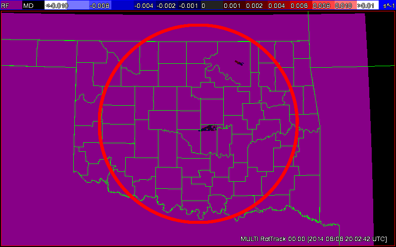
    Current Conditions
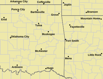
    Norman Warning Area Map Tulsa County Warning Area Map
    Tornado Warning | Tornado Watch | Severe Thunderstorm Warning | Severe Thunderstorm Watch
    Red Flag Warning | Fire Warning | Severe Weather Statement | Special Weather Statement
    Hazardous Weather Outlook | Fire Weather Watch
    Other Color Meanings: http://www.weather.gov/wwamap-prd/faq.php
    Oklahoma Mesonet Current Conditions
    Red - Air Temp, Green - Dewpoint, Barbs - Wind Speed/Direction, Gray - Gusts, Blue - Precip since Midnight
    Severe Weather Information


    SPC Convection (Severe Weather) Outlooks

    *Click any above graphic to view discussion.*

    Day 1 Outlook Tornado Outlook Wind Outlook Hail Outlook

    Day 2 Outlook Day 2 Probabilistic Outlook Day 3 Outlook Day 3 Probabilistic Outlook

    Days 4 through 8 Outlook


    Day 4 Day 5 Day 6 Day 7 Day 8

    SPC Severe Weather Reports


    SPC Fire Weather Outlooks

    *Click any above graphic to view discussion.*


    References


  2. Default Re: Oklahoma Severe Weather Discussion - May 2012

    State Radar Images
    WSR-88D Twin Lakes WSR-88D Frederick
    WSR-88D Vance AFB Experimental Test Beds or Specialized Radars
    Some experimental products may not always be live or up to date.
    Phased Array Radar (Next Generation Test Bed) CASA Radar Deployment - SW Oklahoma
    Multi-Radar Products
    Multi-Radar Hail Core Tracks (Past 120 min) Multi-Radar Maximum Expected Hail Size (MESH)
    Multi-Radar Products
    Multi-Radar Rotation Tracks (Past 120 min) Multi-Radar Azimuthal Shear Composite

  3. Default Re: Oklahoma Severe Weather Discussion - May 2012

    State Satellite Images

    Oklahoma Mesonet Visible Satellite Image
    Image will appear blank overnight.
    Oklahoma Mesonet IR Satellite Image
    Enhanced Colors - Blues are higher/colder cloud tops, Reds are warmer normally clear skies.

    Oklahoma Mesonet Water Vapor Satellite Image
    Enhanced Colors - Dark gray/black is dry air, bright white/colorized is higher moisture content/colder air.

  4. Default Re: Oklahoma Severe Weather Discussion - May 2012

    Sticking with this format for another month. Once Pete gives the go ahead on the Wiki, I'll transition a lot of the information over there.

  5. #5

    Default Re: Oklahoma Severe Weather Discussion - May 2012

    Venture, its looking like this week is going to get hot and humid. Think this may be a forerunner of a hot summer?

  6. Default Re: Oklahoma Severe Weather Discussion - May 2012

    Quote Originally Posted by SoonerDave View Post
    Venture, its looking like this week is going to get hot and humid. Think this may be a forerunner of a hot summer?
    12Z GFS (which i'm going off of for this outlook) doesn't really show the evil thermonuclear high pressure dome cap of doom yet, so don't worry.

    May 2nd - Very slight chance of a storm along the dryline in W OK. Extreme instability, any storm that would form would be severe.
    May 3rd - Appears Dry. Extreme instability over most of OK, mainly from NE to Central and SW. If any storm would pop it would be severe.
    May 4th - Slight chance of storms SW and South Central (SC) OK. Very High to Extreme Instability again over Central and East. Any storm that forms will be severe.
    May 5th - Chance of storm North Central into SW OK (better chance SW). Very high to Extreme instability over much of OK. Any storm will likely be severe.
    May 6th - Chance of storms Central & West. Very high to extreme instability, severe weather would be likely with storms that form.
    May 7th - On going AM storms, new storms East to the SW later. High instability south of I-44 by evening, any storm would be severe it appears.
    May 8th - Chance most of OK, better West. Moderate to high instability SE, low to moderate elsewhere south of I-44. Some may be severe.
    May 9th - Storms statewide, higher Central and East. Moderate instability over most of the state, some higher instability over far SW OK. Some severe.
    May 10th - Storms Central and East. Moderate/High instability SC and SE OK. Some severe.
    May 11th - Chance SC and SE. Very low instability.

    May 12th and On...Dry right now, but instability does start to increase again by the 16th and 17th. So don't write in Summer just yet.

    Overall it does appear that there is an outside chance for some severe weather the next 3 days, but nothing widespread at all. Getting into the weekend could raise the potential for more widespread severe weather scenarios. So we'll have to monitor that.

  7. Default Re: Oklahoma Severe Weather Discussion - May 2012

    HRRR last couple of runs showing storms popping in NW and SW OK. Cap is pretty tough today, so not sure that it'll happen. Though do have some CU developing over the SW.

  8. Default Re: Oklahoma Severe Weather Discussion - May 2012

    Sunday is looking like a day that needs to be watched. There will be chances for severe weather before then, but I want to focus on Sunday for right now.

    Click image for larger version. 

Name:	gfsSP_0_prec_96.gif 
Views:	1265 
Size:	31.5 KB 
ID:	1282 Click image for larger version. 

Name:	gfsSP_0_30mbdewp_96.gif 
Views:	1527 
Size:	74.3 KB 
ID:	1283 Click image for larger version. 

Name:	gfsSP_0_lift_96.gif 
Views:	1053 
Size:	46.6 KB 
ID:	1281 Click image for larger version. 

Name:	gfsSP_0_cape_96.gif 
Views:	1342 
Size:	39.0 KB 
ID:	1280 Click image for larger version. 

Name:	30462.GIF 
Views:	1343 
Size:	24.1 KB 
ID:	1284

    Obviously you can't put a ton of weight in these longer range forecasts, but this has been showing up for a couple of days now and we are getting closer. The images above are from the 00Z GFS run this evening. I'm saving them locally here so we can reference back to them.

    The first image is the precip forecast for 00Z Monday which translates to 7PM Sunday evening. The story with this shows a surface low moving through NW Texas. There is also precip showing up from the OKC Metro area back through SW OK. This is a 6 hour accumulation precip forecast, which would suggest precip starting between 1PM and 7PM. It should be noted that the next forecast period does show a full line of precip from NE to SW OK. This tends to indicate isolated/scattered activity which will probably develop around the typical 4-7PM time frame.

    The next frame shows the dewpoint at 7PM Sunday which also has surface wind direction. So two things to take away here. There is a cold front at this time running from around Ponca City down to Weatherford and back through the Panhandle. The difference in dewpoint in SW OK also could highlight a dryline getting taken over at the time by the front. The dryline is running from near Hollis, OK/Childress, TX due south through West Texas. White is very dry air and light green is your 50 degree line. Over the area ahead of the front shows dewpoints well into the upper 60s and low 70s. So moisture check. The other good thing to look at is the wind direction. Strong Southeast winds look pretty common ahead of the boundary which would highlight decent backing to the wind assisting with shear.

    Moving on to the next part is the Lifted Index images with dewpoints again. We are looking at LI's at insane levels ahead of the boundary showing anywhere from -10 to -13.6 over Central OK. This is extremely unstable and would highlight a pretty good chance of some high end severe weather. However it is just one factor and that needs to be rationalized. As we have learned there are many things that have to line up for severe weather to come into play.

    The next image is your CAPE forecast. You can see a very good size area of very high to extreme instability. The gray area is over 5500 j/kg...it doesn't get much higher than that. The red area is 4000 j/kg and up...still very high/extreme. This tells us the atmosphere should have the energy for storms to forms and survive and with levels this high would likely be severe.

    Finally the forecast sounding image. Wind profiles on the far right edge look pretty good showing a good change in wind direction as you go up in altitude - SE winds at surface to W winds 9000 feet up. Looking at some of the numbers on the right we are looking at LCLs around 907, so that would be pretty decent for surface based storms. TT is in the high category. KI is in the moderate category. SW (or SWEAT index) is in the moderate category right now, but still pretty significant. CIN looks pretty low at this time and the CAP strength is 1.4 which is definitely doable. Helicity looks pretty decent at 111, so that needs to monitored. EHI is also high which would lead to some strong tornadoes but could also lead to oversheared storms. The good news in all this if things get crazy, storm motion will be to the Northeast at around 20 mph - so they will not be moving too fast and easy to track. At least for the storms not right along the front being pushed to the SE faster.

    So in the end what does all this mean? First of all it could mean nothing. It all could just go away on the next model run but we've been there before and I always include that disclaimer. However, this does highlight a pretty decent severe weather setup and does warrant monitoring. Am I going to say a high risk day or anything like that? Heck no. I don't trust computer models that much this far out. However if this setup was for tomorrow, it would come across as potential high end slight risk or moderate risk day being limited only by general lack of widespread coverage and still uncertainty in the model solution.
    Attached Thumbnails Attached Thumbnails Click image for larger version. 

Name:	16186.GIF 
Views:	1332 
Size:	24.2 KB 
ID:	1279  

  9. Default Re: Oklahoma Severe Weather Discussion - May 2012

    Slight Risk for tomorrow has been extended into Central OK. This is an enhanced risk area as well. Slight risk is generally along I-35 and to the east - including most of the OKC Metro area. Models do indicate that storms could form just to the west or southwest of OKC and move through tomorrow afternoon/evening. There is also the chance things don't really get going until things move into NE OK. Instability is high as previously advertised so the chance for severe weather with any storm that forms is pretty good.

    DAY 2 CONVECTIVE OUTLOOK
    NWS STORM PREDICTION CENTER NORMAN OK
    1250 AM CDT SAT MAY 05 2012

    VALID 061200Z - 071200Z

    ...THERE IS A SLGT RISK OF SVR TSTMS PORTIONS IL/INDIANA TO ERN
    OK...

    ...THERE IS A SLGT RISK OF SVR TSTMS PORTIONS NRN FL TO SERN TN...

    ...SYNOPSIS...
    SYNOPTIC PATTERN ALOFT WILL BE CHARACTERIZED BY DEAMPLIFYING MS
    VALLEY RIDGING AND RELATED NET HEIGHT FALLS ACROSS MUCH OF ERN
    CONUS. PRIMARY SHORTWAVE TROUGH -- NOW EVIDENT IN MOISTURE CHANNEL
    IMAGERY OVER INTERIOR PAC NW -- IS FCST TO MOVE EWD ACROSS NRN
    ROCKIES DAY-1...CONTRACTING INTO CLOSED 500-MB CYCLONE OVER MT/SK
    BORDER REGION BY START OF PERIOD. LOW SHOULD MOVE EWD ALONG
    CANADIAN BORDER TO NERN ND OR NWRN MN BY 7/12Z...WITH POSITIVELY
    TILTED TROUGH SWWD ACROSS WRN SD AND WY. MEANWHILE...WEAKER
    SHORTWAVE TROUGH WILL MOVE SLOWLY SEWD OVER COASTAL CA AND MAY
    DEVELOP SMALL/CLOSED 500-MB CYCLONE BY END OF PERIOD OVER OR NEAR
    SRN PORTIONS CA/NV. PROGS REMAIN QUITE DIFFERENT BY END OF PERIOD
    REGARDING AMPLITUDE/POSITION OF THIS FEATURE. WEAK/SRN-STREAM
    PERTURBATION...NOW EVIDENT IN VWP/PROFILER DATA AND SATELLITE
    IMAGERY OVER WRN AR -- IS FCST TO DRIFT SEWD OVER PORTIONS AL/GA BY
    7/12Z...BECOMING PART OF BROAD/WEAK AREA OF CYCLONIC FLOW OVER NERN
    GULF AND FL.

    AT SFC...LEE-SIDE LOW NOW OVER CENTRAL HIGH PLAINS IS FCST TO
    MIGRATE TO SERN SD/NWRN IA AREA BY 6/12Z...COLD FRONT EXTENDING SWWD
    INTO SECONDARY/FRONTAL-WAVE LOW OVER SRN KS OR NWRN OK. WAVY
    FRONTAL ZONE -- NOW ANALYZED FROM DELMARVA REGION TO INDIANA AND NEB
    -- IS EXPECTED TO MOVE SWD AS COLD FRONT ACROSS CAROLINAS TO NRN GA
    BY START OF PERIOD. BOUNDARY SHOULD BECOME QUASISTATIONARY NWWD
    OVER TN VALLEY THEN WARM FRONT ACROSS SRN/WRN IL AND IA. FRONTAL
    POSITION MAY BE MODULATED SOMEWHAT THROUGHOUT PERIOD BY OUTFLOW FROM
    CONVECTIVE COMPLEXES. BY 7/00Z...WARM FRONT SHOULD LIFT NEWD ACROSS
    IL AND PORTIONS LOWER OH VALLEY...WHILE COLD FRONT REACHES PORTIONS
    SERN KS...OK AND NW TX. EVEN BY MIDDLE OF PERIOD...MESOSCALE
    DISCREPANCIES ARE APPARENT IN PROGGED FRONTAL POSITIONS THAT WILL BE
    CRUCIAL TO GREATEST SVR PROBABILITIES.

    ...IL/INDIANA TO ERN OK...
    SCATTERED TO LOCALLY NUMEROUS TSTMS SHOULD DEVELOP INVOF SFC COLD
    FRONT DURING AFTERNOON...WHILE CONDITIONAL POTENTIAL FOR SVR
    CONVECTION EXISTS OVER WARM FRONT. DAMAGING HAIL/GUSTS ARE MAIN SVR
    THREATS.

    LACK OF DEEP-LAYER SHEAR OVER MOST OF THIS CORRIDOR SUGGESTS
    PREDOMINANTLY MULTICELLULAR MODE...ALTHOUGH BRIEF SUPERCELL
    STRUCTURES ARE POSSIBLE. WARM SECTOR WILL BE CHARACTERIZED COMMONLY
    BY MID-UPPER 60S SFC DEW POINTS...WITH POCKETS OF 70S F...BENEATH
    STEEP MIDLEVEL LAPSE RATES. STG SFC DIABATIC HEATING IS EXPECTED
    WITH MID-LATE AFTERNOON MLCAPE 3500-5000 J/KG IN MUCH OF OUTLOOK
    AREA. MOST PROBABLE CORRIDOR FOR SUSTAINED/NOCTURNAL CONVECTION
    APPEARS TO BE NEAR WARM FRONT OVER PORTIONS INDIANA/OH...SVR
    POTENTIAL DIMINISHING WITH TIME AND EWD EXTENT.

    GIVEN UNCERTAINTIES IN FRONTAL POSITION/TIMING AND DIFFERENCES IN
    AREAS OF STRONGEST LOW-LEVEL LIFT...SVR OUTLOOK IS KEPT RATHER
    BROAD-BRUSHED ATTM. HOWEVER...GIVEN LIKELIHOOD OF STG-EXTREME
    INSTABILITY ACROSS MUCH OF PREFRONTAL CORRIDOR...30% SVR
    CONCENTRATION EASILY MAY BECOME APPARENT WITHIN THIS AREA IN
    SUCCEEDING OUTLOOKS. AS IT STANDS...THREAT EXISTS FOR ISOLATED VERY
    LARGE/DAMAGING HAIL IN EARLY STAGES OF CONVECTIVE REGIME...ALONG
    WITH SVR HAIL AND GUSTS AS COVERAGE INCREASES ALONG/AHEAD OF FRONT
    AND COLD POOLS ACCUMULATE.

  10. #10

    Default Re: Oklahoma Severe Weather Discussion - May 2012

    http://forecast.weather.gov/MapClick...=250&map.y=161


    Thunderstorm outlook...
    There is a slight risk of severe thunderstorms through tonight
    across portions of oklahoma and western north texas.

    Location...
    the slight risk is along and east of a line from medford and enid...
    To el reno and lawton oklahoma... To wichita falls and archer city
    texas.

    timing...
    The most likely time for severe thunderstorms will be from 4 pm
    through 11 pm.

    Impacts...
    Hail to the size of tennis balls and damaging wind gusts to 65
    mph will be the main concerns. Some damage to automobiles and tender
    vegetation from large hail will be possible.

    Recommended actions...
    Storm spotter groups and emergency management personnel across the
    risk area should plan for severe weather operations from late this
    afternoon through this evening.

    Discussion...
    A cold front will move across the region today and tonight.
    Scattered thunderstorms will develop near the front late this
    afternoon and evening. A moist unstable airmass will be in place
    east of the front. Enough instability and wind shear will be
    available for some of the storms to become severe. Large hail and
    strong wind gusts will be the main concerns.

    The potential for severe storms will diminish late this evening.
    However... Showers and thunderstorms will remain possible overnight
    into early monday morning.

    Probability table...
    Valid through 700 am cdt monday may 7.
    Probability of thunderstorms occurring in the
    nws norman county warning area...60 percent.
    Probability of severe storms if storms occur...60 percent.

  11. Default Re: Oklahoma Severe Weather Discussion - May 2012

    Latest hrrr is showing storms firing in south central ok around 4pm expanding up through the norman area by 8pm. Storm wil then push off to the east before dying out. Large hail is the big thing today. Chat room is open and ill jump in from time to time today.

  12. Default Re: Oklahoma Severe Weather Discussion - May 2012

    New HRRR is holding strong and still wanting to pop storms in OK, though it keeps pushing it back with each run. Latest run has them firing up in the next 1-2 hours from OKC back to the SW to LAW. Quickly moving them off to the NE and dying out by 10-11PM. Not sure how much I'm buying it right now.

    Per the Frederick radar the cold front is could to collide with the retreating dryline here in the next hour. We'll see if that is enough to get anything going. There is plenty of energy out there so if someone can overcome the high CIN values a storm or two could put down some substantial hail and heavy rain. Until then though I expect things to remain quiet for the most part until some rain/storms pop up behind the front later this evening/overnight.

  13. #13

    Default Re: Oklahoma Severe Weather Discussion - May 2012

    It seems like it’s been too quiet for this time of year… That’s not all bad.

  14. #14

    Default Re: Oklahoma Severe Weather Discussion - May 2012

    Quiet works for me, Lets the large amount of insurance claims cool down some so hopefully rates will go down in the future a bit as well as lengthens the time between possible claims. Quiet sunny cool weather with occasional showers/storms is ok with me.

  15. Default Re: Oklahoma Severe Weather Discussion - May 2012

    Well I fell asleep early last night and didn't get to post on the 00Z model runs, so I'll do it now. The 12Z runs won't be out for a few hours yet...at least for GFS.

    The quick version...No heat dome incoming yet next two weeks. Only a couple week rain chances (sorry plants). No severe weather until maybe end of next week. Bonus item, GFS has a tropical system developing in the Caribbean moving across Cuba, SE Florida and just off the East Coast in 2 weeks. Of course nothing is in stone with these longer range model runs, but it tames the boredom I guess.

    End of Week rain chances are very low going by NAM, but GFS does bring in rain for late Friday and Saturday. Then has a complex of storms over SE CO drop into the TX PH and W OK on Sunday Morning. That looks like it until maybe Thursday May 17th. Then by Saturday the 19th could see some storms over W OK, may be severe. Sunday the 20th very very slight chance of storms over W and C OK. That Monday looks dry. Tuesday chance of storms/severe weather in Central OK. Weds Night into Thursday maybe more storms NW, but instability backs off.

    Really nothing standing out right now. All in all a very quiet and tame May for the most part.

  16. #16

    Default Re: Oklahoma Severe Weather Discussion - May 2012

    Aaron Tuttle Meteorologist (weatherman)

    4 hours ago.


    Weather Update: Perfect Spring weather will continue around here for awhile. Another cold front arrives Saturday so a little rain for our weekend. Don't expect much in the way of severe weather though until after the 17th. Kind of a quiet pattern right now.
    http://www.facebook.com/ATsFans

  17. Default Re: Oklahoma Severe Weather Discussion - May 2012

    So pretty much exactly what I said. :-P LOL

  18. #18

    Default Re: Oklahoma Severe Weather Discussion - May 2012

    Quote Originally Posted by venture79 View Post
    So pretty much exactly what I said. :-P LOL
    Meteorology is still part art, 2 opinions are often better than one, are they not?

  19. Default Re: Oklahoma Severe Weather Discussion - May 2012

    Looks like everyone is expecting it to rain tomorrow, what's up, venture? No one's talking about severe weather, which is great, but rain is always welcome!
    Still corrupting young minds

  20. #20

    Default Re: Oklahoma Severe Weather Discussion - May 2012

    Boo! I hope the rain holds off tomorrow evening. I'm graduating and want some fireworks at OU commencement!

  21. Default Re: Oklahoma Severe Weather Discussion - May 2012

    General light/moderate rain for most of today it looks like. Things will get more scattered after this main band moves through.

    Next chance of severe weather still looks to be on or after the 17th.

  22. #22

    Default Re: Oklahoma Severe Weather Discussion - May 2012

    No new weather news?

  23. Default Re: Oklahoma Severe Weather Discussion - May 2012

    Maybe soon. I'll post more this evening. I'm also working on a new weather program (for PC) to help make a lot of the severe weather stuff easier to understand. If anyone has any requests for features toss them my way.

  24. #24

    Default Re: Oklahoma Severe Weather Discussion - May 2012

    Quote Originally Posted by venture79 View Post
    Maybe soon. I'll post more this evening. I'm also working on a new weather program (for PC) to help make a lot of the severe weather stuff easier to understand. If anyone has any requests for features toss them my way.
    Is there any way to include a TOR:CON index forecast or something similar?

    Supposedly the TOR:CON index was developed by Dr. Greg Forbes of The Weather Channel.

  25. Default Re: Oklahoma Severe Weather Discussion - May 2012

    It will have the SPC indexes...Sig Tornado, Supercell, and Sig Hail.

    I can probably would on a derivative of the Sig Tornado to get a similar TORCON like index, but that would essentially just take SIGTOR and put it against existing conditions. So if there is a a high SIGTOR number, but the CAP strength is like 5 or 6 on a sounding...obviously nothing is going to develop. I'll see what I can come up with and we can test it and see how accurate it is over time. LOL

Thread Information

Users Browsing this Thread

There are currently 1 users browsing this thread. (0 members and 1 guests)

Similar Threads

  1. Oklahoma Severe Weather Discussion - April 2012
    By venture in forum Weather & Geosciences
    Replies: 399
    Last Post: 05-01-2012, 09:00 AM
  2. Oklahoma Severe Weather Discussion - March 2012
    By Tydude in forum Weather & Geosciences
    Replies: 91
    Last Post: 03-30-2012, 07:03 PM
  3. Oklahoma Severe Weather Discussion - June 2011
    By venture in forum Weather & Geosciences
    Replies: 155
    Last Post: 06-29-2011, 04:47 AM
  4. Oklahoma Severe Weather Discussion - May 2011
    By venture in forum Weather & Geosciences
    Replies: 377
    Last Post: 05-31-2011, 11:33 PM
  5. Oklahoma Severe Weather Discussion - April 2011
    By venture in forum Weather & Geosciences
    Replies: 286
    Last Post: 04-29-2011, 11:28 PM

Tags for this Thread

Bookmarks

Posting Permissions

  • You may not post new threads
  • You may not post replies
  • You may not post attachments
  • You may not edit your posts
  •  
Single Sign On provided by vBSSO