Widgets Magazine
Page 1 of 16 123456 ... LastLast
Results 1 to 25 of 397

Thread: Oklahoma Severe Weather Discussion - April 2012

Hybrid View

Previous Post Previous Post   Next Post Next Post
  1. Weather Oklahoma Severe Weather Discussion - April 2012

    This thread is used to discussion upcoming/ongoing severe weather events through the month of April. March produced 4 tornadoes in the state (as of March 29th) and several reports of large hail up to the size of softballs. April begins the charge into our peak season (May) and activity should start increasing as we move through the month. This initial post will contain information, images, and links that can be used at any time. Images posted later through the thread may or may not be accurate on the day you are viewing them (check the post comments). Information contained in this thread should not be used as an alternative to weather radios, media, or other means of getting weather warnings/advisories.

    This is going to be the first month I'll be using a new layout for the informational posts. The recent forum upgrades Pete put in place allow more options for formatting posts, so I'm going to try to use them to clean things up. I'm also hoping this will allow for more information to be posted with a better utilization of the space given. Feedback is welcome on this!

    Current Conditions/Severe Weather State Radar Images State Satellite Images

    Current Conditions
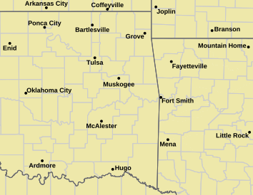
    Norman Warning Area Map Tulsa County Warning Area Map
    Tornado Warning | Tornado Watch | Severe Thunderstorm Warning | Severe Thunderstorm Watch
    Red Flag Warning | Fire Warning | Severe Weather Statement | Special Weather Statement
    Hazardous Weather Outlook | Fire Weather Watch
    Other Color Meanings: http://www.weather.gov/wwamap-prd/faq.php
    Oklahoma Mesonet Current Conditions
    Red - Air Temp, Green - Dewpoint, Barbs - Wind Speed/Direction, Gray - Gusts, Blue - Precip since Midnight
    Severe Weather Information


    SPC Convection (Severe Weather) Outlooks

    *Click any above graphic to view discussion.*

    Day 1 Outlook Tornado Outlook Wind Outlook Hail Outlook

    Day 2 Outlook Day 2 Probabilistic Outlook Day 3 Outlook Day 3 Probabilistic Outlook

    Days 4 through 8 Outlook


    Day 4 Day 5 Day 6 Day 7 Day 8

    SPC Severe Weather Reports


    SPC Fire Weather Outlooks

    *Click any above graphic to view discussion.*


    References


  2. Default Re: Oklahoma Severe Weather Discussion - April 2012

    State Radar Images
    WSR-88D Twin Lakes WSR-88D Frederick
    WSR-88D Vance AFB Experimental Test Beds or Specialized Radars
    Some experimental products may not always be live or up to date.
    Phased Array Radar (Next Generation Test Bed) CASA Radar Deployment - SW Oklahoma
    Multi-Radar Products
    Multi-Radar Hail Core Tracks (Past 120 min) Multi-Radar Maximum Expected Hail Size (MESH)
    Multi-Radar Products
    Multi-Radar Rotation Tracks (Past 120 min) Multi-Radar Azimuthal Shear Composite

  3. Default Re: Oklahoma Severe Weather Discussion - April 2012

    State Satellite Images

    Oklahoma Mesonet Visible Satellite Image
    Image will appear blank overnight.
    Oklahoma Mesonet IR Satellite Image
    Enhanced Colors - Blues are higher/colder cloud tops, Reds are warmer normally clear skies.

    Oklahoma Mesonet Water Vapor Satellite Image
    Enhanced Colors - Dark gray/black is dry air, bright white/colorized is higher moisture content/colder air.

  4. Default Re: Oklahoma Severe Weather Discussion - April 2012

    Severe risk appears to be increasing for Monday, April 2nd. Will go into more detail tomorrow after the morning model runs. This evening's run placed the GFS and NAM pretty close together with the GFS initiating a line of storms over Western OK moving into Central sections by late afternoon/evening. NAM is holding back on storm formation until later in the evening and over Eastern OK. Instability is forecast to be high in both solutions, so we'll need to watch it.

  5. Default Re: Oklahoma Severe Weather Discussion - April 2012

    GFS is still coming in, so will role with NAM as it should be ready when I get to it. Only covering Monday & Tuesday in this post. Still some uncertainty on the extent of development, but will just relay what the 12Z model runs show for this morning and we'll go from there.

    Monday April 2nd
    Expected Start Time: ~ 4PM
    Initiation Location: West of a line from Medford > Fairview > Weatherford > Altus
    Storm Motion: NE @ 15-25 mph
    12Z NAM Discussion: Good fetch of moisture will be over the area with Dewpoints in the 60s. Surface winds out of SE with upper air winds SW will setup for some shear over the area. Helicity looks like it will be fairly low at the start but increase during the evening, as usual. Instability will be high with LI values -7 to -10 in the outlined area. CAPE will be in the neighborhood of 2500-3000 j/kg. CIN will weaken through the day but build strongly behind the line. LCLs will be quite high though, so tornado threat should be mitigated some. Right now looks like severe threat will be there and a general slight risk right now for the western half of OK looks good for large hail and some damaging winds. Tornado threat doesn't look excessive right now at all.

    12Z GFS Discussion: Not much difference here. Instability is a bit higher on GFS and LCL levels are quite low. GFS solution has severe threat a bit higher, but we'll see how things evolve.

    Tuesday April 3rd
    Expected Start Time: ~ 4PM
    Initiation Location: Central third of Oklahoma.
    Storm Motion: NE @ 15-25 mph
    12Z NAM Discussion: Initial storms will push off to the east from overnight and could bring some marginal severe weather early to Central and Eastern OK. Afternoon storms look like they could form in North Central OK down I-35 and through SE OK. Instability won't be quite as high, with CAPE mainly around 1500 and LI's -3 to -5. LCL levels will down a bit, but some dry air will also be punching in from the SW. Some shear present, but not overly impressive numbers. This day really appears to be mostly marginal right now but we'll see how it evolves.

    12Z GFS Discussion: Great storm coverage on the GFS except for far SW OK, so move what the NAM has back west a bit. Could be a lot of ongoing convection that will keep things from going crazy. Instability comparable to the NAM. LCLs are low and shear looks good, better north of I-40. Probably a very conditional slight risk day depending on on going convection.

  6. Default Re: Oklahoma Severe Weather Discussion - April 2012

    The evening 00Z model runs are increasing the risk for severe weather on Monday (Tuesday isn't completely in yet on GFS). GFS is more widespread in the development a bit more favorable for tornadoes. NAM keeps coverage down a bit, but more than previously forecast, and has an environment not as favorable for tornadoes. It will definitely be a day to stay aware.

  7. Default Re: Oklahoma Severe Weather Discussion - April 2012

    Enhanced risk for some large hail tomorrow. Not posting the graphic since we are still on the front page and it is only like 3 posts back. :-)

    DAY 2 CONVECTIVE OUTLOOK
    NWS STORM PREDICTION CENTER NORMAN OK
    1235 AM CDT SUN APR 01 2012

    VALID 021200Z - 031200Z

    ...THERE IS A SLGT RISK OF SVR TSTMS FOR PORTIONS OF THE SRN
    PLAINS...

    ...SYNOPSIS...
    AN UPPER LOW IS FORECAST TO DRIFT SLOWLY EWD ACROSS NM ON MON AND
    INTO W TX BY TUE MORNING. LATEST MODEL GUIDANCE CONTINUES TO DIFFER
    WITH THE EXACT POSITION OF THIS LOW...BUT INDICATIONS ARE THAT A 70+
    KT MIDLEVEL SPEED MAX WILL NOSE INTO SWRN TX BY 00Z. AT THE
    SURFACE...LOW PRESSURE WILL LIKELY EXIST OVER THE TX
    PANHANDLE...WITH SLY FLOW ACROSS THE WARM SECTOR MAINTAINING MID 60S
    F DEWPOINTS.

    MEANWHILE...AN UPPER RIDGE WILL EXIST OVER THE MS VALLEY...AND A NRN
    STREAM SHORTWAVE TROUGH IS EXPECTED TO FLATTEN THIS RIDGE ACROSS MN
    AND WI OVERNIGHT. AGAIN...MODELS DIFFER WITH THE ECMWF MUCH SLOWER
    WITH THE RIDGE BREAKDOWN AND SLOWER WITH A COLD FRONT WHICH WILL
    AFFECT MN...IA...WI AND IL.

    MODELS ALSO INDICATE A LEAD SRN STREAM IMPULSE AFFECTING THE NWRN
    GULF COAST AREA WITH MOSTLY HEAVY RAIN.

    ...MUCH OF CNTRL AND WRN OK INTO CNTRL TX...
    SUBSTANTIAL MOISTURE AND INSTABILITY WILL EXIST ACROSS THE SRN
    PLAINS...WITH BOUNDARY LAYER MID 60S F DEWPOINTS...STEEP LAPSE RATES
    ALOFT AND LITTLE CIN BY AFTERNOON. HOWEVER...THIS WILL BE WELL IN
    ADVANCE OF THE UPPER LOW. WITH A SOMEWHAT MERIDIONAL FLOW REGIME
    ALOFT...A DRYLINE WILL BECOME NEARLY STATIONARY FROM WRN OK INTO
    CNTRL TX. STRONG HEATING WILL OCCUR...BUT CONVERGENCE WILL NOT BE
    PARTICULARLY STRONG. DESPITE MARGINAL SHEAR PROFILES...SLOW MOVING
    SEVERE THUNDERSTORMS WILL BE LIKELY CAPABLE OF LARGE HAIL...SOME
    VERY LARGE. LOCALLY SEVERE WINDS WILL ALSO BE LIKELY...AS WILL HEAVY
    RAIN.

    OTHER STORMS ARE LIKELY ALONG AND N OF A SAGGING COLD FRONT FROM NRN
    OK INTO KS...WITH HAIL POSSIBLE.

  8. Default Re: Oklahoma Severe Weather Discussion - April 2012

    Main threat next two days will be hail with a chance for a tornado or two today.


    DAY 1 CONVECTIVE OUTLOOK
    NWS STORM PREDICTION CENTER NORMAN OK
    0100 AM CDT MON APR 02 2012

    VALID 021200Z - 031200Z

    ...THERE IS A SLGT RISK OF SVR TSTMS ACROSS PARTS OF THE SRN AND
    CENTRAL PLAINS EWD INTO E TX/SRN AR AND MUCH OF LA...

    ...SYNOPSIS....
    MODELS ARE IN FAIRLY GOOD AGREEMENT SHOWING THE SRN EXTENT OF THE
    WRN U.S. TROUGH BECOMING CUT-OFF FROM THE NRN STREAM BY THE START OF
    DAY 1. THE CLOSED LOW WILL MOVE SLOWLY EWD TODAY ACROSS NM...GIVEN
    THE PRESENCE OF A RATHER STRONG DOWNSTREAM RIDGE EXTENDING NWD FROM
    THE LOWER MS VALLEY/CENTRAL GULF COAST STATES TO THE WRN GREAT
    LAKES. MEANWHILE...HEIGHTS WILL RISE ACROSS THE SERN STATES AS A
    TROUGH LOCATED ALONG THE MIDDLE/NRN ATLANTIC COAST MOVES EWD. A
    WEAK MIDLEVEL CIRCULATION...CURRENTLY MOVING SLOWLY NWD INLAND FROM
    THE MID-UPPER TX COAST...SHOULD TRACK NEWD TODAY THROUGH E
    TX/ARKLATEX AND LOWER MS VALLEY REACHING THE OZARKS AND NRN MS BY
    12Z TUESDAY.

    THE NRN EXTENT OF THE WRN TROUGH...CURRENTLY MOVING EWD THROUGH THE
    NRN INTERMOUNTAIN WEST PER WATER VAPOR IMAGERY...IS EXPECTED TO
    TRACK ENEWD THROUGH THE NRN HIGH PLAINS THIS AFTERNOON AS IT PHASES
    WITH A SEPARATE TROUGH MOVING THROUGH CENTRAL CANADA. MODELS DIFFER
    WITH THE EFFECT THE SRN PORTION OF THESE PHASED TROUGHS HAS ACROSS
    NRN MN...BUT THE 12Z ECMWF/00Z GFS AGREE THAT 40-60 METER HEIGHT
    FALLS SHOULD OCCUR ACROSS THAT REGION MONDAY NIGHT.

    AT THE SURFACE...A COLD FRONT WILL ADVANCE E/SEWD INTO THE UPPER MS
    VALLEY THIS FORECAST PERIOD...AND SWD WHERE IT WILL MERGE WITH A
    NE-SW ORIENTED DRY LINE ACROSS CENTRAL KS THIS AFTERNOON. THE DRY
    LINE WILL THEN EXTEND SWD FROM A TRIPLE POINT OVER SWRN-SOUTH
    CENTRAL KS THROUGH WRN OK TO CENTRAL TX THIS AFTERNOON. THE WRN
    EXTENT OF A WARM FRONT...INITIALLY LOCATED OVER NRN MO...IS EXPECTED
    TO SPREAD NWD AND REACH ERN IA/NWRN IL BY THIS EVENING.
    MEANWHILE...A COLD FRONT WILL MOVE SWD THROUGH THE CAROLINAS
    REACHING ERN GA BY 12Z TUESDAY.

    ...CENTRAL TX/WRN AND CENTRAL OK/CENTRAL AND ERN KS...
    A SHORTWAVE TROUGH...CURRENTLY MOVING INTO THE BASE OF THE WRN
    TROUGH OVER SWRN AZ PER WATER VAPOR IMAGERY...IS EXPECTED TO MIGRATE
    THROUGH THE SERN-ERN PERIPHERY OF THE PARENT CLOSED LOW TODAY ACROSS
    SW-W TX INTO WRN OK AND POSSIBLY SWRN KS BY 03/00Z. WEAK HEIGHT
    FALLS ACROSS THE SRN PLAINS...DPVA ATTENDANT TO THE MIGRATORY
    SHORTWAVE TROUGH...AND DIFFLUENT MID-UPPER LEVEL FLOW ALL EXPECTED
    ACROSS THE DRY LINE DURING THE MID-LATE AFTERNOON SUGGEST TSTM
    DEVELOPMENT WILL BE LIKELY FROM CENTRAL/SOUTH CENTRAL TX NWD THROUGH
    WRN OK TO SOUTH CENTRAL KS. THE STRONGEST LOW LEVEL CONVERGENCE
    SHOULD EXTEND FROM NWRN OK/ADJACENT KS NEAR THE TRIPLE POINT NEWD
    ALONG THE COLD FRONT/DRY LINE MERGER INTO CENTRAL KS...WITH MUCH OF
    THE KS TSTM ACTIVITY EXPECTED TO BE MORE ANAFRONTAL-TYPE
    DEVELOPMENT.

    SURFACE HEATING WITHIN THE WARM SECTOR COMBINED WITH VERY STEEP
    MIDLEVEL LAPSE RATES /EXCEEDING 8 C PER KM/...AND SURFACE DEWPOINTS
    IN THE 60S WILL RESULT IN MODERATE TO VERY STRONG INSTABILITY WITHIN
    THE TX/OK/KS PORTION OF THE SLIGHT RISK AREA. EFFECTIVE BULK SHEAR
    WILL BE STRONGEST ACROSS S TO N CENTRAL TX WITH SHEAR VECTORS
    ORIENTED PERPENDICULAR TO THE DRY LINE. THIS WILL PROVE FAVORABLE
    FOR DISCRETE SUPERCELLS PRODUCING HAIL...SOME VERY LARGE /EXCEEDING
    2 INCH DIAMETER/...AND A COUPLE OF TORNADOES. ALTHOUGH DEEP LAYER
    SHEAR WILL DECREASE WITH NWD EXTENT...WITH A GREATER POTENTIAL FOR
    PULSE-TYPE STORMS INTO KS...THE PRESENCE OF STRONG INSTABILITY WILL
    SUPPORT VERY LARGE HAIL WITH THIS ACTIVITY AS WELL. THE THREAT FOR
    AN ISOLATED TORNADO WILL ALSO EXTEND NWD THROUGH WRN OK TO THE
    TRIPLE POINT IN SWRN-S CENTRAL KS.

    DAY 2 CONVECTIVE OUTLOOK
    NWS STORM PREDICTION CENTER NORMAN OK
    0116 AM CDT MON APR 02 2012

    VALID 031200Z - 041200Z

    ...THERE IS A SLGT RISK OF SVR TSTMS OVER MUCH OF OK INTO NRN AND
    CNTRL TX...

    ...SYNOPSIS...
    AN UPPER LOW WILL DRIFT EWD ACROSS THE CNTRL AND SRN PLAINS...WITH
    MODEST MID TO UPPER LEVEL SWLY FLOW ALOFT. AT THE SURFACE...A LOW
    PRESSURE TROUGH/DRYLINE SHOULD EXTEND FROM WRN OK INTO W CNTRL TX AT
    00Z...WHICH WILL BE A FOCUS FOR SOME SEVERE WEATHER AND RAIN.
    MEANWHILE...GENERALLY WEAK FLOW ALOFT WILL RESIDE ACROSS THE MS
    VALLEY INTO THE SERN STATES...BUT A LOW AMPLITUDE SHORTWAVE TROUGH
    WILL AFFECT THE GREAT LAKES REGION AS IT TRAVELS SEWD LATE IN THE
    DAY AND OVERNIGHT. A COLD FRONT ASSOCIATED WITH THIS FEATURE MAY
    HELP FOCUS STORMS FROM NRN IL INTO OH AND WV LATE.

    FROM THE PLAINS DRYLINE EWD TO THE ATLANTIC COAST...A LARGE AREA OF
    MOISTURE WITH DEWPOINTS MAINLY IN THE 60S F WILL CONTRIBUTE TO LARGE
    INSTABILITY AND A CONDITIONAL THREAT OF DIURNAL STORMS...SOME
    SEVERE.

    ...CNTRL OK INTO TX...
    MODELS ARE IN AGREEMENT THAT AN MCS WILL BE ONGOING ACROSS CNTRL TX.
    THIS ACTIVITY WOULD LIKELY HAVE A WIND AND HAIL THREAT...BUT IS
    LIKELY TO DECREASE IN INTENSITY LATER IN THE MORNING AS IT OUTRUNS
    THE INSTABILITY AXIS AND OUTFLOW SURGES EWD BENEATH A CAPPING
    INVERSION...APPROXIMATELY E OF A DFW TO SAT LINE. DESTABILIZATION
    SHOULD OCCUR BEHIND THIS ACTIVITY WITH STRONG HEATING NEAR THE
    DRYLINE FROM SWRN OK INTO W CNTRL TX. DIURNAL DEVELOPMENT IS
    EXPECTED HERE...AND DEEP LAYER SHEAR PROFILES SHOULD FAVOR SOME
    ORGANIZATION WITH LARGE HAIL AND DAMAGING WINDS. RELATIVELY WEAK LOW
    LEVEL SHEAR SUGGEST ANY TORNADO THREAT WILL BE MINIMAL.

    OVERNIGHT...AN UPPER VORTICITY LOBE SHOULD OVERSPREAD ERN
    OK...TX...AND WRN AR/LA. INSTABILITY WILL REMAIN IN PLACE AND
    SCATTERED SEVERE STORMS WITH HAIL...WIND...AND HEAVY RAIN WILL BE
    LIKELY.

  9. #9
    MadMonk Guest

    Talking Re: Oklahoma Severe Weather Discussion - April 2012

    Relevent comic from today's XKCD:
    http://xkcd.com/1037/

  10. Default Re: Oklahoma Severe Weather Discussion - April 2012

    Tornado watch will be issued soon for central and western ok. Highest threat for tornadoes will be this evening as things cool a bit.

  11. #11

    Default Re: Oklahoma Severe Weather Discussion - April 2012


    MESOSCALE DISCUSSION 0415
    NWS STORM PREDICTION CENTER NORMAN OK
    0300 PM CDT MON APR 02 2012

    AREAS AFFECTED...NWRN TX...ERN OK/TX PANHANDLES...SWRN KS...WRN OK

    CONCERNING...SEVERE POTENTIAL...WATCH LIKELY

    VALID 022000Z - 022200Z

    A TORNADO WATCH WILL LIKELY BE NEEDED FOR PORTIONS OF NWRN TX...THE
    ERN OK/TX PANHANDLES...SWRN KS AND WRN OK THIS AFTERNOON AND
    EVENING.

    MID-AFTERNOON MESOANALYSIS SHOWS A COLD FRONT WAS LOCATED FROM SWRN
    KS INTO ERN NM...WHICH IS BEGINNING TO STALL IN RESPONSE TO PRESSURE
    FALLS AHEAD OF A POTENT NEGATIVELY TILT MIDLEVEL SHORTWAVE TROUGH. A
    DRYLINE ACCOMPANIED BY DEEPENING CUMULUS EXTENDED SWD FROM THE KS
    PORTION OF THE COLD FRONT...WHILE A PACIFIC FRONT WAS BEGINNING TO
    ENTER W TX. SURFACE TEMPERATURES ALONG THE DRYLINE HAVE WARMED INTO
    THE MID 80S...AND DEWPOINTS E OF THE BOUNDARY RESIDE IN THE UPR 50S
    TO MID 60S. THE WARM/MOIST AIRMASS LOCATED ACROSS THE WARM SECTOR
    COMBINED WITH STEEP MIDLEVEL LAPSE RATES /IN EXCESS OF 8 C PER KM IN
    THE 700-500 MB LAYER/ ARE CONTRIBUTING TO A VERY UNSTABLE
    ENVIRONMENT...WITH MLCAPE VALUES NEAR 3000 J/KG.

    AS THE UPPER DISTURBANCE LIFTS NWD ACROSS THE SRN HIGH PLAINS THIS
    AFTERNOON AND EVENING...SHORT-TERM MODEL GUIDANCE INDICATES SURFACE
    CYCLOGENESIS WILL RAPIDLY TAKE PLACE OVER NERN NM AND THE TX
    PANHANDLE. STRONG LOW-LEVEL SWLY WINDS OVER W TX...POSSIBLY
    ACCOMPANYING AN EWD SURGE OF THE PACIFIC FRONT...WILL QUICKLY SPREAD
    EWD TOWARD THE DRYLINE...RESULTING IN STRENGTHENING LOW-LEVEL
    CONVERGENCE. AS THIS TAKES PLACE...SCATTERED THUNDERSTORM ARE
    FORECAST TO DEVELOP FROM THE KS TRIPLE POINT SWD ALONG THE DRYLINE
    BY 22-00Z.

  12. #12

    Default Re: Oklahoma Severe Weather Discussion - April 2012

    http://forecast.weather.gov/showsigw...derstorm+Watch

    SEVERE THUNDERSTORM WATCH 129 REMAINS VALID UNTIL 11 PM CDT THIS
    EVENING FOR THE FOLLOWING AREAS

    IN OKLAHOMA THIS WATCH INCLUDES 20 COUNTIES

    IN NORTHWEST OKLAHOMA

    ALFALFA BLAINE DEWEY
    ELLIS HARPER MAJOR
    WOODS WOODWARD

    IN SOUTHWEST OKLAHOMA

    CADDO COMANCHE COTTON
    GREER HARMON JACKSON
    KIOWA TILLMAN

    IN WESTERN OKLAHOMA

    BECKHAM CUSTER ROGER MILLS
    WA****A

    IN TEXAS THIS WATCH INCLUDES 8 COUNTIES

    IN NORTHERN TEXAS

    ARCHER BAYLOR CLAY
    FOARD HARDEMAN KNOX
    WICHITA WILBARGER

    THIS INCLUDES THE CITIES OF...ALTUS...ALVA...ANADARKO...
    ARCHER CITY...ARNETT...BUFFALO...CHEROKEE...CHEYENNE...
    CHILLICOTHE...CLINTON...CORDELL...CROWELL...ELK CITY...FAIRVIEW...
    FREDERICK...HENRIETTA...HOBART...HOLLIS...KNOX CITY...LAWTON...
    MANGUM...MUNDAY...QUANAH...SAYRE...SEYMOUR...TALOG A...VERNON...
    WALTERS...WATONGA...WEATHERFORD...WICHITA FALLS AND WOODWARD

  13. Default Re: Oklahoma Severe Weather Discussion - April 2012

    Things are starting to pick up some. One lone severe storm out in the west right now, but we are seeing storms explode in the Panhandle right at the Triple Point. Additional storms intensifying over western North Texas along the dryline.

    HRRR seems to be handling this well and shows these storms will continue to increase in coverage and intensity through tomorrow morning. AM drive looks like a mess right now.

  14. Default Re: Oklahoma Severe Weather Discussion - April 2012

    The portion just SW of OKlahoma that will move in in the next 1-2 hours is now severe with 2+ inch hail and a line of 70+ mph winds.

  15. Default Re: Oklahoma Severe Weather Discussion - April 2012

    Bulletin - immediate broadcast requested
    severe thunderstorm warning
    national weather service norman ok
    836 pm cdt mon apr 2 2012


    the national weather service in norman has issued a


    * severe thunderstorm warning for...
    Beckham county in west central oklahoma...
    Greer county in southwestern oklahoma...
    Harmon county in southwestern oklahoma...
    Jackson county in southwestern oklahoma...
    Southwestern roger mills county in west central oklahoma...


    * until 915 pm cdt


    * at 834 pm cdt...national weather service doppler radar indicated
    a line of severe thunderstorms capable of producing large damaging
    hail up to golf ball size and damaging winds in excess of 65 mph.
    These storms were located along a line extending from near
    shamrock to madge to 9 miles south of hollis...moving northeast at
    45 mph.

    Attached Thumbnails Attached Thumbnails Click image for larger version. 

Name:	842PM-hail.jpg 
Views:	1453 
Size:	59.5 KB 
ID:	1174  

  16. Default Re: Oklahoma Severe Weather Discussion - April 2012

    Bulletin - immediate broadcast requested
    severe thunderstorm warning
    national weather service norman ok
    915 pm cdt mon apr 2 2012


    the national weather service in norman has issued a


    * severe thunderstorm warning for...
    Extreme northwestern archer county in north central texas...
    Baylor county in north central texas...
    Extreme eastern foard county in north central texas...
    Greer county in southwestern oklahoma...
    Extreme east central hardeman county in north central texas...
    Jackson county in southwestern oklahoma...
    Kiowa county in southwestern oklahoma...
    East central knox county in north central texas...
    Tillman county in southwestern oklahoma...
    Wichita county in north central texas...
    Wilbarger county in north central texas...


    * until 1030 pm cdt


    * at 911 pm cdt...national weather service doppler radar indicated
    a line of severe thunderstorms capable of producing large damaging
    hail up to golf ball size and damaging winds in excess of 65 mph.
    These storms were located along a line extending from near mangum
    to eldorado to chillocothe to vera...moving east at 30 mph.

  17. Default Re: Oklahoma Severe Weather Discussion - April 2012

    Destructive wind threat is going up quickly in Harmon, Greer, Jackson counties.

  18. Default Re: Oklahoma Severe Weather Discussion - April 2012


    MESOSCALE DISCUSSION 0423
    NWS STORM PREDICTION CENTER NORMAN OK
    0912 PM CDT MON APR 02 2012

    AREAS AFFECTED...NERN TX PANHANDLE...WRN OK...TX BIG COUNTRY

    CONCERNING...SEVERE THUNDERSTORM WATCH 129...

    VALID 030212Z - 030315Z

    THE SEVERE WEATHER THREAT FOR SEVERE THUNDERSTORM WATCH 129
    CONTINUES.

    REPLACEMENT OF PORTIONS OF WW 129 WILL LIKELY BE COORDINATED BY
    03Z...PRIOR TO 04Z SCHEDULED EXPIRATION.

    02Z SURFACE ANALYSIS PLACED A NEARLY STATIONARY CYCLONE OVER THE
    NERN TX PANHANDLE WITH A PACIFIC COLD FRONT/DRYLINE ARCING SWD
    TOWARDS THE TX BIG COUNTRY. TSTMS RAPIDLY GREW UPSCALE INTO A QLCS
    AS THE COLD FRONT OVERTOOK THE DRYLINE ACROSS THE NERN TX PANHANDLE
    INTO NWRN TX. LOW-LEVEL SELYS HAVE STRENGTHENED AHEAD OF THIS LINE
    TO 30-40 KT PER FDR VWP DATA MAINTAINING A FEED OF LOWER TO MIDDLE
    60S SURFACE DEW POINTS ACROSS WRN OK. FARTHER E...SURFACE DEW POINTS
    HAVE FALLEN INTO MIDDLE 50S ACROSS S-CNTRL OK IN THE WAKE OF
    CONVECTIVE OUTFLOW FROM THE DYING MCS OVER THE LOWER MS VALLEY. AS
    SUCH...GREATEST SEVERE THREAT SHOULD EXIST DURING THE NEXT FEW HOURS
    ACROSS MAINLY SWRN OK/NWRN TX. CONVECTIVE MODE WILL LARGELY MITIGATE
    SIGNIFICANT HAIL...BUT THREATS FOR EMBEDDED SEVERE HAIL ALONG WITH
    ISOLATED DAMAGING WINDS AND EVEN A BRIEF TORNADO WILL REMAIN
    POSSIBLE.

    ..GRAMS.. 04/03/2012
    Attached Thumbnails Attached Thumbnails Click image for larger version. 

Name:	mcd0423.gif 
Views:	1468 
Size:	20.1 KB 
ID:	1175  

  19. Default Re: Oklahoma Severe Weather Discussion - April 2012

    Bulletin - immediate broadcast requested
    severe thunderstorm warning
    national weather service norman ok
    1027 pm cdt mon apr 2 2012


    the national weather service in norman has issued a


    * severe thunderstorm warning for...
    Caddo county in southwestern oklahoma...
    Comanche county in southwestern oklahoma...
    Cotton county in southwestern oklahoma...
    Kiowa county in southwestern oklahoma...
    Tillman county in southwestern oklahoma...
    Extreme southeastern wa****a county in west central oklahoma...
    Extreme northwestern wichita county in north central texas...
    East central wilbarger county in north central texas...


    * until 1130 pm cdt


    * at 1021 pm cdt...national weather service doppler radar
    indicated a line of severe thunderstorms capable of producing half
    dollar size hail and damaging winds in excess of 65 mph. These
    storms were located along a line extending from lone wolf
    to tipton to grayback...moving northeast at 45 mph.

  20. Default Re: Oklahoma Severe Weather Discussion - April 2012

    Risk today is mainly Central and Eastern OK ahead of the dryline.

    DAY 1 CONVECTIVE OUTLOOK
    NWS STORM PREDICTION CENTER NORMAN OK
    0800 AM CDT TUE APR 03 2012

    VALID 031300Z - 041200Z

    ...THERE IS A SLGT RISK OF SVR TSTMS OVER PARTS OF THE SRN
    PLNS...WRN OZARKS...AND LWR MS VLY...

    ...THERE IS A SLGT RISK OF SVR TSTMS OVER PARTS OF THE MID MS AND
    LWR OH VLYS...

    ...SYNOPSIS...
    NM UPR LOW EXPECTED TO MOVE ONLY SLOWLY E THIS PERIOD AS SYSTEM
    REMAINS WELL REMOVED FROM MAIN BELT OF THE AMPLIFIED WLYS EXTENDING
    ACROSS THE PACIFIC NW...CENTRAL CANADA...AND THE UPR GRT LKS-NERN
    U.S. VORT LOBE ASSOCIATED WITH THE NM LOW...NOW EXTENDING SWD
    THROUGH ERN NM...SHOULD PIVOT ENE ACROSS W TX LATER THIS MORNING AND
    THEN TURN NE ACROSS WRN N TX AND WRN OK THIS AFTN.

    FARTHER NE...SATELLITE AND VWP DATA SUGGEST THAT DISTURBANCE IN PART
    RESPONSIBLE FOR LARGE MCS OVER E TX...AR...AND LA YESTERDAY NOW
    EXTENDS IN AN ARC FROM SW MO THROUGH NE AR TO CSTL MS. THIS FEATURE
    SHOULD CONTINUE ENE THROUGH THE DAY...REACHING A CNTRL IL...MIDDLE
    TN...FL PANHANDLE LINE BY EVE.

    AT LWR LVLS...QSTNRY SFC LOW THAT HAD BEEN PRESENT OVER THE TX
    PANHANDLE HAS PARTLY FILLED AS A RESULT OF /1/ SWD MOVEMENT OF POLAR
    AIR FROM KS-NEB...AND /2/ WIDESPREAD OUTFLOW FROM CONVECTION OVER
    THE SRN PLNS-LWR MS VLY. AN ELONGATED LOW LVL CIRCULATION
    WILL...NEVERTHELESS...LIKELY PERSIST TODAY OVER NW TX...NEAR
    INTERSECTION OF THE POLAR COLD FRONT WITH MERGED DRY LINE-PACIFIC
    COLD FRONT. THIS CIRCULATION OR WEAK LOW SHOULD DRIFT NE TOWARD THE
    OK-KS BORDER BY EVE...AHEAD OF AFOREMENTIONED NM VORT LOBE.

    FARTHER NE...RESIDUAL TRIPLE POINT LOW NOW IN SE IA SHOULD EDGE ESE
    INTO IL-IND LATER TODAY AS THE APPROACH OF A SHORTWAVE IMPULSE IN
    THE NRN STREAM /OVER THE UPR GRT LKS/ ENHANCES WSWLY LOW LVL FLOW
    OVER THE OH VLY. THIS WILL ALLOW EXISTING STNRY FRONT EXTENDING E
    FROM THE LOW TO ADVANCE ENEWD AS WARM FRONT INTO PARTS OF
    IND...OH...AND KY.

    THE VORT LOBE AND ASSOCIATED FRONT/DRYLINE OVER THE SRN PLNS...AND
    THE LOW/WARM FRONT OVER THE OH VLY...WILL BE THE MAIN FOCI FOR
    STRONG TO SVR TSTMS TODAY INTO TNGT.

    ...SRN PLNS INTO LWR MS VLY TODAY THROUGH TNGT...
    SCTD TO NUMEROUS TSTMS AND STORM CLUSTERS ARE EXPECTED THROUGH THE
    PERIOD OVER ERN PORTIONS OF THE SRN PLNS AND ADJACENT PARTS OF THE
    WRN OZARKS/LWR MS VLY AS VORT LOBE ROTATING NNE AROUND ERN SIDE OF
    NM UPR LOW...AND SUBSEQUENT WEAKER DISTURBANCES...ENHANCE ASCENT
    ACROSS REGION.

    GIVEN THAT OVERNIGHT MCSS HAVE SOMEWHAT STABILIZED REGION N OF THE
    RED RIVER...THE STRONGEST DIURNALLY DRIVEN DEVELOPMENT IS EXPECTED
    OVER CNTRL AND N TX. COMBINATION OF INCREASING ASCENT IN
    MODERATELY-SHEARED...RICHLY MOIST LOW LVL ENVIRONMENT BENEATH
    DEEP/PERSISTENT EML SHOULD YIELD STORMS CAPABLE OF VERY LARGE HAIL
    AND LOCALLY DMGG WIND. WIND PROFILES WILL REMAIN DIFFICULT TO
    GENERALIZE OVER SPACE AND TIME...AND EXPECTED FAIRLY WIDESPREAD
    COVERAGE LIMITS PREDICTABILITY OF PREDOMINANT CONVECTIVE MODE/STORM
    TYPE. BUT SETUP APPEARS AT LEAST CONDITIONALLY SUPPORTIVE OF A FEW
    SUPERCELLS ALSO CAPABLE OF TORNADOES GIVEN QUALITY OF MOISTURE
    INFLOW/DEGREE OF BUOYANCY. THE STORMS LIKELY WILL MERGE INTO ONE OR
    MORE MCSS THIS EVENING. ONE OF THESE COULD BECOME RATHER LARGE AND
    MOVE/DEVELOP E/SE TOWARD THE HOUSTON/BEAUMONT AREA TOWARD WED
    MORNING...WITH A CONTINUING RISK FOR SVR WEATHER. A MORE
    LIMITED...THOUGH NON-ZERO...RISK FOR SVR STORMS WILL EXIST IN MUCH
    OF OK THROUGH EARLY TNGT...WHERE LARGE SCALE FORCING FOR ASCENT WILL
    BE GREATER...BUT SFC-BASED INSTABILITY MORE LIMITED THAN IN TX.

  21. Default Re: Oklahoma Severe Weather Discussion - April 2012


    MESOSCALE DISCUSSION 0428
    NWS STORM PREDICTION CENTER NORMAN OK
    0836 AM CDT TUE APR 03 2012

    AREAS AFFECTED...CENTRAL AND NRN TX/SRN OK

    CONCERNING...SEVERE POTENTIAL...WATCH POSSIBLE

    VALID 031336Z - 031500Z

    STRENGTHENING CONVECTION/INCREASING SEVERE POTENTIAL SUGGEST THAT WW
    ISSUANCE MAY BE REQUIRED IN THE NEXT HOUR.

    LATEST RADAR LOOP SHOWS STORMS INCREASING IN COVERAGE AND INTENSITY
    ACROSS PARTS OF CENTRAL AND N TX...WITHIN ZONE OF ASCENT PIVOTING
    NEWD ACROSS CENTRAL AND N TX AROUND THE SERN FRINGE OF THE SRN
    ROCKIES UPPER LOW. STORMS ARE DEVELOPING IN CLOSE PROXIMITY TO THE
    SURFACE COLD FRONT -- WHICH HAS PUSHED EWD ACROSS THE WRN HALF OF TX
    AND NOW LIES ROUGHLY N-S FROM JUST W OF ABI TO JUST E OF JCT. E OF
    THE FRONT WITHIN THE WARM SECTOR...A SLIGHTLY STABLE BOUNDARY LAYER
    IS INDICATED...WITH WIDESPREAD LOW CLOUDS PER LATEST VISIBLE IMAGERY
    LIKELY TO HINDER THE INITIATION OF BOUNDARY LAYER
    HEATING/DESTABILIZATION OVER THE NEXT COUPLE OF HOURS.
    STILL...MORNING FWD /FORT WORTH TX/ RAOB REVEALS STEEP LAPSE
    RATES/MODERATE CAPE ABOVE THE BOUNDARY LAYER ALONG WITH AMPLE
    CLOUD-LAYER SHEAR. THUS...EXPECT THREAT FOR LARGE HAIL WITH THE
    DEVELOPING CONVECTION ALONG WITH LIMITED WIND GUST POTENTIAL --
    POTENTIAL WHICH COULD INCREASE LATER THIS MORNING PRESUMING LOW
    CLOUD EROSION ALLOWING HEATING TO COMMENCE.

    ..GOSS.. 04/03/2012


    ATTN...WFO...FWD...OUN...EWX...SJT...

  22. #22

    Default Re: Oklahoma Severe Weather Discussion - April 2012

    Tornadoes in D/FW area as we speak. Will see what breaks this afternoon here.

  23. #23

    Default Re: Oklahoma Severe Weather Discussion - April 2012

    Quote Originally Posted by FritterGirl View Post
    Tornadoes in D/FW area as we speak. Will see what breaks this afternoon here.
    Just got off the phone with my sister and parents down there. Already some reports of significant damage in the SE suburbs and a cell producing a tornado is moving over the DFW Airport area.

  24. #24

    Default Re: Oklahoma Severe Weather Discussion - April 2012

    Quote Originally Posted by FritterGirl View Post
    Tornadoes in D/FW area as we speak. Will see what breaks this afternoon here.
    Suspect that the extensive rainfall and persistent cloud cover from the early storms here in OK have worked to keep the atmosphere cool enough such that the tornadic/severe threat here in central OK is very small. Appears the early cloudcover in N. Texas eroded/burned off early morning, allowing for lots of warming, and that really started the pot boiling with lots of convection and moisture for lots of surface-based storms to erupt very quickly. Don't know if anyone else saw it, but a Dallas TV station had a radar image on their website of the twin supercells over Dallas along with a tremendous hook echo signature on one of the storms..

  25. #25

    Default Re: Oklahoma Severe Weather Discussion - April 2012

    Our 'baby', now 19, is in school just sw of DT Dallas. He texted a bit ago they were headed to safe rooms for a bit. Waiting to hear more. His reception isn't all that great even above ground.


    From yahoo, about 30 minutes ago:

    Massive twin twisters have touched down near Dallas and Fort Worth this afternoon, crushing homes and sending thousands of North Texans scrambling to take cover.

    Reports of injuries were not immediately known, but the National Weather Service declared the Dallas-Fort Worth metro area to be under a "tornado emergency." Warnings for most counties are still active.

    Sirens were going off in downtown Dallas and Fort Worth. Schools across the area were huddling children in hallways. Passengers at DFW International Airport were being rushed to safe areas at 1:50 p.m. CT.

    "This is as serious of a tornado we've seen in years," said CBS 11 meteorologist Larry Mowry.
    Television news helicopters broadcast images of the twisters. Spotters on the ground estimated the tornadoes to be 1/2-mile wide. The first tornado, first spotted about 20 miles south of Fort Worth, was believed to be on the ground for 30 minutes.

    That twister was captured on video near Arlington. KXAS (NBC 5) published the raw video.

    Storm spotters were reporting widespread major damage of homes and other buildings in communities south of Fort Worth.
    Source: http://news.yahoo.com/blogs/dallas/t...184640541.html
    Last edited by kevinpate; 04-03-2012 at 01:30 PM. Reason: add news blurb

Thread Information

Users Browsing this Thread

There are currently 1 users browsing this thread. (0 members and 1 guests)

Similar Threads

  1. Oklahoma Severe Weather Discussion - March 2012
    By Tydude in forum Weather & Geosciences
    Replies: 91
    Last Post: 03-30-2012, 07:03 PM
  2. Oklahoma Weather Discussion -March/April 2012
    By Tydude in forum Current Events & Open Topic
    Replies: 1
    Last Post: 02-28-2012, 01:24 PM
  3. Oklahoma Weather Discussion-March/April 2012
    By Tydude in forum Current Events & Open Topic
    Replies: 2
    Last Post: 02-28-2012, 01:11 PM
  4. Oklahoma Severe Weather Discussion - May 2011
    By venture in forum Weather & Geosciences
    Replies: 377
    Last Post: 05-31-2011, 11:33 PM
  5. Oklahoma Severe Weather Discussion - April 2011
    By venture in forum Weather & Geosciences
    Replies: 286
    Last Post: 04-29-2011, 11:28 PM

Tags for this Thread

Bookmarks

Posting Permissions

  • You may not post new threads
  • You may not post replies
  • You may not post attachments
  • You may not edit your posts
  •  
Single Sign On provided by vBSSO