Widgets Magazine
Page 1 of 11 123456 ... LastLast
Results 1 to 25 of 263

Thread: Oklahoma Weather Discussion - January/February 2012

  1. Default Oklahoma Weather Discussion - January/February 2012

    This thread is used to discussion upcoming/ongoing severe weather events through the months of January and February. For Winter 2012, we are looking at a typical La Niña pattern of warmer than usual temperatures with dryer conditions. This doesn't mean that large winter storms can't occur those. Winter 2011 was also a La Niña year and Oklahoma broke many winter weather records. Spring-like severe weather is also possible during this time as temperatures can still get very mild this time of year. This initial post will contain information, images, and links that can be used at any time. Images posted later through the thread may or may not be accurate on the day you are viewing them (check the post comments). Information contained in this thread should not be used as an alternative to weather radios, media, or other means of getting weather warnings/advisories.


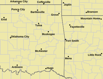
    _________Norman Warning Area Map __________________ Tulsa County Warning Area Map____

    Tornado Warning | Tornado Watch | Severe Thunderstorm Warning | Severe Thunderstorm Watch | Blizzard Warning | Red Flag Warning | Fire Warning | Winter Storm Warning | Winter Storm Watch | Freezing Rain Advisory | Heavy Snow Warning | Winter Weather Advisory | Severe Weather Statement | Special Weather Statement | Hazardous Weather Outlook | Fire Weather Watch
    Other Color Meanings: http://www.weather.gov/wwamap-prd/faq.php

    NWS NEXRAD Radar Loop - Twin Lakes/Oklahoma City/Norman


    SPC Convection (Severe Weather) Outlooks

    ________ Day 1 ________________ Day 2 _________________ Day 3 ___________ Days 4 through 8 ___


    *Click any above graphic to view discussion.*

    SPC Fire Weather Outlooks

    ________ Day 1 ________________ Day 2 ______________ Days 3 to 8 _____


    *Click any above graphic to view discussion.*

    Current Snow Cover Graphic: http://www.nohrsc.noaa.gov/nsa/


    Oklahoma Mesonet Visible Satellite Image (will appear blank overnight)


    Oklahoma Mesonet IR Satellite Image (will appear blank overnight)


    Oklahoma Mesonet Water Vapor Satellite Image (will appear blank overnight)


    Oklahoma Mesonet Current Conditions


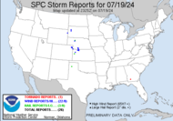
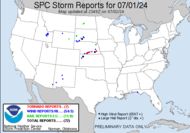
    SPC Severe Weather Reports (Today and Yesterday)
    ________ Today _____________ Yesterday _____


    Useful Links
    COD Weather Analysis Page: http://weather.cod.edu/analysis/
    NWS Norman Page: http://www.srh.noaa.gov/oun/
    Storm Prediction Center: http://www.spc.noaa.gov/
    Oklahoma Mesonet: http://www.mesonet.org/
    West Texas Mesonet: http://www.mesonet.ttu.edu/
    Oklahoma Fire Weather: http://www.srh.noaa.gov/oun/?n=fireweather
    Oklahoma Road Conditions: http://www.dps.state.ok.us/cgi-bin/weathermap.cgi
    Severe Weather Values Reference Guide: http://weatherspotter.net/index11.php -or- http://www.theweatherprediction.com/severe/indices/
    TwisterData Model Page: http://www.twisterdata.com/
    Earl Barker's Central US Model Page: http://128.121.193.153/central_models.htm
    NSSL WRF Model: http://www.nssl.noaa.gov/wrf/
    NSSL 4KM WRF Model Forecast Soundings: http://www.nssl.noaa.gov/wrf/sdg/
    HRRR Rapid Refresh Model: http://rapidrefresh.noaa.gov/hrrrconus/

  2. Default Re: Oklahoma Weather Discussion - January/February 2012

    I would like the honor of being the first responder. SUBSCRIBED!

  3. Default Re: Oklahoma Weather Discussion - January/February 2012

    Will start this off with an extended outlook per the 12Z GFS.

    Now through the morning of January 6th Oklahoma will remain dry. Temps will cool off some starting the 1st with some indications areas of Oklahoma won't get above 40 the next couple of days. However, this is probably being over done a bit so raise those forecast about 10 degrees. Cold front moves through January 7th bring a chance of rain to far eastern OK. This will move out and OK will stay seasonable with temps in the upper 30s to low 50s through January 11th.

    New storm system takes shape over the Northern Plains and will pull some warm air up from the Gulf. Temps could get back into the 60s during this time frame. As the system moves east on the 12th, precip could break out across the eastern half of the state. Very low chance of precip along I-35 east to about US 75. Much colder air will start to move in behind this system. On the 14th, we are looking for a stronger system to form just south of OK which could bring some better chances of precip up to SE OK. Air temps will be below freezing at this time so we are looking for mainly snow in Eastern and Southeast OK.

    The big story though appears to be the cold air moving south. GFS has stuck with this for a bit now on moving a very cold pool into the Lower 48. By the morning of the 16th, areas of the Northern Plains won't get any warmer than 10 below. Precip chances continue on and off with the next chance appearing to be around the 16th for much of Oklahoma. Amounts are forecast extremely low now, but it would all be in the form of snow based on the numbers being put out.

    Overall, nothing major for the next several days and then we slide into Winter. At some point something will give and the precip will return and it could match up with cold air. Like I mentioned in the December thread, going off of history it appears GFS is indicating the setup for a warm up followed by the cold plunge coming down with snow chances going up.We'll have to wait and see though, these things have a tendency to just vanish from these extended forecast periods. :-)

  4. #4

    Default Re: Oklahoma Weather Discussion - January/February 2012

    I like snow but I like this upper 60's on Dec 31st a lot better...

  5. Default Re: Oklahoma Weather Discussion - January/February 2012

    Quote Originally Posted by Roadhawg View Post
    I like snow but I like this upper 60's on Dec 31st a lot better...
    I can't disagree. I would rather it be upper 60s/low 70s, sunny with a good breeze...or...upper 20s, no wind, and a moderate snowfall. I can't stand the cold rain or the excessive heat.

  6. #6

    Default Re: Oklahoma Weather Discussion - January/February 2012

    Quote Originally Posted by venture79 View Post
    I can't disagree. I would rather it be upper 60s/low 70s, sunny with a good breeze...or...upper 20s, no wind, and a moderate snowfall. I can't stand the cold rain or the excessive heat.
    Still hard to believe that on 12/31 I have my windows open and took a ride on the bike with out a coat.

  7. Default Re: Oklahoma Weather Discussion - January/February 2012

    Late night tonight, so quick update from the 00Z GFS that ran.

    - Cold air schedule to arrive on the 13th still.
    - High swill struggle to get above 30 through at least the 16th.
    - Evening of the 8th into AM of the 9th, quick shot of light precip Northern OK and Eastern OK. Rain/snow mix with maybe up to 1 inch of accumulation.
    - Significant storm takes shape on the 13th/14th. Widespread light precip through AM 16th. Appears to be 100% snow for this event. Current precip forecast would have 1 to 3 inches from NE OK back through Central OK. 3 to 6 inches NW, W, SE and Southern OK. 6" or more in the Panhandle.

    The take away is that the model is latching on to producing a storm system about the same time it drops a ton of cold air down. It is being very consistent with cold air arrival in this mid-January time frame. We'll see to watch it.

  8. Default Re: Oklahoma Weather Discussion - January/February 2012

    Normally don't post this, but here are the climatological records for those. Highlighted the interesting parts.

    We ended 2011 at 6 inches below normal in rainfall. For Winter 2011-2012 we are about 3 inches of snow below normal so far with only a trace recorded so far.

    CLIMATE REPORT
    NATIONAL WEATHER SERVICE NORMAN OK
    527 PM CST SAT DEC 31 2011


    ...................................

    ...THE OKLAHOMA CITY CLIMATE SUMMARY FOR DECEMBER 31 2011...
    VALID TODAY AS OF 0500 PM LOCAL TIME.

    CLIMATE NORMAL PERIOD 1981 TO 2010
    CLIMATE RECORD PERIOD 1890 TO 2011


    WEATHER ITEM OBSERVED TIME RECORD YEAR NORMAL DEPARTURE LAST
    VALUE (LST) VALUE VALUE FROM YEAR
    NORMAL
    .................................................. ................
    TEMPERATURE (F)
    TODAY
    MAXIMUM 71 414 PM 80 1951 49 22 57
    MINIMUM 35 611 AM 1 1968 29 6 23
    1927
    AVERAGE 53 39 14 40

    PRECIPITATION (IN)
    TODAY 0.00 2.55 1984 0.05 -0.05 0.03
    MONTH TO DATE 1.86 1.88 -0.02 0.13
    SINCE JAN 1 30.37 36.52 -6.15 32.53

    SNOWFALL (IN)
    TODAY 0.0 3.5 1947 0.1 -0.1 T
    2000
    MONTH TO DATE T 2.2 -2.2 T
    SINCE JUL 1 T 2.6 -2.6 T

    DEGREE DAYS
    HEATING
    TODAY 12 26 -14 25
    MONTH TO DATE 734 757 -23 743
    SINCE DEC 1 734 756 -22 743
    SINCE JUL 1 1316 1355 -39 1245
    .................................................. ................


    WIND (MPH)
    HIGHEST WIND SPEED 33 HIGHEST WIND DIRECTION SW (210)
    HIGHEST GUST SPEED 41 HIGHEST GUST DIRECTION SW (210)
    AVERAGE WIND SPEED 15.3

  9. Default Re: Oklahoma Weather Discussion - January/February 2012

    No major chances to the extended. The precip forecast is going to fluctuate a ton, so just going to ignore that for the most part until the weekend. The temp forecast though is staying solid.

    We will moderate temps up for most of this week and stay seasonable through early next week. Cold air still forecast to come in on the 12th or 13th (Friday the 13th AHHHHH!!! LOL *sigh*). Here are what they will look like:

    • Weds 11th - Low Upper 30s, High Mid 40s
    • Thurs 12th - Low Upper 20s, High Lower 30s
    • Fri 13th - Low Lower 20s, High Mid 30s
    • Sat 14th - Low Upper 20s, High Mid 40s,
    • Sun 15th - Low Lower 30s, High Near 50
    • Mon 16th - AM Temp Near 30, PM Temp Upper 20s
    • Tues 17th - AM Temp Near 20, PM Temp Mid 20s


    The cold front on the 16th/17th is looking to be pretty strong. However, most of the precip is forecast to be ahead of the front so only a chance of rain for far SE OK. So enjoy the mild/seasonable weather now...temps are going to head down here in a couple weeks.


  10. #10

    Default Re: Oklahoma Weather Discussion - January/February 2012

    Here's an interesting page that tries to predict how much it will rain within a 6 hour period and the probability of a selected amount happening over much of North America: http://www.hpc.ncep.noaa.gov/pqpf/conus_hpc_pqpf.php

  11. Default Re: Oklahoma Weather Discussion - January/February 2012

    Cold air still showing up on the evening GFS run, but wasn't there during the daytime runs. We'll just have to keep an eye on the middle part of the month.

  12. #12

    Default Re: Oklahoma Weather Discussion - January/February 2012

    Hello, I'm new to this chat. Was wondering if you see any snow chances for Oklahoma coming in the next couple of weeks? Every prediction I see just says dry and normal temps. I do occasionally look at the Euro model, but didn't see any chances for snow on there.

  13. Default Re: Oklahoma Weather Discussion - January/February 2012

    Aaron Tuttle Meteorologist (weatherman)
    Just a heads up...models now indicating cross polar flow developing over the next 10 days. What does that mean? It means the 2nd half of January is going to make us pay. -40s across Canada and we could see single digits or worse here. A lot of cold air has been building up there with no place to go. It won't have that problem much longer. =)

  14. Default Re: Oklahoma Weather Discussion - January/February 2012

    Quote Originally Posted by OKCMallen View Post
    Aaron Tuttle Meteorologist (weatherman)
    Just a heads up...models now indicating cross polar flow developing over the next 10 days. What does that mean? It means the 2nd half of January is going to make us pay. -40s across Canada and we could see single digits or worse here. A lot of cold air has been building up there with no place to go. It won't have that problem much longer. =)
    Now indicating? Someone has been napping for awhile I'm guessing. :-P

  15. #15
    Uncle Slayton Guest

    Default Re: Oklahoma Weather Discussion - January/February 2012

    Quote Originally Posted by venture79 View Post
    Now indicating? Someone has been napping for awhile I'm guessing. :-P
    I'm hoping the polar air anchors about Austin and stays there til April. It just can't get cold enough fast enough.

  16. #16

    Default Re: Oklahoma Weather Discussion - January/February 2012

    Looks to be uneventful thru the 19th at least...Would be crazy to through all of December and January w/o any frozen precip

  17. #17

    Default Re: Oklahoma Weather Discussion - January/February 2012

    Quote Originally Posted by Easy180 View Post
    Looks to be uneventful thru the 19th at least...Would be awesome to through all of December and January w/o any frozen precip
    fixed!

  18. Default Re: Oklahoma Weather Discussion - January/February 2012

    Okay so quick outlook using the morning/12Z GFS run...

    First push of cold air looks to be coming in around the 11th still. Some chances of precip are going up. Some accumulating snow as well.

    - Sunday 8th to Monday 9th: Very light precip amounts across the state. Best chance is far NW and then South of I-40 and East of I-35. Look for generally a tenth of an inch or less, maybe up to a quarter of an inch in SE OK. Precip in SE OK will be all rain. Will transition from rain to a rain/snow mix. Highs temps look like upper 30s up there, so there is a chance it could go to all snow and put down a light dusting to an inch.

    - Tuesday 10th: Heavier precip forms in eastern OK and could reach as far west as I-35. Amounts look light closer to I-35 but some sports of Eastern OK could see up to two inches of liquid. Right now it just looks like a cold rain, but a few areas could see a few flakes mix in, but upper air temps should be above freezing.

    - Thursday 12th: Front arrives with main cold shot. Not really anything along it, maybe a light shower or light snow in spots. Temps will fall into the 20s for most of the day.

    - Sunday 15th through Thurs 19th: Temps start to moderate some and get back into the 40s and 50s later in the period. Chances of light rain on a few days during this time frame as well, mainly eastern half of OK.

    - After 19th: Should see more moderating temps again, but only back into the 40s.

  19. Default Re: Oklahoma Weather Discussion - January/February 2012

    Quote Originally Posted by venture79 View Post
    Now indicating? Someone has been napping for awhile I'm guessing. :-P
    I love how EXTREME he is. Could be negative temps, according to him!! What a chicken little.

  20. Default Re: Oklahoma Weather Discussion - January/February 2012

    Quote Originally Posted by OKCMallen View Post
    I love how EXTREME he is. Could be negative temps, according to him!! What a chicken little.
    Yeah not seeing below zero. LOL Granted I guess it could happen...but not really showing up yet.

  21. #21

    Default Re: Oklahoma Weather Discussion - January/February 2012

    Quote Originally Posted by Uncle Slayton View Post
    I'm hoping the polar air anchors about Austin and stays there til April. It just can't get cold enough fast enough.
    I'm thinking you need to move to North Dakota and leave our weather alone. LOL

  22. Default Re: Oklahoma Weather Discussion - January/February 2012

    Forecast for the increasing chance of accumulating snow in Oklahoma next week. Cold core system will be moving through Oklahoma starting on the Monday evening. The system will be forming over the Western Gulf or South Texas and cold air will be moving down from the north. Now, surface temps may not get below freezing so that should keep accumulations in check. This entire thing is based on the upper levels not warming as far as previously forecast.

    Monday 6PM - Roughly western 1/2 of OK should be near or below freezing in the upper levels. Surface temps in the upper 30s or low 40s. Precip will mainly be in far southern OK and generally less than a tenth of an inch. We could see a wet snow start to mix in and some areas could see a dusting, but I wouldn't bet on it yet.

    Tuesday 12AM - Low strengthens over east TX and cold area upstairs (850MB) remains over SW OK. Wrap around precip will move up and focused area will be roughly Along and west of I-35 and south of I-40. Amounts generally a quarter to a half inch. Surface temps should be in the mid to upper 30s. Where the coldest 850MB air is the precip should be fairly light, but worst case scenario would bring an inch or two of wet snow.

    Tuesday 6AM - OK is mostly in the mid to upper 30s at this point. 850MB cold pocket is roughly I-35 west and south of I-40. Two main area of precip. SE quadrant of OK will see a quarter up to 0.75" of rain. There could be some rain/snow mix in the I-35 corridor, but probably no accumulation. Another pocket of precip is in SW OK where we could see another 1-2 inches of snow. Mind you, snow will be melting...so what snow you get in a previous 6-hour block may not be there in the next time frame.

    Tuesday 12PM - 850MB cold air is from OKC to Ardmore over to Frederick and back north on I-44. Surface temps along the I-44 corridor are expected to be in the upper 30s, else where 40s. This could get interesting as a burst of precip is forecast for this period. Most of the "heavier" precip is in and area across Central OK and back to the east. OKC has a bullseye of 0.5" of precip during this time period. So if it were to be all snow, we could see 2-4 inches. I would imagine we'll see more rain mixing in so the amounts will be lower, but could see 1-2 inches of snow...unless the cold air gets more established. Elsewhere maybe some light snow with little to no accumulation back to the SW and rain to the east.

    Tuesday 6PM - Surface temps mostly unchanged. Upper air temps have the freezing area right along I-35 and some areas to the east, but still west of US 75. Two areas of notable precip would be in SW OK from El Reno to Altus and another from OKC to TUL and around that general area. Looks like little to no more snow west of I-35...it should be over to mostly rain again. Wherever the precip pocket from OKC-TUL sets up could see a quick 1-3 inches of snow.

    Wednesday 12AM - Surface temps in the mid 30s and upper air temps are showing to be warmed above freezing now. Most of the main precip area is in Arkansas and points east. One band of wrap around could still be over I-35 and would produce very light rain or light snow (or both)...not the VERY light - less than a tenth of an inch.

    Nothing else worth mentioning showing up for now. Yes the cold air is still on schedule to push down...but no below zero stuff for us just yet. Same thing we've been talking about for over a week now.

  23. Default Re: Oklahoma Weather Discussion - January/February 2012

    Accumulating snow still seems to be on track. NAM and GFS are differing on location and amounts. Will wait for tomorrow evening's runs to really pin things down.


  24. #24
    Uncle Slayton Guest

    Default Re: Oklahoma Weather Discussion - January/February 2012

    None of the TV stations are showing much lower than mid-40s for the next several days. Accuweather (yeah, I know...I'm desperate for SNOW) is about the same. Where's this vast ocean of polar air that is supposed to break loose and head south.

    I wonder if I can get in on the oil boom jobs in North Dakota?

  25. Default Re: Oklahoma Weather Discussion - January/February 2012

    Here is an animated loop of the surface temps from the 12Z GFS...the cold pool does get into the northern part of the lower 48, but doesn't dive very deep into the south.

    http://www.twisterdata.com/index.php...&archive=false

Thread Information

Users Browsing this Thread

There are currently 1 users browsing this thread. (0 members and 1 guests)

Similar Threads

  1. Oklahoma Weather Discussion - November/December 2011
    By venture in forum Weather & Geosciences
    Replies: 274
    Last Post: 01-01-2012, 04:25 PM
  2. Oklahoma Severe Weather Discussion - June 2011
    By venture in forum Weather & Geosciences
    Replies: 155
    Last Post: 06-29-2011, 04:47 AM
  3. Oklahoma Fire Weather Discussion 2011
    By venture in forum Weather & Geosciences
    Replies: 17
    Last Post: 06-14-2011, 10:54 AM
  4. Oklahoma Severe Weather Discussion - May 2011
    By venture in forum Weather & Geosciences
    Replies: 377
    Last Post: 05-31-2011, 11:33 PM
  5. Oklahoma Severe Weather Discussion - March 2011
    By venture in forum Weather & Geosciences
    Replies: 94
    Last Post: 04-03-2011, 10:39 AM

Bookmarks

Posting Permissions

  • You may not post new threads
  • You may not post replies
  • You may not post attachments
  • You may not edit your posts
  •  
Single Sign On provided by vBSSO