 Re: Oklahoma Severe Weather Discussion - May 2011

Originally Posted by
ljbab728

So sorry to disappoint Uncle and Thunder (not). There was a little wind damage in places but no houses destroyed or people killed. It was almost a best case scenario with a lot of welcome rain.
We need a like button here so I could "like" this. Even though it made driving on the highway a bit dicey around 4pm going toward Edmond, and there was some spectacular lightning along the way, I would rather have to squint to see in the rain than hide in my laundry room.
Still corrupting young minds


 Reply With Quote
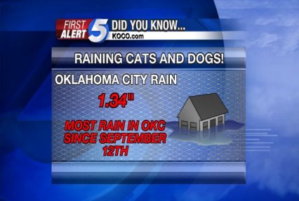


Bookmarks