

Aerial view from Feb. 20th, 1995:
The whole area seems much bigger since then. I think it's funny that Reno had a kink in it to go over the railroad tracks...

 Participating Member

Aerial view from Feb. 20th, 1995:
The whole area seems much bigger since then. I think it's funny that Reno had a kink in it to go over the railroad tracks...
What area does that photograph cover?
Participating Member
Get a snapshot of that area with google maps! I was only in 5th grade at the time..
Participating Member
I was hoping to play some 'Where's Waldo' with the image. Silvergrove is right. Google Earth sends out a monthly email letter with a snapshot of some random local place around the world.Originally Posted by MadMonk

The photo is of the central and eastern portions of Bricktown.
Participating Member

ppsshh, easy, thats (mainly) NW corner Lincoln and Reno, currently Bass Pro, McDonalds, Hotel, etc. The large block to the west is the Ballpark. It has come a long way, but some of this space is still surprisingly empty.
No wonder I didn't recognize it! Here's a comparison from Google Maps:

Banned
Yep, we've come a long way....wish I could say it a all good.
Glad I can say that it's mostly good.
Banned
I'll always miss the thriving, vibrant downtown as a shopping mecca and especially during the Xmas season. I'll always miss OKC before white flight.
There are currently 1 users browsing this thread. (0 members and 1 guests)
 Posting Permissions

 Reply With Quote
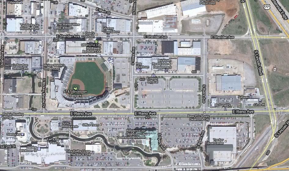
Bookmarks