Widgets Magazine
Page 1 of 2 12 LastLast
Results 1 to 25 of 42

Thread: Upcoming Weather Outlook

  1. Default Upcoming Weather Outlook

    Not doing a severe thread until we get closer to the time period. Current model indications that classic spring arrives at the end of the week through next week. I'll outline each day below.

    Saturday - Moisture return well under way. With dewpoints well into the mid 60s it would appear and a strong southerly flow. Atmosphere will be unstable to very unstable across most of the state, with highest values across the western 1/3rd of Oklahoma. Dryline will be setup out in the panhandles, it will make a run for the TX/OK line but begin retreating in the evening. Storm chances look to be pretty isolated, with best chances in the west on any storms that survive moving out of the Panhandle. Elsewhere an isolated storm could take place, but convective inhibition looks like it will be quite high through out most of the day.

    Sunday - Deep moisture remains as a low pressure system forms just east of Amarillo in the panhandle. Strong front will be draped across NW Oklahoma with associated thunderstorms developing along this by early afternoon. Atmosphere will again be very unstable across most of the area, convective inhibition will be fairly low out west early on which could make storms form earlier and reduce magnitude of severe threat. This will probably end up a moderate risk day from current indications, but we are still a LONG way out. Severe weather will begin to impact central OK by 4-6PM and last through the evening.

    Monday - Cold front will hang just south of I-44 this day as a low strengthens over western north Texas. This low will then move up the boundary during the day. Ongoing precip along the front is likely across the area but severe weather will be limited once the main overnight batch pushes through. Storm complex should develop over NW Texas and begin to right up the front with the low. Instability will provide potential for severe weather with these and they will have the chance to impact the southern Metro area. Main impacts will again be in the early evening to overnight.

    Tuesday - This seems to be a duplicate of Monday. Storms will form in the Panhandles through NW Texas. Storm complex will likely be a bit farther south this time and main severe impacts will be in Southern Oklahoma. This day could end up being mostly a heavy rain event, depending on how much churning the atmosphere gets from the previous two days. Typically we'll need to see a day or two of recovery with having large storm complexes moving through.

    Wednesday - Looks to be quiet right now. Winds will still be from the north and temps nice and cool in the 60s-70s.

    Thursday - Another round of a storm complex moving east seems to be in order. At this time looks like it will be in North Texas this time. Models are too unreliable for this time period, but does indicate some moisture return starting - but should be limited if a North Texas complex gets going.

    Will update as we get closer.

  2. Default Re: Upcoming Weather Outlook

    Updating with tonight's model runs...not going to be as detailed as I can. We'll get those underway tomorrow evening. Biggest thing to keep in mind...it is spring in Oklahoma, chance of storms, they will always have a risk of being severe. Also, when you have a setup with training complexes every day, eventually the atmosphere cannot recover fast enough and the severe threat is toned down for that day. So some of the days may show a chance for a lot of storms, but may end up pretty quiet with the subsiding air behind these complexes stabilizing things. Typically what that will get is a more active day after the quiet day. The biggest thing I'm see that may be a major headline, this is extremely DEEP and RICH moisture. So there is going to be a chance for a good deal of flooding if the rain total amounts are realized. So with that said...daily outlooks.

    Friday - Some indications of some storms in Southeast Oklahoma in the late afternoon. Instability will be marginal, much strong back across the rest of Oklahoma but we'll have a strong cap in place.

    Saturday - Deep moisture will be well established across Oklahoma. No other major changes, things look in line with previous outlook. Highest risk area will be in Northwest Oklahoma into the panhandles. There will be a low tornado risk due to the amount of instability and other factors coming into play.

    Sunday - Indications we may have early development in Southwest OK at the start of the period, and also left over activity in the Northwest. This could have a major impact on activity during the day, reducing severe threat some and increasing heavy rain potential. Isolated to scattered activity will be the rule of the day for most of the afternoon/early evening. Metro impact will be anytime after 12 due to the scattered nature of it all and the numerous boundaries we'll have around. Squall line/storm complex (MCS) will develop over northern oklahoma and may impact central sections moving into Monday morning.

    Monday - Ongoing activity. Moderate to heavy rain will be widespread. Models indicate complex will restrengthen along or just east of I-35. We could see heavy rain amounts well in the 2-3 inch totals. Severe potential may be mitigated by previous activity turning the atmosphere over a bit too much. Any higher risks will be along the Red River or far east.

    Tuesday - Clearing out late Monday into the Morning on Tuesday. A storm complex will develop over SW Oklahoma and move up I-44 through the evening. Severe threat is questionable right now, but models are kicking out crazy rainfall with this too from 2-4 inches of rain.

    Wednesday - Looks like the warm front may budge north a bit, allowing instabilities to increase here, so severe weather looks a bit more likely. Scattered storms will be ongoing most of the day, and a complex will start SW of OKC again. Again more heavy rain.

    Thursday - Way far out and models are crazy on this day. Models are pointing to a elevated risk of severe weather this day with extremely unstable air in place, with extremely deep moisture. I am concerned that subsidence behind the overnight/morning complex will over stabilize the air too much. However, if it can recover, we could have a show later in the day. Again, it is a week out i'm not buying it yet - but it is there.

    Friday - Hey guess what, extremely unstable again. Dryline is making a move here, so I would imagine (if the timing is right) Thursday will be held back some due to the issues I mentioned. This would open Friday to be an interesting day if things play out. We'll need to watch.

  3. #3

    Default Re: Upcoming Weather Outlook

    Venture, I love your posts. Finally someone who enjoys the fascinating aspects of weather forecasting. I know we've discussed ST before and I have to say that I still check that sight every morning to see what the chasers are thinking. I use to be a member but their membership rules were a bit obtrusive. I really miss the part of that website that used to have a target map where each member could pinpoint their virtual storm chasing target. oh well.

    The models have been sooooo inconsistent with this system and I wanted to wait til they came more inline with each other to make a post on it. This could very well be the start of the real storm season coming up this weekend. Finally the gulf should open up for buisness, and no more cool temps to foil things. I am a little worried that an MCS could develop from saturdays storms and roll through OKC saturday night (in its weaking phase) and stabalize the atmosphere temporarily for Sunday. Hopefully we are deep enough into spring that the atmosphere will recover fairly quickly. Hopefully we'll know more this afternoon or this evening when new models come out.

    The heavy rain would be welcome...most of the lakes (especially the ones I frequent) are pretty low. Spring is not the time for low lake levels. I'll keep watching the models and websites and make more comments when the picture clears up a little. Right now I think Sunday could be very interesting if for no other reason than I will be busy all day and not be able to do much weather watching....aarrgghh.

    Everyone should make sure they are prepared for severe weather this weekend into next week and make whatever preperations they need to now. ie...storm kits, weather radio batteries.

  4. #4

    Default Re: Upcoming Weather Outlook

    > most of the lakes (especially the ones I frequent) are pretty low.

    I've not made any lake shore hikes of late, so I wasn't aware of this. Is there a reasonably convenient online spot to check lake levels so i can keep myself in the loop a bit better until some time gets freed up for on site strolling inspections.

    I miss my lake walks, alot.

  5. Default Re: Upcoming Weather Outlook

    Westside,

    Yeah the rules at ST have become really insane over the last year. I've been a member there for about 5 years or so now, but the new crop of kids running it are ego driven and a bit too over the top with their rules. I can understand wanting discussion focused, but I think the overdone rules stamp out much of any community building there. Though I was always the shy chaser that kept to myself and had anxiety attacks when surrounded by 25 other cars. LOL

    Model wise...yeah. For the most part i'm using GFS with everything. It seems to be the best in handling this, even though the last run came out a bit crazy. WRF/ETA is junk right now. I love the fact that they do show some 70 degree dewpoints coming up, but that also screams flooding rain more than nice discrete and visually stimulating structure. I wish the late periods of the GFS could really be believed, the amount of instability being forecast is just crazy insane. 4000-6000 j/kg CAPE values over Central OK just screams monster storms if everything comes together to utilize that instability.

  6. #6

    Default Re: Upcoming Weather Outlook

    Kevin....There are several sites. Heres one for now. Tulsa District Water Control Home Page Its easiest to click on the map region you want to check on, then click on any available lake or stream. And I may have been wrong, from what I see several lakes are at normal levels, unfortunatly that doesn't include Lake of the Arbuckles which is 5' below normal (my favorite boating lake). Hope this helps.

  7. Default Re: Upcoming Weather Outlook

    You know what I was thinking. How the weather terms is a bit weird. lol

    Like the saying about how quickly the air recovers the next day is the same as how the air becomes more unstable the next day, right? If it doesn't recover, then it is still unstable? Or after a storm pass thru, the air is stablized, isn't that the same as recovered, and then the heat and gulf moisture making it unstable?

    Venture, want to clear these terms for me?

  8. Default Re: Upcoming Weather Outlook

    Air mass recovery in this context means that the atmosphere has become unstable again. One thing to always keep in mind about the forecast oriented posts that we'll make, the "good" terms are usually not what is good for property and life. It is backwards a bit I know, but hopefully that helps.

  9. #9

    Default Re: Upcoming Weather Outlook

    Venture....

    This is off topic, but I'm sure you'll start a new thread in the coming days to cover the upcoming weather, and I wanted to add a couple of thoughts I had over lunch. Actually it was Generals Nostalgia threads that got me to thinking. I don't know how old you are but do you remember the black and white radars, where your only hope of detecting a tornado was by the hook? the magic marker drawn watch boxes? Remember opening all the windows so the house wouldn't "blow up"...that was a waste of time. How about when there was no weather channel, or radar channel, and having to wait for very infrequent weather bulletins? I use to listen to ktok to get my weather updates for crying out loud...Even the AM station in Tulsa (Krng maybe?) which had the cool little background sound that let you know there was a warning or watch. Lola Hall and Fred Norman? I actually used to call the NWS (on a short cord rotary phone) when I was about 12-13 (they had a number in the phone book for questions) to ask them where the dryline was located, becuase this was all pre-pc. I think I'm the reason they discontinued that service. lol..... Now theres so much information out there its hard for me to get any work done on stormy days because I have 5 windows up with different weather pages.

    EDIT: I just saw the last two posts and wanted to add again that while I like storms and sometimes refer to storm conditions being good or exciting I in no way, shape or fashion wish damage, injuries or misfortune to anyone due to severe weather. Its just that I find beauty and awe in mother nature.


    Im in a good mood today so I threw in the emoticons just for the hell of it.

    Should be fun this spring. To the internet!!

  10. Default Re: Upcoming Weather Outlook

    I'm not too old (30) so I don't remember a lot of those things. I also grew up in the great lakes where weather coverage was far from good. The local TV stations up there got their first doppler radar about 10 years ago. The area that I lived in was also in a weird area between 3 different where offices (I was in Detroit's area, go south 10 miles and it was Cleveland, go west 30 miles and it was Northern Indiana). Even to today, radar coverage by the NWS is still below the typical for most areas. Warnings were always slow, and still are. It makes me feel good to be in Norman's area since we really are extremely spoiled here and I don't think a lot of people realize that.

    And yes...I'll get the first severe focused thread up and going tomorrow for the activity on Saturday.

  11. #11

    Default Re: Upcoming Weather Outlook

    ST sucks now. Bunch of egomaniacs. Let's start our own forum!

  12. Default Re: Upcoming Weather Outlook

    I don't know how many more message boards my poor SQL server can handle. LOL

  13. #13

    Default Re: Upcoming Weather Outlook

    I actually thought about starting one awhile back but never got enough ambition. Even though its fairly easy with vBulletin or something...

  14. Default Re: Upcoming Weather Outlook

    phpBB is normally what I run. It is free and pretty easy to customize and setup.

  15. #15

    Default Re: Upcoming Weather Outlook

    Storms......if you can call them that are trying to keep their act together in sw Oklahoma, now severe. I wouldnt expect much except maybe some very localized high winds when the storms collapse.

    QUOTE "ST sucks now. Bunch of egomaniacs. Let's start our own forum!"

    Are there any good weather forums for this part of the country for severe and non severe weather?

  16. Default Re: Upcoming Weather Outlook

    Not that I can find. Think of a good name for it and maybe we can have another hobby. LOL

  17. #17

    Default Re: Upcoming Weather Outlook

    I'll try to put on my thinkin cap and see what I can come up with.

    I found one a few years back I think the name was eastern US weather forum, but it dealt with mainly winter weather and obviously the eastern US. I figured there would be one for the central and western states.....but I still cant find one.

  18. #18

    Default Re: Upcoming Weather Outlook

    Searching for open domain names...

    Wow, I suck for creativity.

  19. Default Re: Upcoming Weather Outlook

    Severe storm to the southwest still won't die out. Winds up to 63mph recorded so far with a few mesonet stations. If it comes near you expect some strong winds, especially as it collapses - so OKC metro should be ready for some gusty winds regardless.

  20. #20

    Default Re: Upcoming Weather Outlook

    hmm name it something weather in general, or severe? I've always loved the name meso

  21. Default Re: Upcoming Weather Outlook

    Venture, this storm wasn't predicted/expected, so what was the cause?

  22. #22

    Default Re: Upcoming Weather Outlook

    Wow, winds up to 52 up in Edmond from the thunderstorm that collapsed.

  23. Default Re: Upcoming Weather Outlook

    Yeah, half my new planters and new flowers fell over are laying on the ground right now..... ugh.
    " You've Been Thunder Struck ! "

  24. Default Re: Upcoming Weather Outlook

    Probably extremely high temps in the SW provided enough heating to allow what little lift was down there to pop a storm. I believe there was a weak boundary in the area as well most of the day. One thing that is kind of cool, if you look at the radar right now you can see the outflow circle from the storm as they are collapsing. Sucks for those like Karrie with flowers in pots, but neat to look at on radar. : )

  25. Default Re: Upcoming Weather Outlook

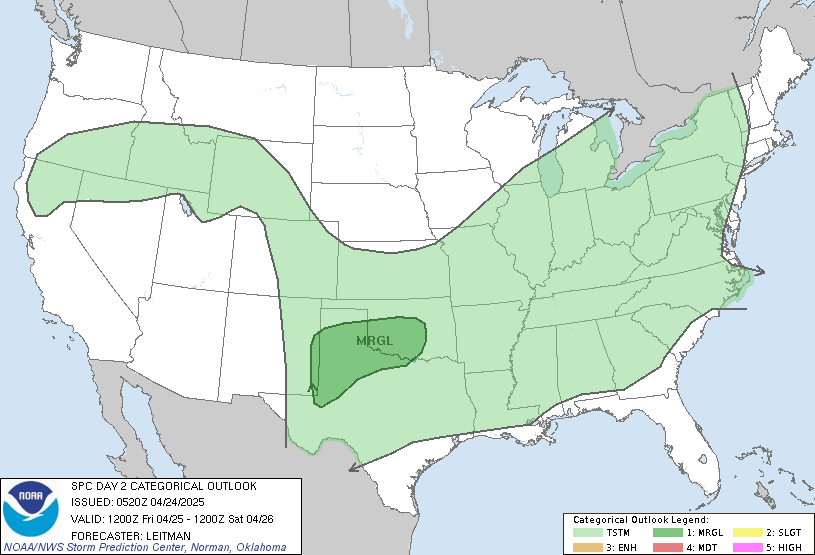
    Models are a little screwy tonight, so I'm gonna let us get the morning run in before I get the run down. Regardless, SPC has us outlooked for Saturday, with initiation where ever the triple point sets up. Still a lot of difference between models for Saturday, which is why I want to look at another set of data in the morning. Will be getting the threads for specific time periods going tomorrow when things are more clear.


    ...CNTRL AND SRN PLAINS AREA...

    COLD FRONT WILL LIKELY ADVANCE INTO SRN KS...PARTS OF NRN OK AND THE
    TX PANHANDLE BY SATURDAY EVENING. RICHER LOW LEVEL MOISTURE WILL
    ADVECT NWD THROUGH PRE-FRONTAL WARM SECTOR WITH DEWPOINTS IN THE MID
    60S AS FAR NORTH AS OK. SWLY FLOW ALOFT WILL EXIST OVER THE CNTRL
    AND SRN PLAINS DOWNSTREAM FROM SHORTWAVE TROUGH BOTTOMING OUT NEAR
    THE FOUR CORNERS REGION. THIS WILL RESULT IN EWD TRANSPORT OF STEEP
    MID LEVEL LAPSE ABOVE THE MOIST WARM SECTOR. THESE PROCESSES AND
    DIABATIC HEATING WILL CONTRIBUTE TO MODERATE SURFACE BASED
    INSTABILITY FROM TX NWD THROUGH OK SATURDAY AFTERNOON. HOWEVER...EWD
    ADVECTION OF THE EML WILL LIKELY CONTRIBUTE TO A CAP OVER MUCH OF
    THE WARM SECTOR DURING THE DAY.

    NAM AND GFS BOTH SUGGEST A WEAK LEAD WAVE WILL EJECT ENEWD THROUGH
    KS EARLY IN THE PERIOD. HOWEVER...TIMING OF ANY SUCH FEATURE AT THIS
    POINT WOULD BE DIFFICULT. GIVEN PRESENCE OF CAP AND WEAK LARGE SCALE
    FORCING...THUNDERSTORM INITIATION DURING THE DAY IS SOMEWHAT
    UNCERTAIN. HOWEVER...INITIATION IS MOST LIKELY TO OCCUR NEAR TRIPLE
    POINT OVER SW OK OR NW TX WHERE THE DRYLINE INTERSECTS THE COLD
    FRONT AS WELL AS OVER SRN KS ALONG SWD ADVANCING COLD FRONT. LOW
    LEVEL HODOGRAPHS WILL INITIALLY NOT BE PARTICULARLY LARGE IN WARM
    SECTOR...BUT WILL INCREASE DURING THE EVENING AS THE LOW LEVEL JET
    STRENGTHENS. BULK SHEAR WILL SUPPORT SUPERCELLS WITH LARGE HAIL
    LIKELY AND ISOLATED TORNADOES POSSIBLE DURING THE EARLY
    EVENING...ESPECIALLY WITH ANY STORM THAT CAN INITIATE NEAR TRIPLE
    POINT.

    OVERNIGHT...THE STRENGTHENING SLY LOW LEVEL JET WILL AUGMENT
    DESTABILIZATION AND ISENTROPIC LIFT NORTH OF FRONTAL BOUNDARY
    RESULTING IN AN INCREASE IN ELEVATED STORMS ACROSS KS. LARGE HAIL
    WILL BE THE MAIN THREAT WITH THIS ACTIVITY.

Thread Information

Users Browsing this Thread

There are currently 1 users browsing this thread. (0 members and 1 guests)

Similar Threads

  1. Severe Weather Risk - 3/23/2009 (Monday)
    By venture in forum Current Events & Open Topic
    Replies: 82
    Last Post: 03-24-2009, 10:01 PM
  2. Long-range weather forecasts....why??
    By SoonerDave in forum General Civic Issues
    Replies: 6
    Last Post: 06-03-2008, 12:49 PM
  3. False weather warnings being investigated
    By PUGalicious in forum Current Events & Open Topic
    Replies: 6
    Last Post: 06-11-2007, 12:44 PM
  4. Norman - The Weather Capital of the World
    By floater in forum General Civic Issues
    Replies: 11
    Last Post: 01-13-2005, 11:50 AM

Bookmarks

Posting Permissions

  • You may not post new threads
  • You may not post replies
  • You may not post attachments
  • You may not edit your posts
  •  
Single Sign On provided by vBSSO