Widgets Magazine
Results 1 to 9 of 9

Thread: Okc Street Map History

  1. Default Okc Street Map History

    I've not had time to finish the text yet, but I did get the images (at least, most of them) posted in a new blog thread ... if you want vintage Okc maps, that what this one is for.

    The link: Doug Dawgz Blog: Okc Street Map History

    All pics are at least the size below ... almost all have a larger resolution (but not more than 1024 x 768 px, since I have a "free" Photobucket account and that's the limit ... EXCEPT ... I posted 5 high resoution images in my own web server (not the blog) so, if you want, some are verrry large. Don't use dial-up to look at them, though! The largest is 9.75 MB and is 6,101 x 8,571 px. These are for "serious" map lovers!

    Here's what I've got so far (smaller image version):

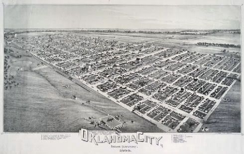
    Everyone's seen this, but it has to be included ... 1890 Drawing ...


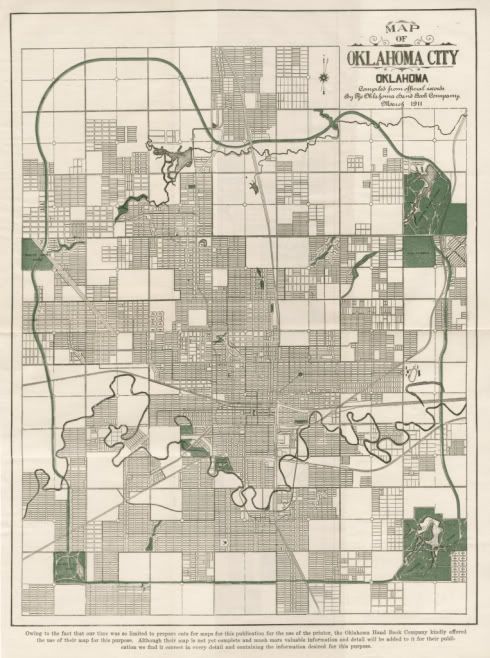
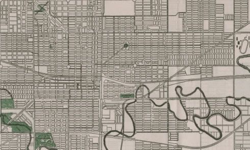
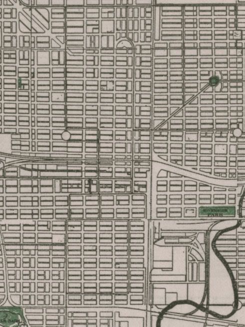
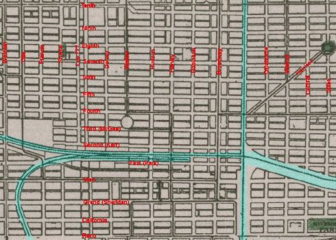
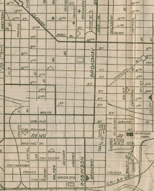
    1911 Planning Map ... check out the North Canadian! ... and the E/W RR tracks through downtown ... and wonder where is the rest of Classen Blvd?


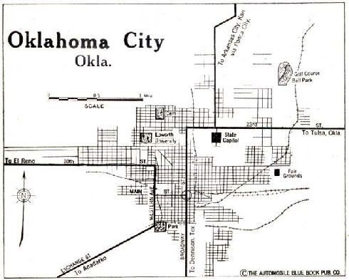
    1920 Blue Book Map ... nothing special but I don't have anything else from the 1920s (yet!)


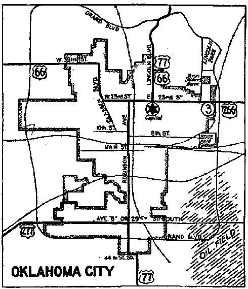
    From the 1930 Oklahoma state highway map (I think) another "unspecial" map


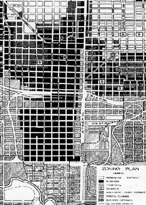
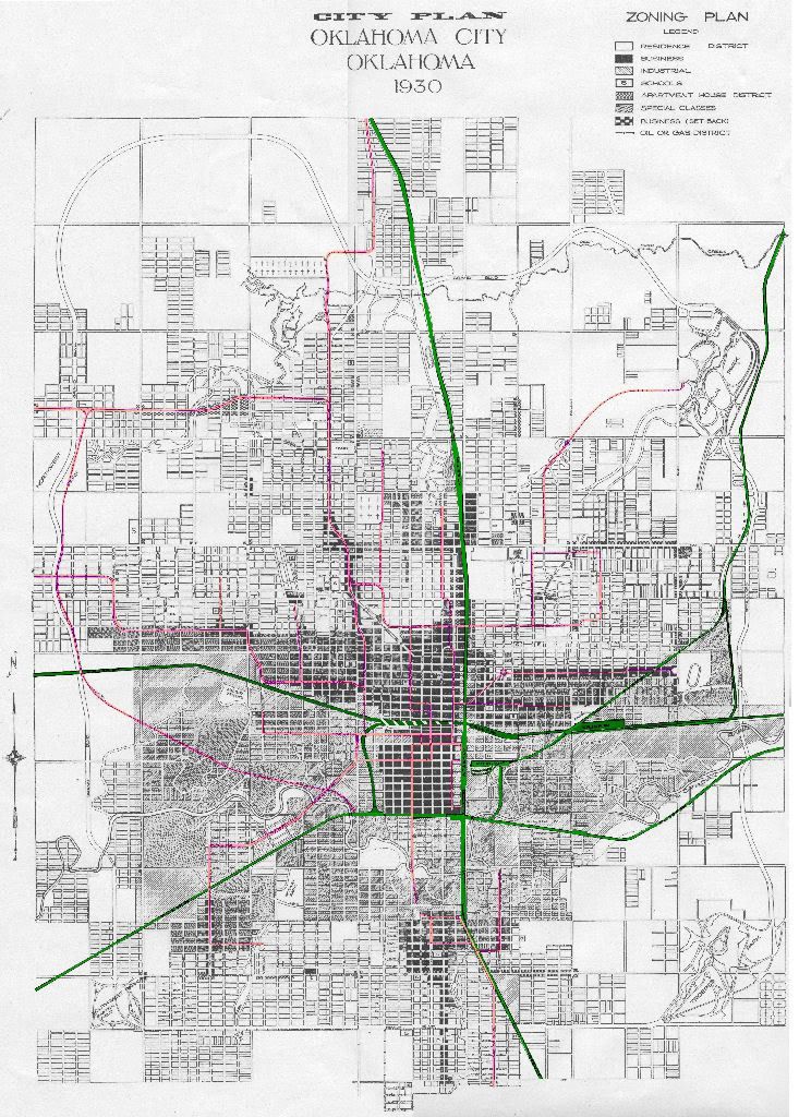
    The 1930 Okc Zoning Map ... this cutout showing downtown only ... trolley routes as well as the big train tracks are shown


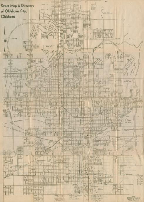
    Manly's Okc Street Map ... undated ... probably early 1940s, judging by the clues ... this is a great map! ...


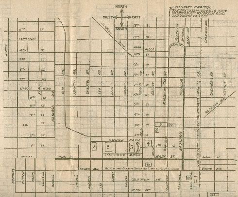
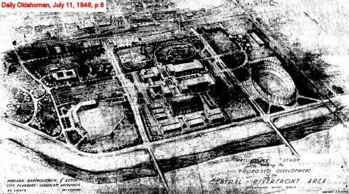
    The south part of Classen is still missing ... so I went looking for it ... along the way, I found this 1946 bold proposal for a downtown park by the river, complete with stadia, etc. ... bad pic (from the Oklahoman's archives) but you can see the vision ...


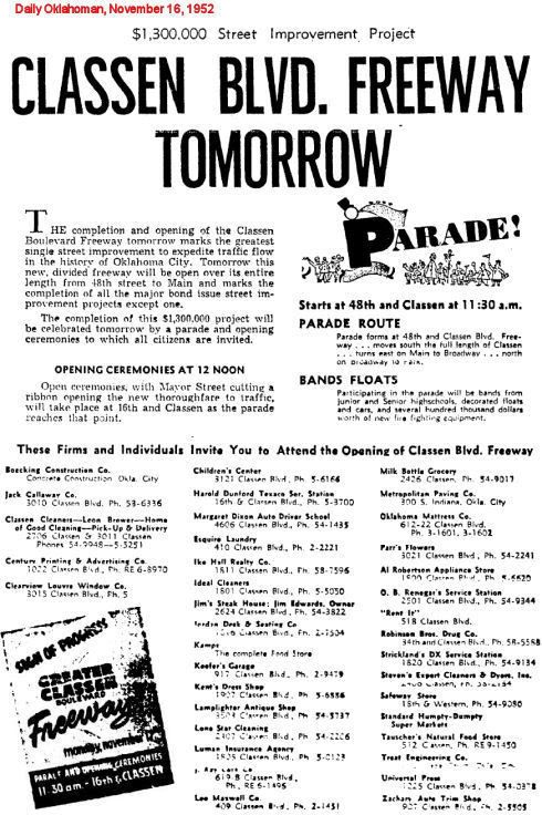
    ... and I finally found the south part of Classen ... in 1952, the Classen project was called a "freeway!"


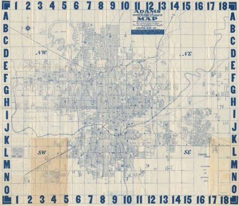
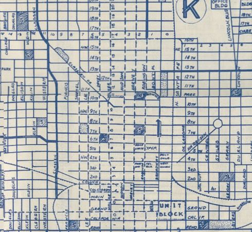
    And, the last map ... a huge (opened up, it's about 5 feet x 5 feet) 1957 City Map ...


    Scanning 8 1/2" x 11" segments and putting them back together again like a puzzle was quite a challenge ... not perfectly done, but, hey, it's free!

    My best 3 maps were purchased from Doug Hamilton at his booth here: Antique Avenue Market

    It's immediately west of Bishop McGuinnes and is next to the Crown Heights Florist shop. Nice place to go and spend some coin!
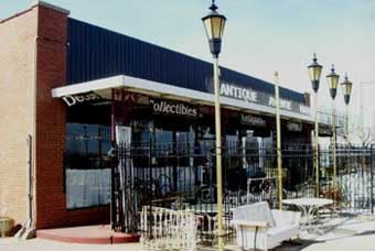
  2. #2

    Default Re: Okc Street Map History

    awesome stuff.

  3. #3

    Default Re: Okc Street Map History

    I agree Doug great job. I didn't notice your scanning job wasn't perfect until you pointed it out. I just love old maps and I will definitely try to visit Doug Hamilton's shop. My birthday is coming up maybe I can get someone in my family to visit there too. Keep up the good work Doug.

  4. #4

    Default Re: Okc Street Map History

    That's really interesting stuff. I remember years ago going through the archives at the downtown library and finding out that they have some stuff like this, including old Southwestern Bell telephone books from years gone by. Some of them had maps in the front pages of the phone book. You might give that a shot.

  5. Default Re: Okc Street Map History

    After looking at serveral phone books and city directories, the problems with such maps are (1) poor paper hence poor quality, (2) not high resolution, and (3) most often not complete detail.

    I did find a couple of good maps there, though, that I copied on their zerox and then scanned. One is the January 1930 Okc Zoning Map ... mainly, it was useful in identifying the location of RR tracks and trolley and interurban routes then in place and I'm using it in working on a new post, not done, Okc Trains & Trolleys.

    The map scan, with my modifictions to highlight the routes, is in a high resolution image located at http://www.dougloudenback.com/downto...rainslarge.jpg ... a smaller version is below.


    I should have at least a preliminary version of that post up in a day or two.

  6. #6

    Default Re: Okc Street Map History

    this is all very interesting stuff, doug. i myself bought a few maps from that shop this weekend... a 1947, 1948, 1957, 1967 and (around) 1970. i guess old maps are "my thing." i can scan any of those in if you're interested... or, if it would help out, could trace portions of some of the maps... what would really be cool is a multi-layered map where a user could toggle between the different years and see how the streets changed over time.

    as for the last map posted, i was looking at the trolley routes (the ones in pink, right?) and noticed that a line ended on around sw 25th & penn. there's an odd looking home on that corner and we've long suspected that it was some structure related to the trolley system... this map would seem to support that theory.

    again, really cool stuff! -M

  7. Default Re: Okc Street Map History

    Quote Originally Posted by mmm View Post
    this is all very interesting stuff, doug. i myself bought a few maps from that shop this weekend... a 1947, 1948, 1957, 1967 and (around) 1970. i guess old maps are "my thing." i can scan any of those in if you're interested... or, if it would help out, could trace portions of some of the maps... what would really be cool is a multi-layered map where a user could toggle between the different years and see how the streets changed over time.

    as for the last map posted, i was looking at the trolley routes (the ones in pink, right?) and noticed that a line ended on around sw 25th & penn. there's an odd looking home on that corner and we've long suspected that it was some structure related to the trolley system... this map would seem to support that theory.

    again, really cool stuff! -M
    Thanks, mmm! Sure, I'd love to have scans of your 1947 & 1948 maps! Did you get yours from Doug Hamilton or from some other booth there?

    A problem I have with my own scans is that my scanner's capacity is 8 1/2 x 14" ... which means that for larger maps than that (as most are) multiple scans are needed and then the "pieces" must be reassembled together ... and correct horizontal alignment of the individual pieces becomes very important ... I didn't do a perfect job of that and so there are occasional mismatches/jogs in the putting together of the puzzles!

    I'm also doing high resolution maps of the better ones I locate. While Photobucket won't accept larger images than a combination of 1024 px by 768 px, I'm storing the high resolution images on my website server which has no such limitation. Ordiinarily, I have 3 sizes ... a smaller (490 px wide) image that "fits" into the blog post, a larger (1024 x 768 or vice versa) which is the image linked to from the "blog post" image ... both of the former are stored in Photobucket ... and, then, a high resolution image which hasn't got limitations which is stored at my web host server.

    Yes, the trolley/interurban routes are the pink/salmon/whatever color. I'm operating under the assumption that the 1930 zoning map is the most reliable I have since it came form a city source ... but it would be good to have another source to confirm the routes. There's a hard-to-find book out there somewhere (I forget the name) on Oklahoma's interurban routes, including Okc/El Reno/Guthrie/Norman) but I've not gotten my grubby hands on a copy yet. But ... sooner or later ... I WILL!

    Looking in the high-res map at what you mentioned about SW 25 & Penn, I see that I missed "marking" a tolley line in Capitol Hill ... Harvey ... and north of NW 12, Youngs ... I'll fix that! If you spot any other errors, please let me know!

    A "multi-layer" map would be a nifty project! What suggestions do you have for how that might be done?

    On Edit: I've now added the earlier omitted "Youngs" (north of nw 12th) and "Harvey" in Capitol Hill trolley routes. The text in my blog post is pretty much done, as well.

  8. #8

    Default Re: Okc Street Map History

    for the 'multi-layer' map, i was thinking something done in flash... each layer could be turned on and off via user interface. it'd be nifty.

    i'll get those maps scanned in as soon as i can! my scanner's 11x14, too... so i'll be stitching pieces together myself.

    -M

  9. Default Re: Okc Street Map History

    Ok, I see ... I have some rudimentary flash skills but I think I could handle that. Great idea!

Thread Information

Users Browsing this Thread

There are currently 1 users browsing this thread. (0 members and 1 guests)

Similar Threads

  1. Want OKC History Books?
    By Doug Loudenback in forum General Civic Issues
    Replies: 3
    Last Post: 06-29-2007, 08:56 PM
  2. A Model For OKC
    By Kerry in forum General Civic Issues
    Replies: 43
    Last Post: 06-28-2007, 07:26 AM
  3. Help Map out OKC...
    By hipsterdoofus in forum General Civic Issues
    Replies: 28
    Last Post: 08-24-2006, 08:53 AM
  4. Zip Code Map of OKC
    By Luke in forum General Civic Issues
    Replies: 3
    Last Post: 08-04-2006, 08:56 AM

Bookmarks

Posting Permissions

  • You may not post new threads
  • You may not post replies
  • You may not post attachments
  • You may not edit your posts
  •  
Single Sign On provided by vBSSO