

Just wishful thinking on your part.Originally Posted by Bobby821


Just wishful thinking on your part.

 Participating Member

No I don't think so
Participating Member

This.
Next weekend's severe threat is starting to fizzle out. Once we get into June, it gets a lot more difficult to have a high-end event. It can happen (anybody remember June 13, 1998) but it's not near as common as in May.
Participating Member
Great Memorial weekend shaping up. It will be HOT today and Saturday. SW OK will likely be in the low 100s.
Chance of storms popping up right overhead on Saturday evening in C OK, but mainly an eastern OK event.
Rain chances for C OK move back in around middle of this coming week.
Participating Member
Weathermen have been calling for moderate chances for baseball to grapefruit sized hail for NE OK on Saturday.
One thing to keep in mind is that the cap is strong this Sat, but when/if one or two of those storms does happen to pop, it'll likely be an angry little beast with great chance to be a hailer and might line out into a big storm complex from C into E OK. Wind/hail prob seems to be higher than that for tornadoes..
Participating Member
Thanks to the poster who explained what CAPE was as it's help me understand things better.
CAPE values are expected to be over 6000 tomorrow in Eastern OK. Definitely dangerous situations are expected: http://m.newson6.com/Story.aspx?stor...3&catId=112042
These CAPE values are historically signifiant. Just staggering numbers. CAPE values in OK a couple weeks back were neae 4500, more than high enough to support convection for severe development. But 6000??? That's amazing. SPC talking about possible derecho (large, generally linear, long-lasting storm complex with heavy rains and high winds) coming out of this system.
Meanwhile, but no wonder. Dew points are well past 70.
HEAT ADVISORY, includes Oklahoma City
Updated: Sat May-27-17 03:24am CDT
Effective: Sat May-27-17 03:24am CDT
Expires: Sat May-27-17 07:00pm CDT
Severity: Minor
Urgency: Expected
Certainty: Likely
Status: Actual
Type: Alert
Category: Met
Areas affected: Carter; Cleveland; Garvin; Grady; Jefferson; Lincoln; Logan; Love; McClain; Murray; Oklahoma; Payne; Pottawatomie; Stephens
Instructions: A heat advisory means that a period of hot temperatures is expected. The combination of hot temperatures and high humidity will combine to create a situation in which heat illnesses are possible. Drink plenty of fluids, stay in an air-conditioned room, stay out of the sun, and check up on relatives and neighbors. Take extra precautions, if you work or spend time outside. When possible, reschedule strenuous activities to early morning or evening. Know the signs and symptoms of heat exhaustion and heat stroke. Wear light weight and loose fitting clothing when possible and drink plenty of water. To reduce risk during outdoor work, the occupational safety and health administration recommends scheduling frequent rest breaks in shaded or air conditioned environments. Anyone overcome by heat should be moved to a cool and shaded location. Heat stroke is an emergency, call 9 1 1.
Message summary: ...heat advisory in effect from 1 pm this afternoon to 7 pm cdt this evening...
The national weather service in norman has issued a heat advisory, which is in effect from 1 pm this afternoon to 7 pm cdt this evening.
* temperature...93 to 99 degrees.
* heat index... 103 to 109.
AFFECTED AREA:
Participating Member
Walking across the parking lot today, I found myself just momentarily wishing for hail instead of this heat that I'm not mentally prepared for......ugh......but I came to my senses.
Participating Member
Took my three year old to the splash pad. Hot and humid when we left, rain and thunder and a tornado watch 20 minutes later.
Platinum Member
Tornado watch just issued to include Oklahoma county. I'm sitting at my home office desk and the weather radio just a few feet away startled the heck out of me when it went off!
Participating Member
Tornado watch is out for C and E OK. Models can't decide where storms will develop. As it stands, it looks explosive development will take place in NC and NE OK first, then attempt to back-build development in towards OKC.

Participating Member
Some of these CAPE values are just huge from the last couple soundings, 7455 from Ardmore. Wow!
Northeast Oklahoma getting it first. Tornado warning issued for Craig and Ottawa County until 6 pm.
Good GAREEEEEEFFFF?!? 7,500???? That's just absurd..
Participating Member
Hopefully the cold front starts lighting up with storms to the SW toward the metro later..
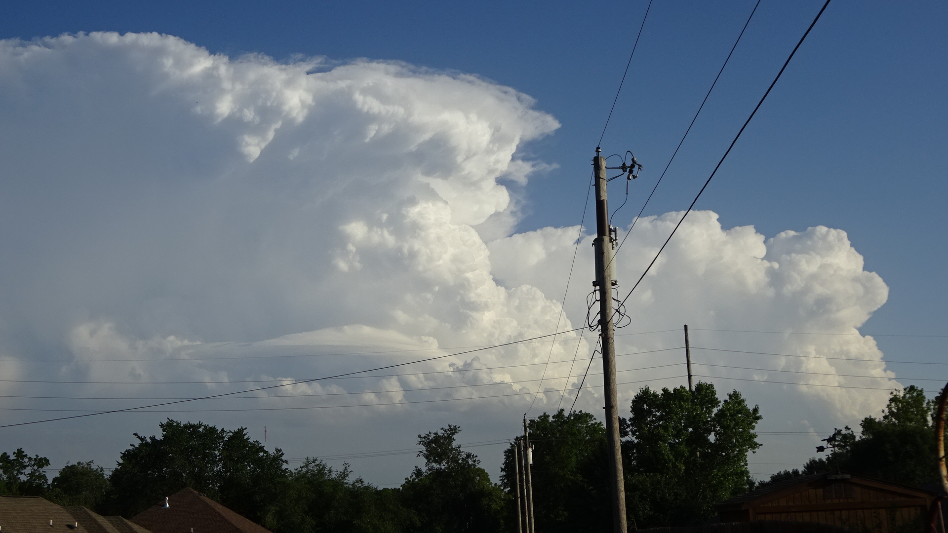
As of 7 pm, they were back building to central Lincoln County as pictured:
Participating Member
Damon Lane @KOCOdamonlane · 1m1 minute ago
More
OKC Metro PM Update: Severe threat remains. hi-res models show storms popping up over South OKC by 9pm. Look outside! You can see the storms
I'm in SW OKC roughly near 104th and May, and there is development to our south but appears to be moving east fairly rapidly. Skies are otherwise absolutely clear except for activity well to our east. I don't have a radar in front of me but I'd hazard a guess the development I'm seeing is south of Norman, maybe in the Wayne/Payne area, and at least for the moment does not appear to be getting closer - sliding off east.
EDIT: The activity I'm seeing appear to be the anvils from the storms SW of Ada and near Ardmore. Nowhere near the southern part of OKC.
Participating Member
Huge pair of supercells down in S OK.
C OK will miss out on the early development, but could see a development wave come across from NW OK overnight with fast moving storms on the wrap-around. These will be primarily wind damage threat.
Big tornado-warned storm east of Stroud appears to be making a slight right-hand turn and moving more E than NE, maybe even trending ESE a bit. Well-defined hook on the SW edge.
Gold Member
How are the storms looking this week? Looks like Thursday through Sunday rain?
Participating Member
Chances yes, but likely not a complete wash-out.
Participating Member
Looks like the metro is going to get shafted and miss out on some of the rainfall the next day or so.
There are currently 1 users browsing this thread. (0 members and 1 guests)
 Posting Permissions

 Reply With Quote

Bookmarks