
Originally Posted by
Anonymous.

Models trending towards additional moisture this morning. Thus, snow totals could be higher if it holds. Also the trend to move the heavier band further north over I-40 has continued.
Winter Weather Advisory for basically central W and C OK for tonight.
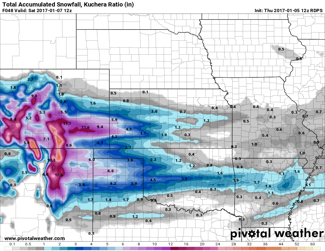
As of this morning here are the model forecast amounts:
GFS: I-40 corridor heaviest band 2-5" (highest amounts out towards Elk City, then tapering off as you head east)
NAM: I-40 corridor heaviest band 1-3"
GEM: I-40 corridor heaviest band 1-2"
WRF: S of I-40 corridor heaviest band 1-2" (Lawton to Norman area)
Like I mentioned earlier, this will be a swath of a heavier snowband that may not exceed 20 miles N to S, so every deviation in track will significantly adjust the totals in your area. The radar tonight will tell the real story.


 Reply With Quote


Bookmarks