


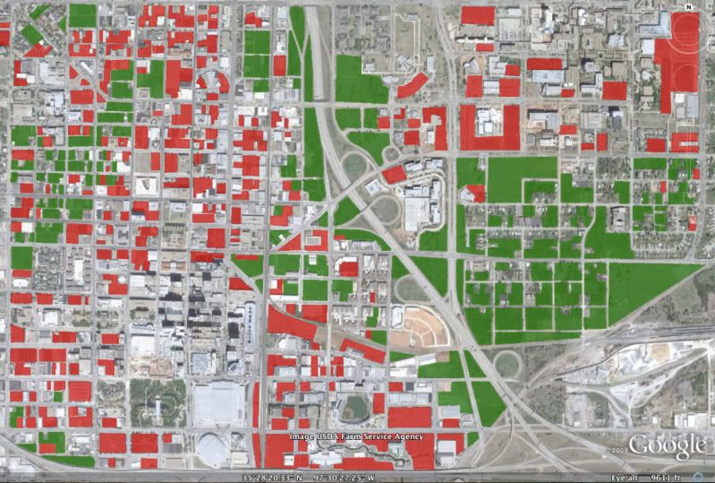
I came across a thread at SkyscraperCity (http://www.skyscrapercity.com/showthread.php?t=12557910) where one of the members had created images comparing some North American cities by taking a Google Earth shot from 9000 ft and filling in areas of surface parking lots to show how surface parking dominates business districts. This got me wondering how Oklahoma City's shot would look.
I knew that the core of our CBD has no surface parking lots, but beyond that there are a lot of them. As I started drawing them out, I noticed that raw land (where structures have probably been demolished in the past) is extremely plentiful in central OKC. So I have made maps showing most of the sites in central OKC where a developer could build WITHOUT TEARING DOWN A SINGLE BUILDING.
Here is the map with parking and greenfields shown:
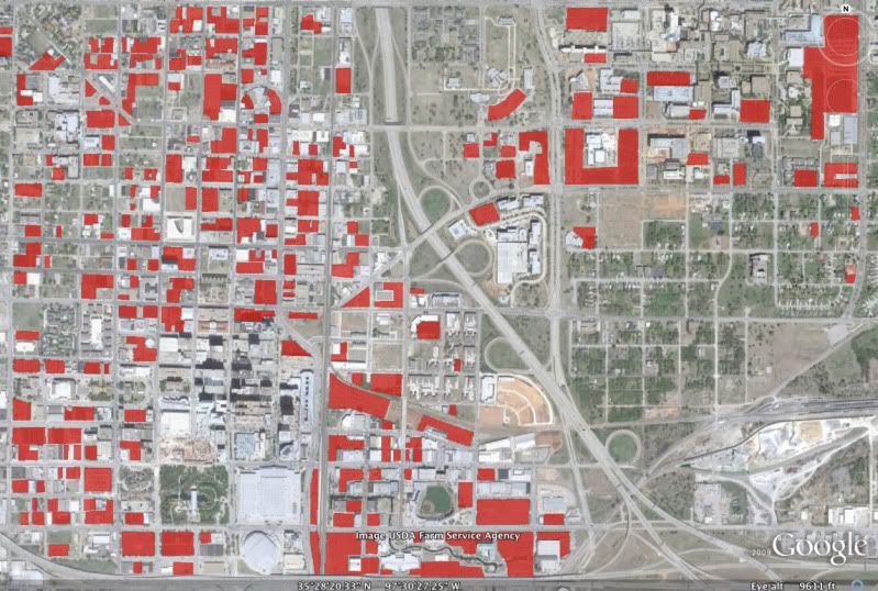
Parking only:
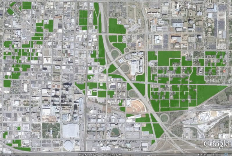
And greenfields only (SoSa, the area South of the Medical District (SoMed?), and the area between the Medical District and DT are amazing):
And we thought the frontier days were over. We have work to do!


 Reply With Quote
Bookmarks